Roman Fort (Roman)
Site Name Newstead
Classification Roman Fort (Roman)
Canmore ID 55621
Site Number NT53SE 20.01
NGR NT 56980 34410
Datum OSGB36 - NGR
Permalink http://canmore.org.uk/site/55621
Ordnance Survey licence number AC0000807262. All rights reserved.
Canmore Disclaimer.
© Bluesky International Limited 2025. Public Sector Viewing Terms
- Correction
- Favourite


SC 923321
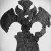
View of artefact from the James Curle excavation 1905-1909.
Records of the Society of Antiquaries of Scotland, Edinburgh, Scotland
1905
© Courtesy of HES (Society of Antiquaries of Scotland Collection)

SC 1291577
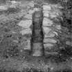
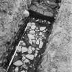
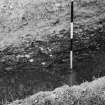
Newstead, Roman forts and temporary camps. Excavation photograph, I A Richmond Dividing wall, looking W
1947

SC 1291578
Newstead, Roman forts and temporary camps. Excavation photograph, I A Richmond Flavian I rampart
1947

SC 1741719
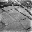
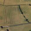
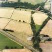
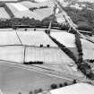
Newstead, Roman fort and temporary camps: air photograph showing fort (NT 569 344), Western annexe (NT 567 343), 160-acre temporary camp (NT 567 337) and linear feature (NT 565 341).
RCAHMS Aerial Photography
1984
© Crown Copyright: HES

SC 1741722
Newstead, Roman fort and temporary camps: air photograph showing fort (NT 569 344) and annexe (NT 571 343).
RCAHMS Aerial Photography
1984
© Crown Copyright: HES


SC 1741936
Newstead, Roman fort and temporary camps: air photograph showing fort (NT 569 344), Southern annexe (NT 569 341), Eastern annexe (NT 572 343), Western annexe (NT 567 343), annexe (NT 571 343) and possible annexe (NT 570 346).
RCAHMS Aerial Photography
1984
© Crown Copyright: HES


SC 1742018
Oblique aerial view
RCAHMS Aerial Photography
22/8/1994
© Crown Copyright: HES


SC 1742075
Newstead, oblique aerial view, taken from the NW, centred on the Roman fort and western annexe.
RCAHMS Aerial Photography
25/7/1996
© Crown Copyright: HES

SC 1742076
Newstead, oblique aerial view, taken from the W, centred on the Roman fort and western annexe.
RCAHMS Aerial Photography
25/7/1996
© Crown Copyright: HES

SC 1742080
Newstead, oblique aerial view, taken from the SSE, centred on the Roman fort eastern annexe and 'great camps' complex.
RCAHMS Aerial Photography
25/7/1996
© Crown Copyright: HES

SC 1742141
Oblique aerial view of Newstead centred on the cropmarks of the Roman fort, southern and western annexes, taken from the SW.
RCAHMS Aerial Photography
11/8/1999
© Crown Copyright: HES

SC 1742146
Oblique aerial view of Newstead centred on the cropmarks of the Roman fort, eastern and southern annexes, enclosure and Roman temporary camps, taken from the ESE.
RCAHMS Aerial Photography
11/8/1999
© Crown Copyright: HES

SC 1742164
Oblique aerial view of Newstead centred on the cropmarks of the Roman fort, eastern and southern annexes, enclosure and Roman temporary camps, taken from the SE.
RCAHMS Aerial Photography
11/8/1999
© Crown Copyright: HES

DP 280750
Oblique aerial view.
Historic Environment Scotland
14/7/2018
© Copyright: HES

SC 1924004
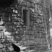
Detail of stonework at Drygrange summerhouse, incorporating Roman stones from the pit in the principle at Newstead.
1980
© RCAHMS

SC 1928312
Aerial view
Papers of Professor Dennis W Harding, archaeologist, Edinburgh, Scotland
1978
© Copyright: Professor Dennis W Harding. Courtesy of HES.

SC 1952679
Newstead, Roman forts and temporary camps. Excavation photograph, I A Richmond Antonine II drain, W of dividing wall
1947
© Richmond, Lady

SC 1952683
Newstead, Roman forts and temporary camps. Excavation photograph, I A Richmond Dividing wall, looking W
1947
© Richmond, Lady

SC 2449631
Newstead, NT53SE 20.1, Ordnance Survey index card, page number 2, Recto
Records of the Ordnance Survey, Southampton, Hampshire, England
c. 1958
© Crown Copyright: HES (Ordnance Survey Archaeology Division)

SC 923282
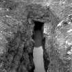
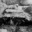
Excavation photograph showing drain carrying water from outer court Praetorium passing through ambulatory, S side, taken during the James Curle excavation 1905-1909.
Records of the Society of Antiquaries of Scotland, Edinburgh, Scotland
1905
© Courtesy of HES (Society of Antiquaries of Scotland Collection)

SC 923287
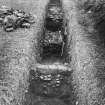
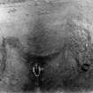
Excavation photograph showing workman indicating scale in excavated trench, taken during the James Curle excavation 1905-1909.
Records of the Society of Antiquaries of Scotland, Edinburgh, Scotland
1905
© Courtesy of HES (Society of Antiquaries of Scotland Collection)

DP 019868
Oblique aerial view centred on the cropmarks of the Roman fort and fort annexes, taken from the N.
RCAHMS Aerial Photography Digital
27/7/2006
© Crown Copyright: HES

DP 019870
Oblique aerial view centred on the cropmarks of the Roman fort and fort annexe, taken from the S.
RCAHMS Aerial Photography Digital
27/7/2006
© Crown Copyright: HES

DP 019879
Oblique aerial view centred on the cropmarks of the Roman fort and fort annexe, taken from the SSE.
RCAHMS Aerial Photography Digital
27/7/2006
© Crown Copyright: HES

DP 050252
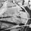
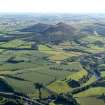
General oblique aerial view looking across the bridge, viaduct, village and site of the Roman fort towards the fort and Eildon Hills, taken from the NNE.
RCAHMS Aerial Photography Digital
4/7/2008
© Crown Copyright: HES

SC 1291575
Newstead, Roman forts and temporary camps. Excavation photograph, I A Richmond Antonine I dividing-wall, looking W
1947

SC 1291583
Newstead, Roman forts and temporary camps. Fort-wall, looking across inner Agricolan ditch, from N
1947


DP 163841
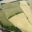
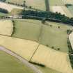
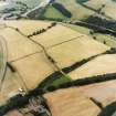
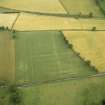
Oblique aerial view of the cropmarks of the Roman fort at Newstead, looking NE.
RCAHMS Aerial Photography Digital
8/7/2013
© Crown Copyright: HES

DP 277865
Oblique aerial view.
Historic Environment Scotland
10/7/2018
© Copyright: HES

SC 1741716
Newstead, Roman fort and temporary camps: air photograph showing fort (NT 569 344), Southern annexe (NT 569 341), Eastern annexe (NT 572 343), Western annexe (NT 567 343), annexe (NT 571 343), possible annexe (NT 570 346), and 160-acre temporary camp (NT 567 337).
RCAHMS Aerial Photography
1984
© Crown Copyright: HES

SC 1741793
Newstead, Roman fort: RCAHMS air photograph showing annexe (NT 571 343)
RCAHMS Aerial Photography
1976
© Crown Copyright: HES

SC 1741797
Newstead, Roman fort: RCAHMS air photograph showing annexe (NT 571 343) and western annexe (NT 567 343)
RCAHMS Aerial Photography
1976
© Crown Copyright: HES


SC 1741925
Newstead, Roman fort and temporary camps: air photograph showing fort (NT 569 344), Southern annexe (NT 569 341), Eastern annexe (NT 572 343), annexe (NT 571 343), possible annexe (NT 570 346) and 'Great camp' complex of temporary camps (NT 574 341).
RCAHMS Aerial Photography
1984
© Crown Copyright: HES

SC 1741926
Newstead, Roman fort and temporary camps: air photograph showing fort (NT 569 344), Southern annexe (NT 569 341), Eastern annexe (NT 572 343), annexe (NT 571 343), possible annexe (NT 570 346) and 'Great camp' complex of temporary camps (NT 574 341).
RCAHMS Aerial Photography
1984
© Crown Copyright: HES


SC 1741974
Oblique aerial view Excavation
RCAHMS Aerial Photography
1991
© Crown Copyright: HES

SC 1741977
Oblique aerial view Excavation
RCAHMS Aerial Photography
1991
© Crown Copyright: HES

SC 1742028
Oblique aerial view
RCAHMS Aerial Photography
22/8/1994
© Crown Copyright: HES

SC 1742061
Newstead, oblique aerial view, taken from the NNE, centred on the Roman fort and the western and southern annexes. The Newstead by-pass (under construction) is visible in the top half of the photograph.
RCAHMS Aerial Photography
9/8/1995
© Crown Copyright: HES

SC 1742087
Newstead, oblique aerial view, taken from the NW, centred on the cropmarks of the Roman Fort and Eastern Annexe.
RCAHMS Aerial Photography
25/7/1996
© Crown Copyright: HES

SC 1742089
Newstead, oblique aerial view, taken from the WSW, centred on the cropmarks of the Roman Fort and Western Annexe.
RCAHMS Aerial Photography
25/7/1996
© Crown Copyright: HES

SC 1742094
Newstead, oblique aerial view, taken from the ENE, centred on the cropmarks of the Great Camps Complex.
RCAHMS Aerial Photography
25/7/1996
© Crown Copyright: HES

SC 1742144
Oblique aerial view of Newstead centred on the cropmarks of the eastern annexe, enclosure and Roman temporary camps with Roman fort adjacent, taken from the SSE.
RCAHMS Aerial Photography
11/8/1999
© Crown Copyright: HES

SC 1859732
Newstead, oblique aerial view, taken from the N, centred on the Roman fort and the western and southern annexes. The Newstead by-pass (under construction) is visible in the top half of the photograph.
RCAHMS Aerial Photography
9/8/1995
© Crown Copyright: HES

SC 1860510
Newstead, Roman fort: RCAHMS air photograph showing annexe (NT 571 341)
RCAHMS Aerial Photography
1976
© Crown Copyright: HES

SC 1924005
Detail of stonework at Drygrange summerhouse, incorporating Roman stones from the pit in the principle at Newstead.
1980
© RCAHMS

SC 1952681
Newstead, Roman forts and temporary camps. Excavation photograph, I A Richmond. Antonine I Wall, on Flavian II rampart foundation, over Flavian I ditch.
1947
© Richmond, Lady

SC 2081840
Newstead, Roman fort and temporary camps: oblique aerial photograph showing annexe (NT 571 343).
John Dewar
7/1976
© Copyright: HES (John Dewar Collection)

SC 2449635
Newstead, NT53SE 20.1, Ordnance Survey index card, page number 6, Recto
Records of the Ordnance Survey, Southampton, Hampshire, England
c. 1958
© Crown Copyright: HES (Ordnance Survey Archaeology Division)

SC 349340
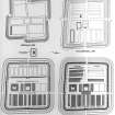
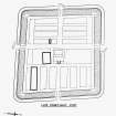
Publication drawings illustrating the different phases of Newstead fort. Roxburgh Inventory fig. 424.
1947
© RCAHMS

SC 923279
Excavation photograph showing drain mouth, W side, taken during the James Curle excavation 1905-1909.
Records of the Society of Antiquaries of Scotland, Edinburgh, Scotland
1905
© Courtesy of HES (Society of Antiquaries of Scotland Collection)

SC 923284
Excavation photograph showing drain mouth on W side showing outer ditch of W annexe paving below the wall, taken during the James Curle excavation 1905-1909.
Records of the Society of Antiquaries of Scotland, Edinburgh, Scotland
1905
© Courtesy of HES (Society of Antiquaries of Scotland Collection)

SC 923291
Excavation photograph showing W side of praetorium during the James Curle excavation, 1905-1909.
Records of the Society of Antiquaries of Scotland, Edinburgh, Scotland
1905
© Courtesy of HES (Society of Antiquaries of Scotland Collection)

SC 923302
Excavation photograph taken during the James Curle excavation 1905-1909.
Records of the Society of Antiquaries of Scotland, Edinburgh, Scotland
1905
© Courtesy of HES (Society of Antiquaries of Scotland Collection)

SC 923307
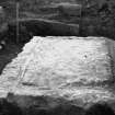
Excavation photograph showing large block at corner of courtyard, taken during the James Curle excavation 1905-1909.
Records of the Society of Antiquaries of Scotland, Edinburgh, Scotland
1905
© Courtesy of HES (Society of Antiquaries of Scotland Collection)

SC 923319
View of artefact from the James Curle excavation 1905-1909.
Records of the Society of Antiquaries of Scotland, Edinburgh, Scotland
1905
© Courtesy of HES (Society of Antiquaries of Scotland Collection)

DP 019554
Oblique aerial view centred on the cropmarks of the Roman fort and the fort annexes, taken from the WNW.
RCAHMS Aerial Photography Digital
24/7/2006
© Crown Copyright: HES

DP 019866
Oblique aerial view centred on the cropmarks of the Roman fort and fort annexes, taken from the ENE.
RCAHMS Aerial Photography Digital
27/7/2006
© Crown Copyright: HES

DP 050251
General oblique aerial view looking across the bridge, viaduct, village and site of the Roman fort towards the fort and Eildon Hills, taken from the NE.
RCAHMS Aerial Photography Digital
4/7/2008
© Crown Copyright: HES

DP 080859
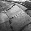
Oblique aerial view of the soilmarks of the W ditch of Newstead Roman fort, taken from the WSW.
RCAHMS Aerial Photography Digital
28/8/2009
© Crown Copyright: HES

SC 1291584
Newstead, Roman forts and temporary camps. Excavation photograph, I A Richmond Flavian I rampart from W
1947


SC 1741934
Newstead, Roman fort and temporary camps: air photograph showing fort (NT 569 344), Southern annexe (NT 569 341), Eastern annexe (NT 572 343) and annexe (NT 571 343).
RCAHMS Aerial Photography
1984
© Crown Copyright: HES


SC 1742022
Oblique aerial view
RCAHMS Aerial Photography
22/8/1994
© Crown Copyright: HES

SC 1742029
Oblique aerial view
RCAHMS Aerial Photography
22/8/1994
© Crown Copyright: HES


SC 1742062
Newstead, oblique aerial view, taken from the NW, centred on the Roman fort and the western and southern annexes.
RCAHMS Aerial Photography
9/8/1995
© Crown Copyright: HES

SC 1742079
Newstead, oblique aerial view, taken from the S, centred on the Roman fort eastern annexe and 'great camps' complex.
RCAHMS Aerial Photography
25/7/1996
© Crown Copyright: HES

SC 1742145
Oblique aerial view of Newstead centred on the cropmarks of the eastern annexe, enclosure and Roman temporary camps with Roman fort adjacent, taken from the SE.
RCAHMS Aerial Photography
11/8/1999
© Crown Copyright: HES

SC 1742163
Oblique aerial view of Newstead centred on the cropmarks of the Roman fort, eastern and southern annexes, enclosure and Roman temporary camps, taken from the SW.
RCAHMS Aerial Photography
11/8/1999
© Crown Copyright: HES

SC 1742173
Oblique aerial view of Newstead centred on the cropmarks of the Roman fort, eastern and southern annexes, enclosure and Roman temporary camps, taken from the SW.
RCAHMS Aerial Photography
11/8/1999
© Crown Copyright: HES

SC 1952685
Newstead, Roman forts and temporary camps. Excavation photograph, I A Richmond N wall of Antonine I barracks, over Flavian II foundation
1947
© Richmond, Lady

SC 1952688
Newstead, Roman forts and temporary camps. Excavation photograph, I A Richmond S wall of Antonine I barrack, on Flavian II intervallum road.
1947
© Richmond, Lady

SC 1952690
Newstead, Roman forts and temporary camps. Fort-wall, looking across inner Agricolan ditch, from N
1947
© Richmond, Lady

SC 1952691
Newstead, Roman forts and temporary camps. Excavation photograph, I A Richmond Flavian I rampart from W
1947
© Richmond, Lady

SC 1952692
Newstead, Roman forts and temporary camps. Excavation photograph, I A Richmond Flavian II rampart material
1947
© Richmond, Lady

SC 1952697
Antonine fort wall and cobbled foundation of Flavian II rampart
1947
© Richmond, Lady


SC 2081841
Newstead, Roman fort and temporary camps: oblique aerial photograph showing eastern annexe (NT 572 343) and annexe (NT 571 343).
John Dewar
7/1976
© Copyright: HES (John Dewar Collection)

SC 2449636
Newstead, NT53SE 20.1, Ordnance Survey index card, page number 7, Recto
Records of the Ordnance Survey, Southampton, Hampshire, England
c. 1958
© Crown Copyright: HES (Ordnance Survey Archaeology Division)

SC 356087
Publication drawings illustrating the different phases of Newstead fort. Roxburgh Inventory fig. 424.
© RCAHMS

SC 356088
Publication drawings illustrating the different phases of Newstead fort. Roxburgh Inventory fig. 424.
© RCAHMS

SC 923305
Excavation photograph taken during the James Curle excavation 1905-1909.
Records of the Society of Antiquaries of Scotland, Edinburgh, Scotland
1905
© Courtesy of HES (Society of Antiquaries of Scotland Collection)

SC 923323
Excavation photograph showing wall of praetorium, N side outer court, taken during the James Curle excavation 1905-1909.
Records of the Society of Antiquaries of Scotland, Edinburgh, Scotland
1905
© Courtesy of HES (Society of Antiquaries of Scotland Collection)
















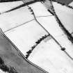

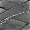


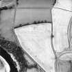
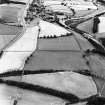





















First 100 images shown. See the Collections panel (below) for a link to all digital images.
- Council Scottish Borders, The
- Parish Melrose
- Former Region Borders
- Former District Ettrick And Lauderdale
- Former County Roxburghshire
Aerial Photographic Transcription (14 August 1992)
An aerial transcription was produced from oblique aerial photographs. Information from Historic Environment Scotland (BM) 31 March 2017.
Sbc Note (21 March 2016)
Visibility: This was the site of an archaeological monument, which may no longer be visible.
Information from Scottish Borders Council
Previously also listed under duplicate site NT96SW 510 -CANCELLED. HES (LCK) 11.6.2024


