Pricing Change
New pricing for orders of material from this site will come into place shortly. Charges for supply of digital images, digitisation on demand, prints and licensing will be altered.
Upcoming Maintenance
Please be advised that this website will undergo scheduled maintenance on the following dates:
Thursday, 9 January: 11:00 AM - 3:00 PM
Thursday, 23 January: 11:00 AM - 3:00 PM
Thursday, 30 January: 11:00 AM - 3:00 PM
During these times, some functionality such as image purchasing may be temporarily unavailable. We apologise for any inconvenience this may cause.
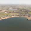
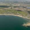
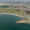
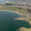
Elie Harbour
Harbour (19th Century)
Site Name Elie Harbour
Classification Harbour (19th Century)
Alternative Name(s) Firth Of Forth; Outer Forth Estuary
Canmore ID 55099
Site Number NT49NE 21
NGR NT 49263 99597
NGR Description Centred NT 49263 99597
Datum OSGB36 - NGR
Permalink http://canmore.org.uk/site/55099
- Council Fife
- Parish Elie
- Former Region Fife
- Former District North East Fife
- Former County Fife
NT49NE 21.00 centred 49263 99597
NT49NE 21.01 NT 4918 9962 Pier
For Elie Harbour, Granary (NT 4921 9959), see NT49NE 22.
For possible shell midden at NT 4928 9955, see NT49NE 67.
(Location cited as NT 493 997). Elie Harbour, rebuilt c.1855. Formed by a pier linked to the shore by a causeway and extended by a pier.
J R Hume 1976.
This extensive harbour remains in use for recreational boating and diving, and houses the clubhouse of the Elie and Earlsferry Sailing Club. It dries at low water.
Information from RCAHMS (RJCM), visited 7 August 2000.
INFORMATION TAKEN FROM THE ARCHITECTURE CATALOGUE:
REFERENCE:
SCOTTISH RECORD OFFICE:
Plans for improving and rebuilding harbour.
Letter, which accompanied plans prepared by Messrs. Stevenson and Co. Engineers.
GD 147 Box 53
Proceedings, report and a letter accompanied the plan for Elie Harbour by Messrs Stevenson and Son. Abstracts of expenditure.
1836-39, GD 147/55/4/6-9 and 10-11
1842 and 1844
(Undated) information in NMRS.


