
Blarich


Hut Circle(S) (Prehistoric)
Site Name Blarich
Classification Hut Circle(S) (Prehistoric)
Canmore ID 5477
Site Number NC60SE 1
NGR NC 692 040
Datum OSGB36 - NGR
Permalink http://canmore.org.uk/site/5477


- Council Highland
- Parish Rogart
- Former Region Highland
- Former District Sutherland
- Former County Sutherland
NC60SE 1 692 040.
(A: NC 6925 0408, B: NC 6927 0406, C: NC 6932 0408 and D: NC 6935 0418) Enclosures (NR)
OS 1:10,000 map, (1970)
A group of four enclosures (A-D) noted by the RCAHM.
Surveyed at 1:2500.
RCAHMS 1911, visited 1909; Visited by OS (W D J) 6 July 1963.
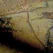
A settlement of three hut circles (A-C) in a field presently under pasture. The alleged enclosure (D) at NC 6935 0418 is a hollow, either natural or an old quarry,on the top of a rise; random boulders litter the periphery and central area.
The huts are turf-covered.
'A' measures 14.5m diameter inside a wall reduced to a rubble spread varying from 1.5m to 3.0m broad by 0.2m to 0.6m high. The probable entrance is in the SE.
'B', levelled back into slight slope, measures about 11.5m internal diameter. In the south quarter the wall has practically disappeared and the hut stance is mutilated; elsewhere the wall survives as a rubble spread 2.5m to 3.0m broad and from 0.2m to 0.7m high. The entrance is no longer discernible.
'C' is an estimated 13.0m diameter internally. The hut has been considerably mutilated on the ESE to WNW axis particularly at the former end where an entrance may have been. The north arc of the hut is scooped into the slope; in the south, the wall is most pronounced in a rubble spread 2.0m to 3.0m broad and up to 0.3m high.
There are no signs of associated land-use.
Revised at 1:10,000.
Visited by OS (J M) 3 October 1980.

