
Soutra Aisle


Field System (Period Unassigned), Village (Period Unassigned)
Site Name Soutra Aisle
Classification Field System (Period Unassigned), Village (Period Unassigned)
Canmore ID 54543
Site Number NT45NE 2
NGR NT 453 584
Datum OSGB36 - NGR
Permalink http://canmore.org.uk/site/54543


- Council Scottish Borders, The
- Parish Fala And Soutra (Ettrick And Lauderdale)
- Former Region Borders
- Former District Ettrick And Lauderdale
- Former County Midlothian
NT45NE 2 453 584.
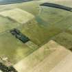
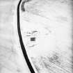
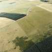
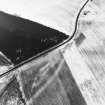
(NT 4540 5830) Deserted Mediaeval Village of Soutra (Site of) (NAT)
OS 6" map (1964)
The Statistical Account [OSA] notes that Soutra seemed formerly to have been a very considerable village, of which only two or three cottages remained. By 1852, there were only a few undulations left, marking the site of the village.
OSA 1794; Name Book 1852
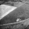
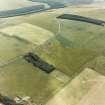
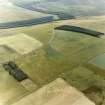
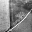
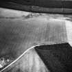
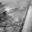
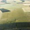
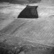
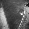
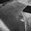
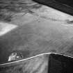
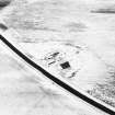
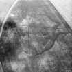
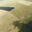
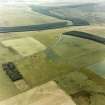
Beside Soutra Aisle (NT45NE 1), crop marks reveal the foundations of another buiding, probably also medieval, but on the level ground N and NE of the Aisle are a number of lines of ditch, one circular (see NT45NE 10). Excavation alone can show if they formed part of the medieval village known to have existed here.
J K St Joseph 1955
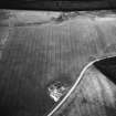
There is nothing to be seen of this village in ground under cultivation.
Visited by OS (BS) 31 July 1975.

