Pricing Change
New pricing for orders of material from this site will come into place shortly. Charges for supply of digital images, digitisation on demand, prints and licensing will be altered.
Upcoming Maintenance
Please be advised that this website will undergo scheduled maintenance on the following dates:
Thursday, 9 January: 11:00 AM - 3:00 PM
Thursday, 23 January: 11:00 AM - 3:00 PM
Thursday, 30 January: 11:00 AM - 3:00 PM
During these times, some functionality such as image purchasing may be temporarily unavailable. We apologise for any inconvenience this may cause.
Craigend
Fort (Prehistoric)
Site Name Craigend
Classification Fort (Prehistoric)
Canmore ID 54472
Site Number NT44NE 3
NGR NT 4540 4567
Datum OSGB36 - NGR
Permalink http://canmore.org.uk/site/54472
- Council Scottish Borders, The
- Parish Stow
- Former Region Borders
- Former District Ettrick And Lauderdale
- Former County Midlothian
NT44NE 3 4540 4567.
(NT 4542 4567) Fort (NR)
OS 6" map (1971)
This fort appears to have been an irregular oval on plan, measuring 316ft NE-SW by 236ft internally. It seems to have been defended by two stone walls of which only fragments remain. The inner wall is 15ft wide and between 1 1/2ft and 9ft high. There are traces of several enclosures in the interior.
Several items from this fort were exhibited to the members of the Society in 1912 by Mr A Sulley, Briarbank, Galashiels. They comprised a flat axe mould of sandstone, found in one of the pits, a piece of slate with incised lines, a piece of rough clay pottery showing potter's wheel marks, a piece of animal bone cut as a saw, found in the inner ditch, a cast of a perforated and decorated stone, probably an amulet, and two decorated whorls.
RCAHMS 1929, visited 1913; Proc Soc Antiq Scot 1912
The remains of this fort are represented by the mutilated remains of two ramparts on the S and E sides and the probable remains of the inner face of the inner rampart on the NW side. The outer rampart exists as a mere scarp 0.5m in average height; the inner, again existing as a scarp mainly, has a maximum height of 1.4m on the SE arc, but on the SW arc the remains are very slight, bearing signs of recent disturbances. The remains are too fragmentary to give accurate overall dimensions. Within the fort are several enclosures, small scoops and fragments of old banks, probably of more recent origin. The enclosures are generally formed by low spread banks of earth and stone; the best preserved bank has a width of 5.0m and a height of 0.6m.
Revised at 25".
Visited by OS (WDJ) 22 December 1964
Field Visit (8 June 1954)
This site was included within the RCAHMS Marginal Land Survey (1950-1962), an unpublished rescue project. Site descriptions, organised by county, are available to view online - see the searchable PDF in 'Digital Items'. These vary from short notes, to lengthy and full descriptions. Contemporary plane-table surveys and inked drawings, where available, can be viewed online in most cases - see 'Digital Images'. The original typecripts, notebooks and drawings can also be viewed in the RCAHMS search room.
Information from RCAHMS (GFG) 19 July 2013.
Note (18 November 2015 - 31 August 2016)
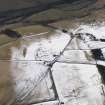
This fort is situated on a spur projecting from the SE flank of Craigend Hill on the NE side of the Gala Water NW of Stow. Enclosed within improved fields, however, the defences have been mutilated by stone-robbing and cultivation, while the interior is largely occupied by a series of courts and yards that probably form part of an overlying late Iron Age settlement. The presence of the latter has confused the various antiquaries, archaeologists and surveyors who have visited since, and though most agree that the defences comprise two ramparts, their estimates of the size of the interior vary widely. Nevertheless, oblique aerial photography and satellite imagery suggest that the fort is oval on plan, measuring about 100m from NE to SW by 85m transversely (0.68ha) within the inner rampart, which on the SE forms a scarp about 1.4m high. Traces of the outer rampart, which does not appear to be strictly concentric, are visible only on the S and SE; elsewhere it has been obliterated by cultivation and even in this sector there is no more than a low scarp about 0.5m in height. A gap in the inner rampart on the WSW probably marks the position of an entrance.
Information from An Atlas of Hillforts of Great Britain and Ireland – 31 August 2016. Atlas of Hillforts SC3760
Sbc Note
Visibility: This is an upstanding earthwork or monument.
Information from Scottish Borders Council


