
Burgh Hill


Fort (Prehistoric), Settlement (Prehistoric)
Site Name Burgh Hill
Classification Fort (Prehistoric), Settlement (Prehistoric)
Canmore ID 54017
Site Number NT40NE 18
NGR NT 4681 0616
Datum OSGB36 - NGR
Permalink http://canmore.org.uk/site/54017


- Council Scottish Borders, The
- Parish Teviothead
- Former Region Borders
- Former District Roxburgh
- Former County Roxburghshire
NT40NE 18 4681 0616.
(NT 4681 0616) Fort & Settlement (NR)
OS 25" map (1968)
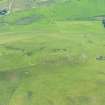
A subrectangular fort, measuring internally 320 ft from NE to SW by 100 ft transversely, occupies the SW summit of Burgh Hill, just over 1000 ft OD. Its defences consist of two massive stony ramparts (A and B on plan) with external quarry-ditches, except on the NW, where only a few boulders remain at the top of the steep slope. At the NE end of the fort, a low earthen bank lies on the outside of the outer ditch. There are entrances at either end of the fort and there are quarries in its interior.
A secondary settlement, measuring 135 ft 100 ft, occupies the NE half of the interior; its SW side is formed by a wide stony bank linking points on rampart A. Its NW side consists of a low, stony bank running along the lip of the steep slope and probably built on the ruins of a rampart of the first phase. There is a hut circle (I) and two possible hut platforms in the interior; '4' on plan is a rectangular, earthfast boulder.
RCAHMS 1956, visited 1949
This fort and settlement are as described by the RCAHM.
Resurveyed at 1:2500.
Visited by OS (WDJ) 23 February 1965
No change in condition. The standing stone has no obvious function within the fort but it may be of independent significance.
Surveyed at 1:10,000.
Visited by OS (JRL) 23 November 1979
Note (5 August 2015 - 19 October 2016)
This fort occupies the rocky ridge forming the SW end of the elongated summit of Burgh Hill. Rectilinear on plan by virtue of the topography, it measures 98m from NE to SW by between 23m and 30m transversely (0.24ha) within twin ramparts with external ditches everywhere except the NW, where the flank of the hills drops away steeply. The inner rampart has been reduced to a stony bank some 9m in thickness, but while it is no more than 0.6m in internal height, externally it falls some 3m into the bottom of the external ditch. Likewise the outer, which is 7.5m in thickness falls about 2.8m into the outer ditch, though this disappears beneath traces of later cultivation around the SW end of the fort; where better preserved at the NE end there is also a counterscarp bank. There are entrances at both ends, that on the NE formed between the terminals of the ramparts and the steep NW flank of the hill, while at the SW end the gaps in the ramparts are staggered to expose the visitor's left side. All that is visible within the SW half of the interior are traces of small quarries, but the NE end has been incorporated into a late Iron Age settlement enclosure bounded on the NE and SE by the inner rampart and elsewhere by a thick stony bank; sub-rectangular on plan it measures about 40m from NE to SW by 30m transversely and contains the footings of at least three round-houses terraced into the slope.
Information from An Atlas of Hillforts of Great Britain and Ireland – 19 October 2016. Atlas of Hillforts SC3250
Sbc Note
Visibility: This is an upstanding earthwork or monument.
Information from Scottish Borders Council
Sbc Note
Rig and furrow covers extensive area around fort. 325/0019/02 (Internal Scottish Borders Council Reference Number).
Information from Scottish Borders Council Historic Environment Record
(n.d.)

