Pricing Change
New pricing for orders of material from this site will come into place shortly. Charges for supply of digital images, digitisation on demand, prints and licensing will be altered.
Newton
Cup Marked Stone (Prehistoric), Long Cist Cemetery (Early Medieval), Pit Alignment (Prehistoric), Ring Groove House (Prehistoric), Tree Trunk Coffin (Early Medieval)
Site Name Newton
Classification Cup Marked Stone (Prehistoric), Long Cist Cemetery (Early Medieval), Pit Alignment (Prehistoric), Ring Groove House (Prehistoric), Tree Trunk Coffin (Early Medieval)
Alternative Name(s) Newfarm; Thornybank; Thorneybank
Canmore ID 53479
Site Number NT36NW 5
NGR NT 3476 6885
NGR Description NT 3476 6885 and NT 3474 6893
Datum OSGB36 - NGR
Permalink http://canmore.org.uk/site/53479
- Council Midlothian
- Parish Newton
- Former Region Lothian
- Former District Midlothian
- Former County Midlothian
NT36NW 5 3478 6885 and 3476 6893
(NT 3478 6885) Long Cists found AD 1837 (NAT)
OS 6" map (1968)
In October 1970, two long cists were cut into by a pipeline trench at NT 3475 6887; they were noticed by the digger driver who notified the RCAHMS. When examined by Maxwell, the cists, whose ends were destroyed by the excavator, lay about 1.0m apart, aligned about NE-SW at a depth of about 40 cms below ground level, and projected from opposite sides of the trench. They were composed of small slabs of locally available sandstone and were no more than 37cm in height and between 56cm and 42cm in internal width as far as visible. The cist to the E had a collapsed capstone still in position, but there was no sign of a cover for the other.
At NT 3474 6887, some 170' NNE, a small collection of bones was found in a shallow dip in the subsoil, here at a depth of 90 cm below modern ground level. No stone slabs were noted in the vicinity, although a number of small rounded boulders were adjacent to the bones, according to the finder.
At NT 3475 6880, about 65' SSW of the two disturbed cists, a horizontal sandstone slab projected from the E wall of the trench and several more slabs were scattered about the spoil heap, indicating the possible whereabouts of another cist, although this one must have been disturbed before being cut by the pipeline. No bones were found in the immediate vicinity.
Information from G S Maxwell, RCAHMS, visited 26 October 1970.
No further information.
Visited by OS (BS) 30 October 1975.
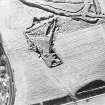
NT 335 695-NT 378 667 An archaeological evaluation was undertaken between September and November 1994 of the proposed route of the A68 Dalkeith Northern Bypass, from its proposed junction with the Edinburgh City Bypass to its proposed junction with the existing A68 at Fordel Mains. The evaluation comprised a desk-based assessment, field inspection, selective fieldwalking, and trial trenching. A total area of 9872 sq m, divided between 154 trenches in 23 land parcels, was sampled by trial trenching along the road corridor. Seperate entries have been compiled for the excavations at Castle Steads pit alignment (NT36NW 53), Smeaton Temporary Camp (NT36NW 33) and Smeaton Brick and Tile Works (NT36NW 109), which were previously known sites and thus not subject to preliminary evaluation.
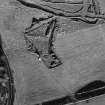
Several known sites lay adjacent to the evaluation corridor; and neighbouring areas were thus examined.The desk-based assessment discounted the site of the Langside cropmark enclosure (NMRS NT36NE 67) being of archaeological significance; its location corresponds with the site of a disused gravel pit recorded on the OS first and second edition maps. The evaluation did not locate any archaeological evidence for a known pit alignment (NMRS NT36NW 52) where its extrapolated line intersected the road corridor immediately beside the Edinburgh City Bypass (NT 335 696). Excavation showed that the area had been severely affected during the construction of the Edinburgh City Bypass, and the pit alignment has most likely been destroyed here. The evaluation did not find any direct evidence of the cist cemetery (NMRS NT36NW 5) known to lie adjacent to a proposed slip road (NT 348 688). However, the sand extraction pit mentioned in the NMRS record, and in which the cists were located, was found, as was a pipe trench opened in the 1970s, in which two cists were also previously located. Trenches excavated adjacent to the site of Smeaton Brick and Tile Works in the same field (NT 349 689) revealed deposits of associated industrial waste material. An area of possible environmental interest was located around the Bellyford Burn, comprising a peat deposit containing pieces of 'bog oak' (NT 368 676 area).
In addition, the evaluation produced evidence of isolated features of lesser significance, such as areas of rig-and-furrow, small (modern) pits, field drains, a probable ploughed out field dyke and a length of ditch of unknown date.
A Data Structure Report has been produced, and will be deposited in the NMRS.
Sponsor: Roads Directorate of The Scottish Office Industry Department, managed on its behalf by Historic Scotland.
R J Strachan and A R Rees 1995.
NT 3476 6893 A watching brief was carried out in advance of pipe rerouting work in the vicinity of Barons Park and the site of the Roman temporary camp (NT36NW 33) excavated by CFA in 1995 (Dunwell 1995, 55). No archaeological features or deposits were located.
Sponsor: a hak Ltd.
A R Rees 1997
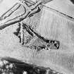
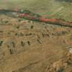
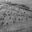
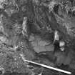
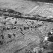
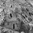
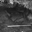
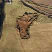
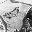
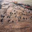
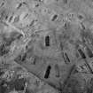
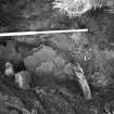
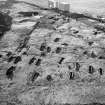
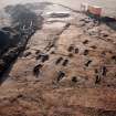
NT 3476 6893 Four stone-lined long cists were located at Thornybank in October 1996, during a watching brief being carried out prior to the rerouting of a gas main. Further excavation revealed a total of 115 burials of a variety of types. The majority of these were of stone-lined long cist type, which dominated the northern area of the site. By contrast, its southern sector contained 38 unlined dug graves, which upon excavation revealed evidence of semi-circular log or leather coffins surviving as stains in the fine sand subsoil. All the burials were aligned approximately ENE-WSW. While the long cists were usually arranged in orderly rows, most of the unlined burials were laid out in a more irregular fashion, often in small groups. Large quantities of skeletal material were recovered from the 47 adult and 21 infant long cist burials, and in some cases complete skeletons survived. From most of the unlined graves, tooth enamel and occasional cranial fragments were also recovered. Almost all the cists were constructed from large, flat, locally available sandstone slabs. These comprised the upright edging stones, flat bases, and the lintel covering slabs which sealed the burials. Three dressed cist slabs were recovered from graves at opposite sides of the cemetery. These slightly wedge-shaped slabs were originally used as arch slabs in a Roman bathhouse and probably originated from the nearby Roman site at Elginhaugh (Lawrence Keppie, pers comm).
Two dug burials were enclosed by shallow U-shaped ditches, rectangular in plan. The ditch of the larger measured 5.6 x 4.4m externally and 4.6 x 3.3m internally. The enclosed grave was 2.5 x 0.95m by 1m deep. The smaller burial had the disturbed remains of a stone cairn spread over the general area of the burial with several large stones set into the top fills of the rectilinear ditch. A further dug burial was bounded at its four corners by four substantial post-holes, three of which were roughly square in plan. A parallel for this has been excavated at Munchen-Aubing in Germany, where a reconstruction proposed a small wooden shrine/mortuary house known as a Totenmemorium constructed over the rectangular grave pit. The example from Thornybank is thought to be the first excavated example of this grave type in Britain.
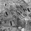
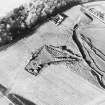
In the process of excavating the cemetery, the remnants of later prehistoric features were identified, consisting of a ring-groove house, a pit alignment and associated bank, and a possible palisade. The ring-groove house, measuring c.9m in diameter, was formed by a curvilinear slot and an internal concentric ring of post-holes. The pit alignment comprised ten pits (nine of which were excavated) aligned approximately E-W. Running parallel to this and some 2m to the N were the vestigial traces of an upcast bank. All the pits were of roughly similar dimensions, measuring 4.2 x 2.2m by 0.8m in depth, with trough-like bases. Some 25m to the S, a linear slot or possible palisade line which also lay exactly parallel to the pit alignment and bank was excavated. It would appear that the four features- the pit alignment, bank, ring-groove structure and possible palisade- are spatially related. However, radiocarbon dates will be required to confirm their contemporaneity as they cannot be linked stratigraphically. Several sherds of prehistoric pottery were recovered from the slot of the ring-groove. Other finds include a large cup-marked stone from the lower fills of a pit on the alignment.
The remains of a rectilinear structure with an adjacent pit were located S of the above features. Overall, the rectilinear structure measured 7.6 x 3.2m (the W side slightly truncated by machine excavator). The structure was aligned E-W and appeared to have a large ?entrance at the E end. The rectangular slot defining the structure had frequent stake-holes along its base, possibly indicating the temporary nature of the structure. The adjacent pit measured 1.3m in diameter, was 0.5m deep and appeared to have been recut on several occasions. It was filled with angular fire-cracked stones 0.15-0.3m in diameter within a sandy matrix of soot and ashy material: it is unlikely to have held any structural uprights.
The pit and the rectangular slot are most likely associated: however, wind and frost damage erased the stratigraphic connection between these features prior to excavation. One small sherd of plain prehistoric pottery was recovered from the slot of the rectilinear structure.
Sponsor: The National Roads Directorate of The Scottish Office Development Department, managed on their behalf by Historic Scotland, via Transco.
A R Rees 1997
Note (1988)
Newfarm NT 347 688 NT36NW 5
In 1838-9 a cemetery of over fifty long cists was discovered in a sand pit to the SE of Newfarm; the cists were aligned E to Wand contained inhumations. In 1970 two more cists, both built of small sandstone slabs, were found about 1m apart in a pipeline trench, and traces of other disturbed cists were observed in the vicinity.
RCAHMS 1988
(NSA, I, Edinburgh, 277-8, 502; Henshall 1956, 279)
Note (June 2017)
A Gruesome Discovery
In the winter of 1838, a group of labourers excavating a sandpit in the vicinity of Newfarm, near Dalkeith, made a gruesome discovery. As the men dug, human skeletal remains emerged from the sand. The find was of such note that it was recorded in the New Statistical Account by the local minister Reverend Norman Macleod. He describes how at least fifty human skeletons were unearthed from graves ‘formed of rough stones loosely placed together in the shape of a coffin’. Although no more digging took place at that time, Reverend Macleod speculated that ‘there can be little doubt that many more remain’.
Over one hundred and thirty years later, the Reverend’s prediction proved correct. In 1970, Dr Gordon Maxwell of the Royal Commission on the Ancient and Historical Monuments was called to investigate after workmen excavating a pipeline trench uncovered two more graves. He concluded that they were most likely part of the cemetery discovered in 1838. The graves, like those described by the Reverend Macleod, were lined with upright stone slabs. However it wasn’t until 1996 that the full extent of the cemetery was investigated when the re-routing of a gas main once again threw the area under the archaeological spotlight. This work coincided with the construction of a major new road connecting the Edinburgh City Bypass with Dalkeith. The discovery of yet further human remains indicated that more of the cemetery survived prompting a full excavation, directed by Alastair Rees of CFA Archaeology.
The Cemetery Revealed
Excavation revealed that the graves had been laid out roughly in rows with many of them lined with upright stones in keeping with the earlier accounts. This type of burial is known by archaeologists as a long cist, and once the body is placed in the grave, a slab or capstone is placed over the top, sealing it. They are generally associated with Christian practices of the early medieval period, and the extensive suite of radiocarbon dates obtained from the remains confirmed the cemetery had been in use between the mid-5th century and the mid-6th century AD. The stones used in the cists were mostly of local sandstone though three of the graves incorporated Roman stone, possibly taken from the bathhouse at Elginhaugh fort. The soil conditions meant that bone preservation was poor on the whole but analysis nonetheless revealed a population in relatively good health with few indications of bone trauma or disease. Of particular interest was the skeleton of a young woman who had unusual wear on her lower front teeth. Experts interpreted this as having been caused by repeatedly gripping material in her mouth, possibly a result of textile making.
Long cists were not the only type of grave found in the cemetery and there were also graves visible only as stains in the soil, perhaps reflecting the use of timber coffins rather than stone cists. Three were particularly unusual, with two graves enclosed within square ditches and another with the imprints of postholes at each of its four corners, practices reminiscent of pre-Christian practice. It seems likely that the people who placed their dead in these particular graves wanted to distinguish them from the others in the cemetery.
Driving past the area today, there is nothing to suggest that the cemetery was ever there, much like in 1838 when the unsuspecting labourers began excavating the sandy soil. Like so many archaeological sites, our knowledge of their presence is the result of simple chance discoveries. In the case of Newfarm, it was a series of discoveries and rediscoveries over a hundred and fifty years that would eventually piece together its overall extent and significance.
Further Reading:
Rees, A. (2002) A first Millennium AD cemetery, rectangular Bronze Age structure and late prehistoric settlement at Thornybank, Midlothian', Proc Soc Antiq Scot, vol. 132, 2002. Page(s): 313-356
Macleod, N (1848) ‘The Parish of Dalkeith’, The New Statistical Account of Scotland, vol. 1 Edinburgh. Page(s): 502
Leanne McCafferty - Data Project Manager


