
'Dere Street': Border - Newstead - Elginhaugh


Roman Road (Roman)
Site Name 'Dere Street': Border - Newstead - Elginhaugh
Classification Roman Road (Roman)
Alternative Name(s) Elginhaugh
Canmore ID 53404
Site Number NT36NW 126
NGR NT 3499 6673
NGR Description NT 3499 6673 to NT 3000 6828
Datum OSGB36 - NGR
Permalink http://canmore.org.uk/site/53404


First 100 images shown. See the Collections panel (below) for a link to all digital images.
- Council Midlothian
- Parish Dalkeith
- Former Region Lothian
- Former District Midlothian
- Former County Midlothian
NT36NW 126.00 from 3499 6673 to 3000 6828 RR 2.
Formerly RR8g.
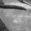
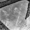
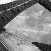
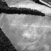
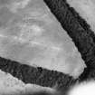
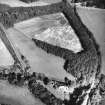
From where the modern road which is considered to overlie Dere Street (see NT36NE 75) rejoins the main A68 (NT 3501 6669), the line is continued into Dalkeith by a hollow, now a watercourse, with parish boundary, (to NT 3481 6698) but for a few yards the remains of an agger seem clearly visible on the W side of it.
I D Margary 1957.
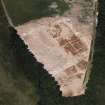
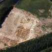
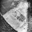
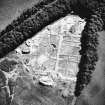
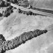
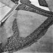
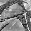
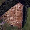
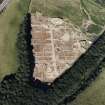
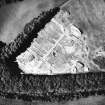
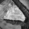
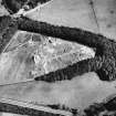
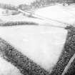
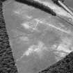
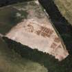
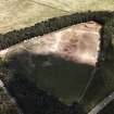
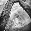
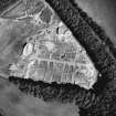
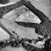
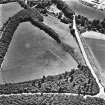
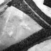
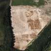
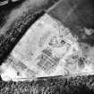
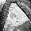
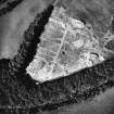
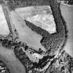
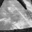
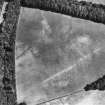
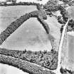
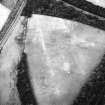
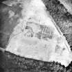
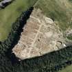
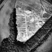
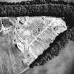
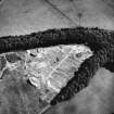
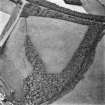
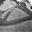
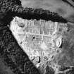
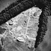
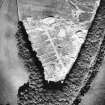
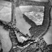
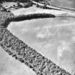
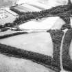
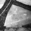
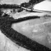
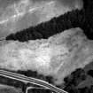
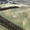
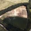
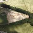
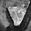
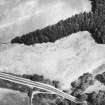
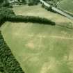
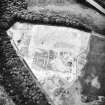
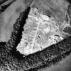
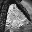
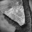
The crossing point on the River South Esk is not known, but the North Esk was presumably crossed in the vicinity of the fort at Elginhaugh (NT36NW 61), the road which issues from the E and W gates of the fort probably being a spur of the main route. (See NT36NW 126.01 for a section cut W of the fort.) Parchmarks visible on air photographs show the road running W from the fort towards the line of the A7, which is thought to be the course followed by Dere Street NW to Liberton.
G S Maxwell 1983; RCAHMS 1988.

