Carberry Tower
Country House (17th Century) - (19th Century), Tower House (16th Century)
Site Name Carberry Tower
Classification Country House (17th Century) - (19th Century), Tower House (16th Century)
Alternative Name(s) Carberry Castle; Musselburgh
Canmore ID 53362
Site Number NT36NE 4
NGR NT 36308 69671
Datum OSGB36 - NGR
Permalink http://canmore.org.uk/site/53362
- Council East Lothian
- Parish Inveresk (East Lothian)
- Former Region Lothian
- Former District East Lothian
- Former County Midlothian
NT36NE 4.00 36308 69671
NT36NE 4.01 36226 69592 Garden
NT36NE 4.02 36314 69646 Sundial
NT36NE 4.03 36358 69760 Chapel
NT36NE 4.04 36266 69457 Curling Pond
NT36NE 4.05 36248 69398 Summerhouse
NT36NE 4.06 36429 69756 Stables/Offices
NT36NE 4.07 35941 69603 Main gate and lodge
NT36NE 4.08 35912 69868 North lodge
NT36NE 4.09 39606 69046 South Lodge
NT36NE 4.10 36 39 Unlocated Game Larder
NT36NE 4.11 36671 69951 Carberry House
NT36NE 4.12 36639 69930 Carberry Gardens
NT36NE 4.13 36606 69836 Sundial
NT36NE 4.14 36313 69647 Garden
NT36NE 4.15 36320 69815 Gymnasium
(NT 36308 69671) Carberry Tower (NR)
OS 6" map (1967)
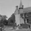
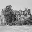
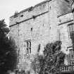
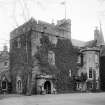
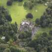
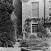
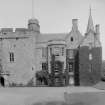
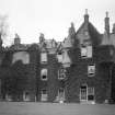
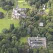
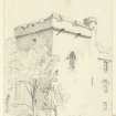
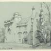
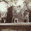
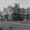
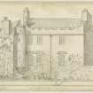
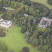
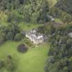
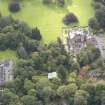
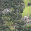
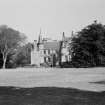
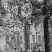
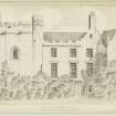
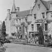
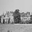
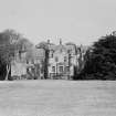
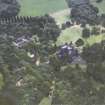
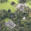
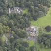
Carberry Tower consists of a smallish but massive tower dating probably from the early 16th c, though, it is likely, incorporating an earlier nucleus (N Tranter 1962), with large, mainly modern additions. The early tower occupies the NW extremity of the building; it measures 34' x 30' over walls about 7' thick. It rises four storeys to the particularly massive parapet, which the RCAHMS suggests may be secondary. Placed on the NW angle of the parapet is a wrought iron fire-basket, for use as a warning beacon. An early addition, probably dating from the late 16th c, extends to the S. It is oblong on plan, three storeys and a garret high, with a square tower projecting to the SW. It has been much altered, and now gives little impression of age. The remainder of the mansion is modern, and in excellent condition.
There are two 17th c sundials within the grounds (at NT 3631 6964 and NT 3660 6983). Only the octagonal dial-stone of the former is original.
RCAHMS 1929, visited 1920; D MacGibbon and T Ross 1889; 1892
Carberry Tower and the sundials are generally as described.
Visited by OS (BS) 22 October 1975.
NMRS REFERENCE:
ARCHITECT: Archibald Scott - stables 1855
OWNER: Church of Scotland Tower of early 16th century
Warden - Rev. D. Ross Flockhart
ARCHITECT: Thomas Ross (MacGibbon and Ross) c.1913 - additons, renovated and additions sundial 1909
EXTERNAL REFERENCE:
Scottish Record Office:
Masonwork. Account, estimate and alterations from original contract of additions executed by George Blair, Builder.
1855 #924
Ditto Plumber #220.11.7 1/2
1856
Ditto. Carpenter and Joiner work by Mr Robert Wilson, Builder #1127.15.10 1/4
1856
Ditto. Plaster work. #127 James Summers.
1856.
Masonwork. Account, estimate and alterations from original contract of additions executed by George Blair, Builder. Stables and Offices. #157.
1856
Ditto. Slater, Peter McEwan #77.11.9 1/2
Letter giving Masons' and Slaters' estimates for the new stables. Those chosen amount to #2340. Archibald Scott.
1855
Vine houses and Observatory. Account #586. Robt. Wilson.
1856
Wright work. Porter's Lodge. Robt. Wilson.
1856
GD 156/Box 64
1856 Bank
Statements of Building Accounts. TOTAL #9,959.5.6
(A. Scott for plans of stable offices #65. Dec. 1856).
A. Scott for plans Jan. #65. Dec. 1850.
For 1855. #6,964.1.10. A. Scott #690.
1854 #4115.1.9
1853 #3,279.3.10
1852 #2,596.7.10
1851 #17,999.1.8
1850 #1,156.15.10
EXTERNAL REFERENCE:
National Library:
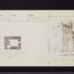
Ross Bequest. Sgd 65 Frederick Street, Edinburgh - plans, elevation and sections
July 13 (Thomas Ross) plans of tower inscribed "traced from Mr Bryce"
drawings of sundial
photograph of house before 1913 additions
Country Life, 15th April, 1939 - photograph
Country Life, 27th February, 1942 - article and photographs on the garden
Field Visit (30 September 1920)
Carberry Tower.
On the same ridge as Elphinstone and Falside Towers in East Lothian, but at a lower elevation, Carberry Tower (Fig. 108), stands 1 ½ miles distant from and south-south-east of Inveresk railway station. It is a smaller and more simple tower than the others mentioned and is later in date, having been founded, in all probability, within the first half of the 16th century. It forms the north-west angle of the mansion which has grown round it in course of time, and which includes a late 16th-century addition, oblong on plan, with modern extensions, leaving only the north and west faces of the tower unobscured. Within the tower, as well as in the earlier addition, considerable alterations have been made to suit the structure to modern requirements; while modern work appears externally in the enlarged windows and projecting porch, oriel, and balcony.
The tower is oblong on plan and measures 30 ½ feet from east to west by 34 feet from north to south, over walls about 7 feet thick. In height there are two main storeys, both vaulted, but beneath each vault there has been an entresol with timber floor. The wall-head is surmounted by a massive parapet, which has large merlons, finishing in a massive weathered cope. The parapet slightly overhangs and is borne on a continuous corbelling, a cavetto in section, enriched with winged heads. A rather similar enrichment is found on the corbelling at the Palace, Stirling Castle. The roof within the parapet is flat and may have been intended as a gun-platform; the merlons, or solids, are unusually massive and have heavy sloping copes, while the central merlon on each side except the southern is pierced by a gunloop.
The masonry of the parapet is inferior to that of the lower part of the walls and may be secondary. The turret at the south-west angle is modern. The lower part of the walls is constructed in rubble, brought to courses, with axe dressed quoins; these latter are massive, and range up to 4 ½ feet by 1 ½ feet, built in courses 13 to 15 inches high. The original voids have a chamfer wrought on jambs and lintel.
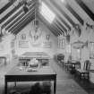
Where the original entrance was placed is now problematical. Internally the tower is completely modernised, and contains no features worthy of mention; there was one apartment on each floor.
On the roof should be noted the fire-basket surmounting the parapet at the north-east angle and reached by rough steps. The basket is constructed of wrought iron and is circular; it has a diameter of 19 inches and a height of 14 inches. The vertical bars are ½ inch square, while the horizontal bars are ¾ of an inch by ¼ inch. The present basket may be are production. In the west wall the southern merlon contains a seated recess, which has been furnished with a door; a similar recess is noted at Cakemuir Castle (No. 58). The roof water has been conveyed clear of the walls by gargoyles fashioned to resemble grotesque animals.
The late 16th-century addition runs about 52 feet southward from the tower in alignment with its west wall and returns rectangularly to this for a distance of 45 ¾ feet. A quadrangular tower projects from the south-west angle and furnishes two re-entrant angles, one of which, facing south-east, contains a circled stair turret, which projects at first-floor level and is borne on a continuous corbelling of eight moulded members. Beneath the turret in the east wall of the tower a loop for a hand-gun commands the entrance, which is in the south wall of the main wing. The masonry of this addition is of rubble, which has been harled; the dressings at the original voids are rounded at jamb and lintel. There are three storeys, and the basement is vaulted. The tower is carried one storey higher. The addition has been completely modernised internally .
The fabric of the mansion is structurally in excellent condition.
SUNDIALS.
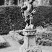
(a) In the garden north-east of the house is a fine 17th-century free-standing dial. It is 5 feet 5 inches in height. On two square plinths, the upper placed diagonally on the lower, rests a circular shaft with moulded base and necking; the capital is in the form of two female busts, one facing north, the other south, each bearing on the head a debased Ionic capital with volutes and abacus. At either shoulder is a circular dial, and the abacus is surmounted by the main dial-stone so wrought as to furnish upright, horizontal, and inclined dials, making a total of thirteen dials.
(b) There is a free-standing dial on the lawn east of the house, but only the octagonal dial-stone is original; it dates from the 17th century. Erected on a modern shaft and surmounted by a modern finial, both in keeping with the original fragment, the dial stone has a diameter of 1 foot 5 ¼ inches and contains a dial on each facet, 16 in all. The stone is pierced or hollowed in a remarkable manner.
HISTORICAL NOTE. In 1543 the lands of Carberry were granted by charter to Mr Hugh Rig, burgess of Edinburgh, who for the previous four years had held them in lease. The tower is not specifically mentioned in the deeds till 1618, but in 1598 there is a reference to the "new house built . . . on the south side of the enclosure adjoining the garden" by James the son of Hugh Rig, who was infefted in 1555. This "new house" is the addition to the already existing tower, probably built by Hugh Rig. The Rigs were in Carberry till 1668, when the lands passed to Sir Adam Blair of Lochwood.
Laing Charters, Nos. 431, 476 etc., 633 etc., 1363, 1806, 2639.
RCAHMS 1929, visited 30 September 1920.
Photographic Survey (1955)
Photographic survey by the Scottish National Buildings Record in 1955.
Photographic Survey (20 June 1961)
Photographic survey by the Scottish National Buildings Record in June 1961.
Field Visit (22 October 1975)
Carberry Tower and the sundials are generally as described.
Visited by OS (BS) 22 October 1975.


