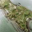
Inchkeith, Old Lighthouse
Lighthouse (18th Century)
Site Name Inchkeith, Old Lighthouse
Classification Lighthouse (18th Century)
Alternative Name(s) Outer Forth Estuary
Canmore ID 52873
Site Number NT28SE 7
NGR NT 29337 82790
Datum OSGB36 - NGR
Permalink http://canmore.org.uk/site/52873
- Council Fife
- Parish Kinghorn
- Former Region Fife
- Former District Kirkcaldy
- Former County Fife
NT28SE 7 29337 82790
Old lighthouse (NAT)
OS 6" map, (1959).
Location formerly entered as NT 2934 8278.
For (successor and present) New Lighthouse (NT 29296 82877), see NT28SE 6
A small circular house, about 110 yards S of the lighthouse (NT28SE 6), erected by the Lighthouse Commissioners as a place for trying lights previous to there being transferred to stationary lighthouses.
OS Name Book 1853.
This building is still intact but is in a poor state of repair.
Visited by OS (BS) 14 September 1978.
In about 1785 Thomas Smith set up an experimental lighthouse incorporating an oil-burning reflector system on the Argand model on Inchkeith.
K Allardyce and E M Hood 1986.
This building is situated on the raised central 'spine' of the island to the S of the (present) 'new' lighthouse (NT28SE 6). It is depicted, but not noted, on the 1982 edition of the OS 1:10,000 map and the current OS (GIS) AIB.
Information from RCAHMS (RJCM), 28 April 2006.
A circular structure situated immediately SSE of the Port War Station (NT28SE 5.12). It measures about 3.8m in diameter and has several small opening in the wall. Terracotta tiles were noted on the floor and the entrance is in the WNW.
The building is depicted as seven-sided on the current OS digital Master Map series.
Visited by RCAHMS (DE, AL), 5th March 2009.
Construction (1785)
In about 1785 Thomas Smith set up an experimental lighthouse incorporating an oil-burning reflector system on the Argand model on Inchkeith.
K Allardyce and E M Hood 1986
Field Visit (11 September 1978)
This building is still intact but is in a poor state of repair.
Visited by OS (BS) 14 September 1978.
Note (28 April 2006)
This building is situated on the raised central 'spine' of the island to the S of the (present) 'new' lighthouse (NT28SE 6). It is depicted, but not noted, on the 1982 edition of the OS 1:10,000 map and the current OS (GIS) AIB.
Information from RCAHMS (RJCM), 28 April 2006.
Field Visit (5 March 2009)
A circular structure situated immediately SSE of the Port War Station (NT28SE 5.12). It measures about 3.8m in diameter and has several small opening in the wall. Terracotta tiles were noted on the floor and the entrance is in the WNW.
The building is depicted as seven sided on the current OS digital Master Map series.
Visited by RCAHMS (DE, AL), 5th March 2009


