Following the launch of trove.scot in February 2025 we are now planning the retiral of some of our webservices. Canmore will be switched off on 24th June 2025. Information about the closure can be found on the HES website: Retiral of HES web services | Historic Environment Scotland
Inchkeith, Artillery Fortifications
Artillery Fortification(S) (19th Century), Artillery Fortification(S) (17th Century)
Site Name Inchkeith, Artillery Fortifications
Classification Artillery Fortification(S) (19th Century), Artillery Fortification(S) (17th Century)
Alternative Name(s) Inchkeith, Franco-scottish Fort Of 1556-64; Victorian 1880 Forts And Batteries; Forth Defences
Canmore ID 52867
Site Number NT28SE 1
NGR NT 29336 82831
NGR Description Centred NT 29336 82831
Datum OSGB36 - NGR
Permalink http://canmore.org.uk/site/52867
- Council Fife
- Parish Kinghorn
- Former Region Fife
- Former District Kirkcaldy
- Former County Fife
NT28SE 1.00 centred 2934 8284
(NT 2934 8284) Fort (NR) (Remains of)
OS 6" map, Fifeshire, 1st ed., (1854)
NT28SE 1.01 NT 29138 82871 Coast Battery; Magazine; Barracks (Fort No.1 19th Century)
NT28SE 1.02 NT 29240 83114 Coast Battery; Magazine; Barracks (Fort No.2 19th century)
NT28SE 1.03 NT 29567 82295 Coast Battery; Magazine; Barracks (Fort No.3 19th Century)
NT28SE 1.04 NT 29554 82331 and NT 29577 82268 Blockhouse; Trench (19th Century)
NT28SE 1.05 NT 29089 82897 Trench (19th Century)
NT28SE 1.06 from NT 2956 8237 to NT 2954 8246 Gun emplacements (19th century Practice Battery)
For later 20th century defences see NT28SE 5.00.
For 'new' lighthouse within the area of these fortifications, see NT28SE 6.
For tunnel, see NT28SE 8.
For (associated) Memorial to Lord Herbert of Lea (the 'Lord Herbert Inscription' at NT c. 2927 8280), see NT28SE 11.
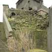
The remains of the NE wall of a fort built during the period 1550-64, probably by the French allies of Scotland, to replace one which the invading English had built in 1547 or 1549. The latter can only have been a temporary structure of timber and earth since it was erected within a fortnight. Its successor is described in 1560 as consisting of a wall 30ft thick, comprising 14ft of stone and 16ft of earth. Parliament ordered its demolition in 1567 but in 1698 it was still almost entire. In 1803 most of it was removed when a lighthouse was built.
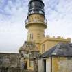
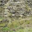
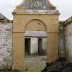
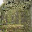
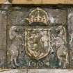
The remains consist of a 50 yards long stretch of rubble masonry, averaging 5 1/2ft in thickness, strengthened by piers of squared stones about 12ft apart. Within a short re-entrant is a gun embrasure 2ft 2ins wide with a semicircular head of continental type. A core of rubble below the signal-tower may be the base of a 16th century structure. A panel bearing the Royal Arms, the initials M R (for Maria Regina) and the date 1564 has been inserted over the entrance to the courtyard of the lighthouse.
A H Millar 1895; RCAHMS 1933, visited 1928; S Cruden 1960.
This 16th century walling with the gun embrasure is as described above and is undoubtedly part of the E wall of the fort. It survives to a maximum height of 6.0m and has been incorporated within the modern wall around the lighthouse building.
The rubble wall core at the E base of the old signal tower (NT 2934 8278) extends 10.0m to the N and 20.0m westwards under a modern wall. Slight traces can be seen to continue for a further 10.0m W. The position of this walling, on the edge of the summit plateau, and its similar composition to the known 16th century wall to the N suggest that it may be an extension of that wall and could represent the SE corner of the fort.
The royal coat of arms is as described at NT 2932 8287.
Surveyed at 1:10,000.
Visited by OS (B S) 14 September 1978.
The 16th century fortification walling survives to the S, E and SE of the Lighthouse (NT28SE 6.00). In some lengths of walling the lower courses of the facing stones are still in situ. A casemate and bastion flank were noted at NT 29337 82832.
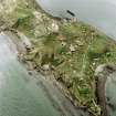
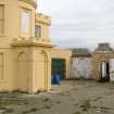
The three 19th century forts, numbered 1 to 3, (NT28SE 1.01, NT28SE 1.02, NT28SE 1.03 ). Two retain above ground remains in one form or another, the third having only underground remains. They are situated NW side and the N and S ends respectively. In addition, at the S end of the Island, to the N and S of Fort No.3 are two large E-W rock cut ditches with stone built blockhouses set half way along them. To the N of Fort No.1 is the remains of a half filled rock cut ditch with another short length to the S.
The remains of the two above ground forts have datestones 'VR 1880', one above the main entrance to the magazines the other on an arch above the entrance road in to the courtryard.
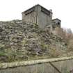
The forts date from between 1878 and 1881 following a visit to the Island by Colonel John Yerbury Moggridge of the Royal Engineers who prepared plans for the gun batteries. The work to build the forts was given to Messrs. Hill and Co. of Gosport, Hampshire, the same firm as had built the major Victorian fortifications at Portsmouth and Spithead (Grant 1882). The surviving walls are built in random rubble with much of the remains underground or below later gun batteries. The ditch is about 7m (20 feet) deep. First and Second World War coast batteries have been built over the stonework of Forts No.1 and 3 (NT28SE 5.07 and NT28SE 5.03). Fort No.2 retains elements of the magazine and accommodation under the M Group 6-inch gun emplacement and Battery Observation Post (NT28SE 5.02).
The forts were originally connected by a military road eighteen feet wide (c.6m). All forts were completed by 1883 and by 1898 had been armed with one 9.2-inch breech-loader (BL) and two 10-inch rifled muzzle loaders with additional emplacements mounting two 6-inch BLs and two 4.7-inch BLs (Saunders 1989).
Visited by RCAHMS (DE), 25 February 2009
Following a photographic survey in February 2009, RCAHMS returned to Inchkeith to undertake a measured drawing survey of selected structures. Included was a floor plan of Fort No.3 along with a GPS mapped outline plan. The plan shows the relationship between the fort, the caponiers in the ditches and the below ground magazines.
Information from RCAHMS (DRE), 2009.
Field Visit (12 November 1928)
Sixteenth-Century Fortification, Inchkeith.
A fort was constructed upon Inchkeith by the English during their occupation of the island in the early part of 1549, but, as it was raised within a fortnight (1), it can have been only a temporary structure of timber and earth. After the recovery of the island, however, it was again fortified in 1550 on behalf of the Scots (2), probably by their allies the French, who were still in garrison there in 1558 (3). A description of the fort in 1560 speaks of the wall as "30 foot thick, i.e. 14 foot of stone and 16 of earth” (4). The Parliament of 1567 ordered the demolition of the place (5), but much of it still existed in 1773 (6). In 1803, however, most of this was removed, when a lighthouse was erected on the site.
What remains is a stretch of rubble masonry 50 yards in length, and averaging 5 ½ feet thick, which was part of the outer wall on the northeast side. Piers of squared stones, built out-and-in band, are placed in the rubble work about 12 feet apart from centre to centre, their purpose being apparently to stiffen the wall. Within a short re-entrant is a gun embrasure, 2 feet 2 inches wide, which has a semi-circular head of Continental type and was probably the work of a foreign engineer. Beneath the signal tower is a core of rubble, which may be the base of a 16th-century structure.
An armorial panel bearing the Royal arms has been inserted over the entrance to the courtyard of the lighthouse. The shield seems to be enclosed within an Order, and beneath it a repainted the initials of M(aria) R(egina), while lower down is the date 1564, carved in relief and also painted.
RCAHMS 1933, visited 12 November 1928.
(1) Histoire de la Guerre d'Ecosse, 1548-9, Jean de Beaugué (Maitland Club), pp. 128,134; Calderwood's History of the Kirk of Scotland (Wodrow Soc.), i, pp. 260-1. 2 Reg. Privy Co., i, p. 90. (3) Calendar of Scottish Papers, i, p. 206. (4) Ibid., p. 365. (5) Acts Parl. Scot., iii, p. 33. (6) Johnson's Journey to the Western Islands, ed. 1791, p. 3.


