|
Photographs and Off-line Digital Images |
A 57028 |
Records of the Ordnance Survey, Southampton, Hampshire, England |
View from North of surviving rubble masonry, including gun embrasure |
1978 |
Item Level |
|
|
Photographs and Off-line Digital Images |
A 57029 |
Records of the Ordnance Survey, Southampton, Hampshire, England |
Detail of panel bearing coat of arms and the date 1564. |
1978 |
Item Level |
|
|
Photographs and Off-line Digital Images |
D 36071 CN |
RCAHMS Aerial Photography |
Oblique aerial view of Inchkeith Island centred on the defences, taken from the NE. |
24/8/1998 |
Item Level |
|
|
Photographs and Off-line Digital Images |
D 36072 CN |
RCAHMS Aerial Photography |
Oblique aerial view of Inchkeith Island centred on the defences, taken from the NNE. |
24/8/1998 |
Item Level |
|
|
Photographs and Off-line Digital Images |
D 36073 CN |
RCAHMS Aerial Photography |
Oblique aerial view of Inchkeith Island centred on the defences, taken from the NNW. |
24/8/1998 |
Item Level |
|
|
Photographs and Off-line Digital Images |
D 36074 CN |
RCAHMS Aerial Photography |
Oblique aerial view of Inchkeith Island centred on the defences, taken from the NW. |
24/8/1998 |
Item Level |
|
|
Photographs and Off-line Digital Images |
D 36075 CN |
RCAHMS Aerial Photography |
Oblique aerial view of Inchkeith Island centred on the defences, taken from the W. |
24/8/1998 |
Item Level |
|
|
Photographs and Off-line Digital Images |
D 35226 |
RCAHMS Aerial Photography |
Oblique aerial view of Inchkeith Island centred on the defences, taken from the NE. |
24/8/1998 |
Item Level |
|
|
Photographs and Off-line Digital Images |
D 35227 |
RCAHMS Aerial Photography |
Oblique aerial view of Inchkeith Island centred on the defences, taken from the NE. |
24/8/1998 |
Item Level |
|
|
Photographs and Off-line Digital Images |
D 35228 |
RCAHMS Aerial Photography |
Oblique aerial view of Inchkeith Island centred on the defences, taken from the N. |
24/8/1998 |
Item Level |
|
|
Photographs and Off-line Digital Images |
D 35229 |
RCAHMS Aerial Photography |
Oblique aerial view of Inchkeith Island centred on the defences, taken from the NNW. |
24/8/1998 |
Item Level |
|
|
Photographs and Off-line Digital Images |
D 35230 |
RCAHMS Aerial Photography |
Oblique aerial view of Inchkeith Island centred on the defences, taken from the WNW. |
24/8/1998 |
Item Level |
|
|
Photographs and Off-line Digital Images |
D 35231 |
RCAHMS Aerial Photography |
Oblique aerial view of Inchkeith Island centred on the defences, taken from the WNW. |
24/8/1998 |
Item Level |
|
|
Photographs and Off-line Digital Images |
E 99180 CS |
RCAHMS Aerial Photography |
Oblique aerial view of Inchkeith Island centred on the defences, taken from the ENE. |
24/8/1998 |
Item Level |
|
 |
On-line Digital Images |
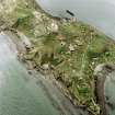
SC 890767 |
RCAHMS Aerial Photography |
Oblique aerial view of Inchkeith Island centred on the defences, taken from the NNE. |
24/8/1998 |
Item Level |
|
|
Manuscripts |
MS 2043/736 |
Records of the Council for British Archaeology, York, England |
Defence of Britain Project. Council of British Archaeology.
Scotland Lists.
Photocopies of general sites in Scotland including, pillboxes, A.A. Gun-sites, observation posts. |
|
Item Level |
|
 |
On-line Digital Images |
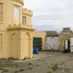
DP 055862 |
RCAHMS Field Survey Digital Photography |
Detail of entrance, lower part of the tower, the commemorative plaque and the gateway with a 16th century datestone above in the background from WSW. |
23/2/2009 |
Item Level |
|
 |
On-line Digital Images |
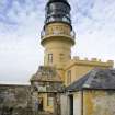
DP 055866 |
RCAHMS Field Survey Digital Photography |
View of lighthouse from work yard with the rear of the gateway and 16th century datestone, taken from the ESE. |
23/2/2009 |
Item Level |
|
 |
On-line Digital Images |
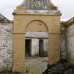
DP 056217 |
RCAHMS Field Survey Digital Photography |
View of arched entrance way with 16th cenutry date and Royal Coat of Arms from WNW. |
23/2/2009 |
Item Level |
|
 |
On-line Digital Images |
DP 056218 |
RCAHMS Field Survey Digital Photography |
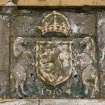
Detail of the Royal Coat of Arms dated 1564 on archway adjacent to the lighthouse from WNW. |
23/2/2009 |
Item Level |
|
 |
On-line Digital Images |
DP 056333 |
RCAHMS Field Survey Digital Photography |
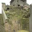
View of possible surviving section of 16th century wall below the Port War Signal Station from the SW. |
3/3/2009 |
Item Level |
|
 |
On-line Digital Images |
DP 056334 |
RCAHMS Field Survey Digital Photography |
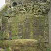
Detail of a section of possible 16th century wall showing rubble infill and facing blocks with 20th century brick platform, taken from SW. |
3/3/2009 |
Item Level |
|
 |
On-line Digital Images |
DP 056335 |
RCAHMS Field Survey Digital Photography |
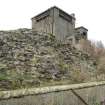
View of a section of 16th century wall surviving rubble infill from SE. |
3/3/2009 |
Item Level |
|
 |
On-line Digital Images |
DP 056336 |
RCAHMS Field Survey Digital Photography |
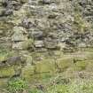
Detail of surviving section of 16th century wall showing rubble infilling and lower two course of faced blocks from SE. |
3/3/2009 |
Item Level |
|