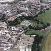
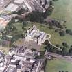
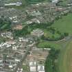
Edinburgh, 28-30 Croft An Righ, Croft An Righ House
Gardeners Lodge(S) (Post Medieval), House (16th Century)
Site Name Edinburgh, 28-30 Croft An Righ, Croft An Righ House
Classification Gardeners Lodge(S) (Post Medieval), House (16th Century)
Alternative Name(s) Holyrood Palace, Gardener's Houses
Canmore ID 52523
Site Number NT27SE 59
NGR NT 26959 74076
Datum OSGB36 - NGR
Permalink http://canmore.org.uk/site/52523
- Council Edinburgh, City Of
- Parish Edinburgh (Edinburgh, City Of)
- Former Region Lothian
- Former District City Of Edinburgh
- Former County Midlothian
NT27SE 59 26959 74076
(NT 2696 7407) Croft an Righ House (NAT)
OS 1/1250 plan, (1972)
The name Croft-an-Righ, meaning "the king's field", applies to a little L-shaped mansion immediately outside the N garden of Holyroodhouse. Judging by its architectural detail, it dates from the 16th century, and was extensively remodelled in the 17th century. The house is popularly associated with the Regent Moray who was assassinated in 1569-70, a date which seems too early for any part of the present fabric. Wilson (1848), however, points out that it answers generally to the description of a house, sometime the property of Lord Elphinstone, which William Graham, Earl of Airth, bought from the Earl of Linlithgow. Within two years of the sale, the house took fire and was "totallie burned" which may explain the traces of rebuilding so evident here.
The house was reconditioned some years ago by H M Office of Works, and is now subdivided into two dwellings which are in use.
D Wilson 1848; RCAHMS 1951.
This house is generally as described in previous information. It is still habited.
Visited by OS (S F S) 3 December 1975.
See also NT27SE 2853
This is a 16th Century laird's house. L-plan with turrets. Fine plaster ceiling.
In possession of Ministry of Works and Buildings.
National Buildings Record: 1 page in pencil, Ferguson sketch book no.9.
NMRS REFERENCE:
Croft-an-Righ - Feuing
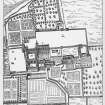
Edinburgh. Garden of Croft-an-Righ. Feuing plan, 1768.
Particulars from David henderson, architect
(Edinburgh Evening Courant, June 25, 1768)
Publication Account (1951)
88. Croft-an-Righ, Holyrood.
This pseudo Gaelicname, meaning "the king's field," is applied to a little countrified mansion, standing immediately outside the N. garden of Holyroodhouse, which dates, to judge by its architectural detail, from the 16th century but which was extensively remodelled in the century following. The house is popularly associated with the Regent Moray, Queen Mary's half-brother, who was assassinated at Linlithgow on January 23rd, 1569-70, a date which seems too early for any part of the present fabric. Sir Daniel Wilson, however, has pointed out (1) that it answers generally to the description of a house, sometime the property of Lord Elphinstone, which William Graham, Earl of Airth, bought from the Earl of Linlithgow. Within two years of the sale that house took fire and was "totallie burned"; and this may explain the traces of rebuilding that are so evident here.
The house was reconditioned some years ago by H.M. Office of Works and is to-day subdivided into two dwellings, occupied by gardeners of the Palace of Holyroodhouse. Facing a lane which originally gave access to the Abbey churchyard but which now leads to the King's Park, it is L-shaped on plan with the re-entrant angle facing S. The main block contains three storeys and the wing four. The top floor of the former being lower than that of the latter, it was originally lit by dormers; but the wall-heads have been raised throughout, those of the wing sufficiently to include an additional storey, which is lit by dormers. Gordon of Rothiemay's drawing, however, seems to indicate a T-shaped layout, in which a lofty main block, recognisable as the existing wing, faces the street, while a low extension occupies the position of the present main block. If this view is an accurate representation, it follows that the rebuilding took place after 1647. The masonry is rubble, once harled, with chamfered and rounded dressings. Turrets with conical roofs project from the S. corners, and all three have been heightened and re-roofed. Where not entirely modern, the windows with few exceptions date only from the 17thcentury; and at this same time the upper part of all three gables was reconstructed.
The lower part of the W. gable has always been recessed at both corners beneath a simple corbel. In the S. recess there seems to be a built-up doorway, intended to give access to the basement of the main block. Two built-up doorways are seen side by side in the wall of the wing facing the courtyard. While the one to the S. gave access to the basement of the wing, the other opened at the foot of a narrow scale-and-platt stair which still rises to the top floor; the lower end of the stair has, however, been closed off and diverted to a modern forestair on the street, for the purpose of shutting off the upper tenant from his neighbour. There is nothing of interest in the basement; it is not vaulted and its original arrangement is uncertain. There can have been only one apartment at this level in the wing, but the main block may have been, and probably was, subdivided. On the first floor, however, it is certain that there was no more than a single room in either division. The one in the main block which, before alteration, measured about 37 ft. by 17 ft., has been divided up, and its fine enriched ceiling, which is of early 17th century date, now covers two rooms and a lobby. The ceiling is divided by moulded ribs into square and circled compartments, each enriched with devices in relief such as lion and human masks, terminal figures, lions rampant, fleurs-de-lys, grape bunches, acorn slips, a griffon rampant and a male figure clad only in breeches and hose. The original bolection-moulded fireplace can still be seen in the E. gable. The wing chamber, too, has been subdivided and wholly modernised. The only feature of interest in the upper storeys is another bolection-moulded fireplace in the wing chamber of the second floor.
On the opposite side of the street is an entrance to part of the Palace garden, and above this has been set a large pediment of pierced strap -work containing a cross in its upper part. This pediment is quite out of scale with its surroundings and has presumably been brought from elsewhere. The style is that of the time of Charles I, but the stone is so little decayed that it may be of considerably later date.
RCAHMS 1951, visited c.1941
(1) Memorials, ii, p. 89.
Watching Brief (4 December 2007 - 12 December 2007)
NT 2695 7409 to NT 2713 7401 A watching brief was maintained, 4–12 December 2007, during the excavation of a new service trench. The trench ran from a point opposite the entrance to Croft An Righ House to a point just W of the Education Centre. The cut consisted of three sections.
The first ran S along Croft-An-Righ towards the entrance to Holyrood Park, a distance of c35m. The next section ran diagonally across the present tarmac roadway to meet up with N side of the path to the Education Centre, a distance of c20m. The third trench was cut along the N side of the existing path leading to the Education Centre, c110 m. The N/S section of the walling along the E side of Croft An Righ was also examined.
The area generally affected by the service trench was formed as a result of landscaping over various late medieval structures and road alignments from the early 18th century to the later 19th century. The present N area of the park largely represents the infill of a shallow slope which runs down from a point a short distance N of the tennis courts. At its deepest the infill is up to 1m deep (on the evidence of the threshold of a surviving door in the residual N wall of the park).
Based on the sequence of building, excavated evidence from the first section of the trench and historic map evidence three episodes of activity were identified.
1) Mid 17th to mid 18th century – Masonry may represent parts of the 17th- and 18th-century layout of walls at the S end of Croft-An-Righ. There is evidence to indicate the gateway was still in place in 1742.
2) Mid 18th to mid 19th century – The gateway was rebuilt a short distance to the N, with the construction of a stone buttress/gate pier with an associated cross wall. A slot received the E gate post. The earlier cross wall/gateway complex was dismantled. The main section of walling defining the E side of Croft-An-Righ was built against the new buttress.
3) Mid 19th century to present – Removal of the last gateway, levelling of the cross wall and establishment of
present setts/roadway.
The second section of trench exposed modern road construction, and in the third section, the sequence of
deposits reflected periodic landscaping since the late 19th century, when the area was raised and levelled by up to 0.5m to create the present park and plantation. A rubble spread may be levelling or demolition debris from reduced residual walls associated with the late medieval abbey/palace plan.
Sponsor: Historic Scotland
G Ewart 2007
Kirkdale Archaeology
Standing Building Recording (4 November 2011 - 14 June 2012)
NT 2696 7407 Two short programmes of standing building recording were completed at Croft-an-Righ House, which lies NE of the Palace of Holyroodhouse. The work was completed as part of a programme of repair and conservation that focused primarily on the plaster ceiling at first floor level in the N range and the room immediately above. The work consisted of the detailed recording of newly exposed timber features, primarily a sequence of floor joists and fragmentary panelling in the N range at second floor level. The work was completed in two stages. The first on 4 November 2011 focused on the floor joists and the second on 14 June 2012 on a fragment of painted panelling. The results of the work suggest the sequence of building and repair at Croft-an-Righ consists of six main phases.
Phase 1: Purchase by the Earl of Airth The acquisition of Croft-an-Righ House happened around the second decade of the 17th century after the marriage of the Earl of Airth (c1591–1661) to Agnes Gray in 1612. The house was habitable by this time, but may not have had its current footprint.
Phase 2: Extension The Earl spent considerable expense on the extension to the house and commissioned masons, quarriers, slaters, wrights, smiths, glaziers, painters and plasterers. It is probable that the footprint of the current house emerged during this building campaign.
Phase 3: Rebuilding The house was destroyed in a fire shortly after the completion of Phase 2. However, as Gordon of Rothiemay’s view of Edinburgh (1647) shows an intact building with a turreted two-storey W range and a one-storey N range, the house was rebuilt between c1620 and 1647. The plaster ceiling over the first floor of the N range was probably created during rebuilding and it is possible that the space above the plaster ceiling was not used for any residential purpose.
Phase 4: The second floor of the N range The N range must have acquired its current profile after Gordon of Rothiemay had completed his view of Edinburgh. As the extant chimney disposition on the W range differs from that visible on Rothiemay’s view, it appears that the entire upper floor of the house was altered after completion of Phase 3. Phase 4 saw the introduction of dormer windows, fireplaces and decorated wooden wall panelling to the second floor of the N range. The panelling is characterised by the rhythmic arrangement of stiles, rails and panels, and expresses classical architectural ideas rather than the typical appearance of Scottish pre-Civil War wooden wall and ceiling decoration. It is not clear whether the panelling received its painted decoration immediately after the installation of the wooden walls. The style of the marble imitating decoration appears to be 18th-century in character rather than 17th-century, although the panels could have been repainted during the 18th century.
Phase 5: Restructuring The second floor of the N range shows evidence for significant restructuring that must have been completed before c1892. This building campaign saw the installation of three separate rooms, a wall cupboard and a lath and plaster ceiling. It also included the reinforcement of the 17th-century ceiling joists, in an attempt to relieve the load bearing ceiling timbers from vertical load. This operation coincided with the creation of a new substructure for a new set of floorboards and may also have involved concealing the decorated wooden panelling with wallpaper and fabrics.
Phase 6: Remodelling the second floor All but one of the partitions were removed after the publication of Castellated and Domestic Architecture of Scotland in 1892. This operation saw the installation of grooved-and-tongued floorboards and industrial plasterboard. Plasterboard was invented in the USA by the late 19th century and appeared in Europe no earlier than WW1, suggesting that this work took place in the second quarter of the 20th century.
Archive: RCAHMS (intended)
Funder: Historic Scotland
Gordon Ewart, Kirkdale Archaeology
Thorsten Hanke,
2012
Archaeological Evaluation (2 August 2017)
NT 2695 7407 An evaluation consisting of the hand excavation of a foundation trench for a new flight of stairs was carried out, August 2017, within the scheduled monument of Holyrood Abbey (SM13031). No finds or features of archaeological significance were recorded.
Archive: NRHE (intended). Report: Edinburgh City Council SMR
Funder: Historic Environment Scotland
Magnus Kirby – CFA Archaeology Ltd
(Source: DES, Volume 18)


