
Pricing Change
New pricing for orders of material from this site will come into place shortly. Charges for supply of digital images, digitisation on demand, prints and licensing will be altered.
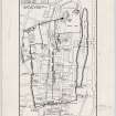
Edinburgh, Grassmarket, West Port


Gateway (15th Century)
Site Name Edinburgh, Grassmarket, West Port
Classification Gateway (15th Century)
Alternative Name(s) West Bow Port; Portsburgh
Canmore ID 52146
Site Number NT27SE 14.01
NGR NT 2530 7330
Datum OSGB36 - NGR
Permalink http://canmore.org.uk/site/52146


- Council Edinburgh, City Of
- Parish Edinburgh (Edinburgh, City Of)
- Former Region Lothian
- Former District City Of Edinburgh
- Former County Midlothian
NT27SE 14.1 2530 7330
West Port succeeded the earlier West Bow Port (West Bow: NT 254 734) and was in existence by 1437. It stood, on the line of the later Flodden Wall, at the W end of the Grassmarket and opened roads to Queensferry and Glasgow. Stark (1806) notes that although the Port had been removed, the wall still remained on both sides.
J Stark 1806; A T Simpson, S Stevenson and N Holmes 1981.
No trace.
Visited by OS (JLD) 29 December 1953.
Wester Portsburgh was outside the West Port
Portsburgh Street - unlocated at time of upgrade, 3.2.2000
Sources: Dean of Guild. Bundle 1812. January-June. 20.2.1812
Pet. George Tweedale, mason and Allan Boak, tanner.
To demolish and rebuild.
Plan and elevation. unsigned. 3 floors.

