Following the launch of trove.scot in February 2025 we are now planning the retiral of some of our webservices. Canmore will be switched off on 24th June 2025. Information about the closure can be found on the HES website: Retiral of HES web services | Historic Environment Scotland
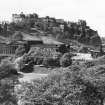
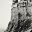
Edinburgh Castle
Castle (Medieval)
Site Name Edinburgh Castle
Classification Castle (Medieval)
Alternative Name(s) Edinburgh Castle, General
Canmore ID 52068
Site Number NT27SE 1
NGR NT 25112 73497
NGR Description Centred NT 25112 73497
Datum OSGB36 - NGR
Permalink http://canmore.org.uk/site/52068
First 100 images shown. See the Collections panel (below) for a link to all digital images.
- Council Edinburgh, City Of
- Parish Edinburgh (Edinburgh, City Of)
- Former Region Lothian
- Former District City Of Edinburgh
- Former County Midlothian
NT27SE 1.00 NT 25112 73497 (Centred)
NT27SE 1.01 NT 25159 73541 Mons Meg
NT27SE 1.02 NT 25082 73613 St Margaret's Well
NT27SE 1.03 NT 25152 73501 St Margaret's Chapel
NT27SE 1.04 NT 25177 73522 Portcullis Gate
NT27SE 1.05 NT 25034 73582 'The Queens Post'
NT27SE 1.06 NT 25171 73515 Portcullis Chamber
NT27SE 1.07 NT 25250 73485 Drawbridge
NT27SE 1.08 NT 25199 73482 Fore Well
NT27SE 1.09 NT 25173 73436 Palace Yard
NT27SE 1.10 NT 25223 73457 Half Moon Battery
NT27SE 1.11 NT 25206 73458 David's Tower
NT27SE 1.12 NT 25087 73618 Wellhouse Tower
NT27SE 1.13 NT 25074 73582 Crane Cradle
NT27SE 1.14 NT 25113 73565 Mill's Mount Battery
NT27SE 1.15 NT 25187 73494 Forewall Battery
NT27SE 1.16 NT 25210 73497 Inner Barrier
NT27SE 1.17 NT 25091 73543 Mill's Mount
NT27SE 1.18 NT 25133 73542 Argyle Battery
NT27SE 1.19 NT 25007 73532 Sally Port and Guard House
NT27SE 1.20 NT 25030 73474 Butt's Battery
NT27SE 1.21 NT 25132 73474 Foog's Gate
NT27SE 1.22 NT 25239 73488 Gate House
NT27SE 1.23 NT 2525 7349 Dry Ditch
NT27SE 1.24 NT 2517 7346 St Mary's Church
NT27SE 1.25 NT 25197 73438 Crown Room
NT27SE 1.26 NT 25165 73421 Great Hall
NT27SE 1.27 NT 25196 73444 Old Palace
NT27SE 1.28 NT 25204 73431 Queen Mary's Room
NT27SE 1.29 NT 2509 7361 to 2510 7362 Castle Wall (Town Wall)
NT27SE 1.30 NTc.250 736 Wellhouse Tower, Burials
NT27SE 1.31 NT 25170 73474 Scottish National War Memorial
NT27SE 1.32 NT 251 735 Settlement
NT27SE 1.33 NT 25318 73502 Esplanade
NT27SE 1.34 NT 2500 7360 Old West Sally Port
NT27SE 1.35 NT 25185 73503 Governor's House
NT27SE 1.36 NT 25145 73449 Naval and Military Museum
NT27SE 1.37 NT 2508 7345 New Barracks
NT27SE 1.38 NT 2516 7353 Dogs' Cemetery
NT27SE 1.39 NT 2516 7346 Old Barracks
NT27SE 1.40 NT 25065 73504 National War Museum; Ordnance Store House
NT27SE 1.41 NT 25065 73533 National War Museum; Hospital on Site of Powder Magazine
NT27SE 1.42 NT 2508 7356 Blacksmith's Shop
NT27SE 1.43 NT 25207 73508 Tattoo Store/Coal Yard
NT27SE 1.44 NT 2514 7343 Drury's Battery
NT27SE 1.45 NT 2512 7351 to 2515 7353 Main Guard
NT27SE 1.46 centred on NT 2513 7346 Royal Scots Regimental Museum (and trial excavation)
NT27SE 1.47 NT 250 735 Western Defences, trial excavation
NT27SE 1.48 NT 250 735 Hospital Square, trial excavation
NT27SE 1.49 NT 2515 7345 Watching Brief
NT27SE 1.50 NT 25136 73556 Low Defence
NT27SE 1.51 NT 25290 73522 Duke of York Statue
NT27SE 1.52 NT 25334 73526 Statue of Earl Haig
NT27SE 1.53 NT 25273 73516 72nd Highlanders Memorial
NT27SE 1.54 NT 25350 73529 78th Highlanders Memorial
NT27SE 1.55 NT 25320 73524 Monument to Colonel Mackenzie
NT27SE 1.57 NT 25123 73437 Military Prison
NT27SE 1.58 NT 25158 73529 Lang Stairs
NT27SE 1.59 NT 25134 73422 Dury's Battery
NT27SE 1.64 NT 25110 73480 Prisoner of War camp
(Centred NT 2513 7349) The Castle (NR)
OS 1:2500 map (1931).
Dark Ages - First mention of the rock of Edinburgh as a fortress occurs in an old Welsh poem, the Gododdin of Aneurin, dating from the end of the 6th Century.
The suggestion that the name Edinburgh has associations with Edwin, the great Northumbrian King (617-33) may be disregarded. The Pictish Chronicle mentions that it was vacated by the Angles in the reign of Indulph (Indolb) and left to the Scots under that king. The only hill fort in the region commanding the point where the Roman route from the South reached the Firth of Forth.
Mediaeval - At various times the castle was defended by English, Scots and French garrisons.
Important dates in Castle history:
1093, Death of St Margaret of Scotland at the castle
1174, Castle handed over to Henry II of England.
1312-13 Captured by the Scots.
1336, Refortified by Edward III of England.
1361, Modernisation of castle by David II of Scotland.
1571-3, Castle besieged by Earl of Lennox.
1662, Repairs and additions by Robert Mylne
1689, Held by Duke of Gordon in the cause of James VII and besieged for the last time.
RCAHMS 1951.
As described in guide book.
J S Richardson and M Wood 1953
A major redevelopment programme prompted the first extensive series of archaeological investigations within the Castle. The first year's work was executed in advance of the construction of a new shop, cafeteria and vehicle tunnel. Twelve areas were excavated revealing foundations, industrial activity, Roman and Native pottery, 1-2nd century AD comb, 7-10th c AD comb, and later artefacts.
(see NT27SE 1.11, NT27SE 1.16, NT27SE 1.32, NT27SE 1.43, NT27SE 1.44, NT27SE 1.45 )
Sponsor : SDD (HBM)
P Yeoman 1988
Excavations and watching briefs continued throughout the year. The main development contract began in January and is scheduled to be completed in January 1990. The location of archaeological works has been governed by the building work on the vehicle tunnel, new giftshop, restaurants and toilets. In all cases the extent and quality of the buried archaeological remains surpassed expectations. Discoveries continued to attract considerable media interest, and HBM sponsored an exhibition relating to the discoveries in the royal apartments which reached a large audience.
(see NT27SE 1.16, NT27SE 1.17, NT27SE 1.32, NT27SE 1.42, NT27SE 1.43 )
Sponsor: SDD (HBM)
P Yeoman 1989.
NT 251 734. Watching briefs have been mounted to monitor the continuing construction programme and the associated installation of services.
Sponsor : HS
S T Driscoll 1992b
(see also NT27SE 1.17)
NT 251 735 A watching brief was maintained in January 1998 on engineering test-pits and boreholes. Prior to conversion into firstly hospitals (in 1897), and then museums, these buildings had functioned as ordnance stores. The site of the excavations had been a magazine built around 1677, and pulled down and replaced between 1748-54. This was demolished in 1897, and is shown on the 1877 OS map as a rectangular block, sitting against the W wall, physically separated from the ordnance store to the N, and connected to the one to the S by a corridor. A blast wall ran around the E side.
Three test-pits were machine-dug, and five boreholes were drilled. The northern test-pit revealed a complicated sequence of iron pipes, at a maximum depth of 1.9m.
The borehole deposits were generally too soft to provide a good sample. Where seen, the deposit comprised a light grey silt with many inclusions, identical to that seen in the test-pits. Two of the five boreholes were not bottomed, one produced stone with mortar attached from a depth of 2.2m, indicating something structural, while the two most southerly hit bedrock at depths of 5.1m and 4.85m.
A single sherd of white china (from the silt in the northern trench) was the only datable material noted. However the iron pipes date most of the sequence to the last c 150 years. It seems possible that the rubble noted just over 2m down in the N trench relates to the 1897 destruction of the magazine, with the great depth of silt representing levelling material over this.
Sponsor: Historic Scotland
D Murray 1998
NT 2515 7345 Excavation was completed within this range of buildings, which mainly date to the early 18th century, and was converted from barracks earlier this century.
The Queen Anne period of building is known to have extended and absorbed elements from previous defensive circuits and associated structures. Evidence of two periods of fortification were revealed throughout the area under excavation; one dated to the later 17th-century refurbishment of the inner defensive circuit, while the second reflected a fighting platform in place during the 16th century.
The evidence mainly comprised two horizons of heavily metalled surfaces, both apparently indicating external platforms, probably for artillery, interleaved with dumped make-up levels, culminating in the 18th-century sub-floor deposits. Fragments of masonry presently incorporated in the W facade of the Queen Anne Building complex appear to belong to an earlier defensive line following the same general axis as the 18th-century works.
Sponsor: Historic Scotland
G Ewart and D Murray 1998
NT 2515 7345 A watching brief was carried out in September 1998 while a series of seven test-pits were excavated within the confines of the largest of two adjacent water towers situated in the upper part of Edinburgh Castle.
The various excavations within the old water tower building have revealed that in order to put in place massive foundations for an extremely heavy water tank it was considered essential that the masonry was founded in all places on bedrock. Following the building of the concentric rings of foundation masonry, dated to the first decade of this century, the gaps between the rings were filled up with imported soil to a level 900mm below the wall tops. This level coincided with the highest point of the natural bedrock.
Sponsor: Historic Scotland
D Stewart 1998
NT 251 734 Excavations were undertaken between December 2001 and January 2002 within one of the upper vaults beneath the Palace at Edinburgh Castle, ahead of work to re-lay the floor and upgrade the room for use as an educational centre. Evidence for various earlier floor levels was found. The earliest was uneven and sloped downwards towards the back of the room, and it is suggested that this was due to the roof of the lower vault beneath rising up in the middle of the room. There was a suggestion that the room might originally have been paved in stone, but all subsequent floors seem to have been of compacted dirt or wooden planks.
Much work appears to have been done on the room in the 18th century when it was reputed to have housed prisoners. A wooden floor was laid, and repairs made to other areas. During the 19th century the room was used as a barrack. The floor was levelled, the room may for a time have been partitioned, and finally the wooden floor was laid, probably in the later 19th or early 20th century. Significant finds include a large cache of used revolver cartridges buried at the back corner.
Archive to be deposited in the NMRS.
Sponsor: HS
G Ewart, J Franklin and D Stewart (Kirkdale Archaeology) 2002
NT 251 734 Two of the upper vaults below the Queen Anne Building and Great Hall retain archaeological traces of timber fittings associated with barrack and prison accommodation. The elevations and floors of these rooms were drawn in order to record potential evidence of the bed structures in particular, over three main periods of use:
- Mid- to late 17th-century occupation (Cromwellian barracks)
- Early 18th-century occupation (Hanoverian barracks)
- Mid- to later 18th-century occupation (prisoners of war)
Contemporary plans and specialist analysis of surviving timberwork suggest that tiered bunks for barrack use had been replaced with a single platform arrangement, possibly complemented by the use of hammocks, for the prisoners of war.
Graffiti on wooden doors and masonry was also recorded, with particular reference to names and initials, which apparently reflect the successive occupation of those vaults.
Archive to be deposited in the NMRS.
Sponsor: HS
G Ewart, S Coulter and A Hollinrake (Kirkdale Archaeology) 2002
NT 251 735 A programme of historic building recording was required as a condition of Scheduled Ancient Monument Consent by Historic Scotland along two walls of the fourth floor of the 18th-century 52 Infantry Brigade building or 'New Barracks' at Edinburgh Castle during the knocking through of an original wall to accommodate facilities for a new museum in the building (DES 2004, 53). An area to the E in the fire escape stair was also removed to accommodate a new lift shaft for the same purpose. No original features were exposed, but a written and photographic record was taken of the exposed wall during and after its removal between November 2005-May 2006. All areas were removed by hand.
Archive to be deposited in NMRS.
Sponsor: Campbell and Arnott Ltd
Diana Sproat, 2006.
NT27SE 1.00 NT 25112 73497 (Centred)
ARCHITECT: Francis T Dollman (proposed additions & restoration 1859, not carried out)
Robert Billings 1860-62 (improvements to barracks)
Robert Mylne 1689
Sir Robert Lorimer 1923-8
Colonel Moodie 1858 (alterations)
Timber for Palace block came from Kent & Essex, was of oak, transported to Leith Sept 1616. Palace block reconstructed 1615-17 (inf from J G Dunbar).
REFERENCE:
National Library of Scotland:
Is under the charge of the Commissioners of H.M.Works. The National Library of Scotland holds a series of original drawings (many coloured) of the Board of Ordnance, relating to the works executed in the 18th Century. Reference "MSS.1645-1652".
They include, in Case (or Volume) 1645, the following:-
Z.2/1 1719. Sheets of General Drawings (numbered 1 to 5 inclusive) of "Edinburgh Castle". They are to the scale of 10 Feet to an Inch. Each bears the date 1719 and the name of Thos. Moore.
Z.2/2. 1719. "Edinburgh Castle Church Porch". Plan and Elevations to the scale of 4 Feet to an Inch. Dated April 25 1719 and signed S. Jelfe. There is also a copy. (Photostat in SNBR)
Z.2/2. 1719. "Entrance to castle over the Fosse". Plan and Section, to scale of 20 Feet to an Inch, shewing the Drawbridge. Date 28 April 1719 and signed S. Jelfe. (Photostat in SNBR)
Z.2/3. No date. Old Block Plan of the Castle, with Explanation. Scale 10 Feet to 1 and one-eighth Inch.. (2 photostats in SNBR)
Z.2/3. No date. A copy of the last with References in French, bearing the name of Robt Roe, and dated July 9th 1774
Z.2/4 No date. "A Plan of Edinburgh Castle", With Explanation. Scale 100 Feet to an Inch. Shews the line of the Flodden Wall passing by the West Port, though no buildings there are indicated.
Z.2/4. 1742. "Plan of the Works on the Entrance of the Castle of Edinburgh" Scale 20 Feet to an Inch. Shews Fosse and Drawbridge, and part of wall being built "Conform to Capt Romer's Plan". Bears date 18 June 1742. There is also a copy by J. Anderson 1799, and another by T. Sedley 1800. (Photostat in SNBR)
Z.2/5. 1740. "Elevations and Section of the Govenor's, Storekeeper and Master Gunner's House at Edinburgh Castle for the year 1740. Scale 10 Feet to an Inch. (Copy in SNBR)
Z.2/5. 1740. "Plan of the Works on the Entrance of the Castle of Edinburgh "Scale 20 Feet to an Inch. Shews Fosse and Drawbridge, and part of wall being built "Conform to Capt Romer's Plan". Bears date 18 June 1742. There is also a copy by J Anderson 1799, and another by T. Sedley 1800.
Z.2/5. 1740. Elevations and Section of the Govenor's, Storekeeper and Master Gunner's House at Edinburgh Castle for the year 1740. Scale 10 Feet to an Inch. (Copy in SNBR)
Z.2/5. 1742 "Plan, Elevation &i Section of the Govenour's, Storekeeper's and Master Gunner's new houses at Edinburgh Castle, shewing the partition walls of the gardens and outbuildings being buildt". Scale 10 Feet to an Inch. Dated 14th June 1472 and signed Dug Campbell. & a copy (Photostat in SNBR)
Z.2/6. 1746. "Plan Elevation and Sections of s Shed ordered to be built at Edinburgh Castle for the reception of 50 Bread Cars". Scale 8 Feet to an Inch. Dated Edinr 10th September 1746 and signed Dug Campbell, Engineer. (Photostat in SNBR)
There is also a copy by John Spencer 1795.
Z.2/7. 1747. Three drawing docketted as "received with Col. David Watson's letter to the Board dated from Edinburgh 30 April 1747. They are:-
(1) An exact Plan of a part of Edinr Castle showing the situation of the Powder magazine, &c. Scale 40 Ft to 1 inch
(2) Plan and Section of the Powder Magazine as it is at present, containing 684 'Barrils' of Powder. Scale 10 Feet to an Inch.
(3) Plan and Section of the Powder Magazine with the Alterations proposed & will contain 1054 'Barrils' of powder. Scale 10 Feet to an Inch.
Z.2/8. 1750. "Plan of Edinburgh Castle 1750". With Explanation. Scale 40 Feet to an Inch. Initialed "T.D., 1752" Also a copy. (Photostat in SNBR)
Z.2/9. No date. "Plan of Part of Edinburgh Castle" and Profiles of new (outer) Walls". With Explanation. Sclae for Plan 40 Feet to an Inch, and for Profiles 10 Feet to fifteen-sixteenth of an Inch. The date is suggested in the Index Volume as 1735. (Photostat in SNBR)
Z.2/10. No date "Edinburgh Castle, Grand Store House", Plan and Section. Scale 10 Feet to an Inch. Said in the Index Volume to be of date 1719.
Z.2/11. 1734. "Munsmeg" of Monsmeg, a Drawing and Section. Scale for Section 10 Feet to about fice-eighths fo an Inch. Gives a History of the Gun up till 1734, and a description.
Z.2/12. 1750. "Plans Elevation and Sections of a design for a Barrack for 270 Men to be built in Edinburgh Castle. 1750". Sclae 12 Feet to an Inch. Signed by W. Skinner. There is a copy. (Photostat in SNBR)
Z.2/13. 1753. "Plan Sections and Elevations of the Powder magazines and Storehouses built in Edinburgh Castle Ano.1753 & 1754". Scale 20 Feet in an Inch. (Photostat in SNBR)
Z.2/14. 1754. Three sheets of Drawings of major buildings in the Castle of Edinburgh, Including Plans and Sections of the Several Vaults and Floors, 1754. All to scale of 14 Feet to an Inch.
Z.2/15. 1755 "A Plan, Elevation and Section of the Barracks designed to be built in Edinburgh Castle 1755". Sclae 10 Feet to an Inch. Docketted as "Copied by A. Rae". (Photostat in SNBR)
There are in Case, or Volume, 1649, the following drawings:-
Z.3/54. Undated. "Plan of Part of Edinburgh Castle shewing the proposed Situations for a pipe and Cistern, bringing water from the Town Reservoir. Scale 40 Feet to an Inch. Signed by H. Rudyerd, Captn RI Engineers. There is in connection a Schedule of Prices and Estimates for erecting the Water Cistern at the South end of the Barrier Guard House, dated Edinburgh 18 January 1794 (which is probably the date of the Drawing) and signed by H. Rudyerd. (Photostat in SNBR)
Z.3/58. 1709-10. Five Plans dealing with Hern Work and Entrenchments designed by Captn. Dury, one of Her majesty's Engineers, 1709, and alterations projected by tlabot Edwwards 1710, at the Entrance to Edinburgh Castle. All are docketted as "Handed over to Lieut. monier Skinner RI Engers by his father in 1873".
There is also a small Map, similarly docketted, of the Environs of Edinburgh and Leith. Scale 1000 Yards to an Inch. There is no date, but the New Town seems to have been begun.
David Macgibbon and Thomas Ross, in "The Castellated and Domestic Architecture of Scotland", gives in Volume 1, pp.445-463, a description and Historical Notice, together with a small Plan from the Ordnance Survey, Some copies of old views, and a number of sketches in pen and ink. They also give a Plan and sketches of the Chapel of St. Margaret, at one time used as a Powder magazine, but on the Instance of Mr Neson restored under the superintendence of hippolyte J.Blanc, architect: the Plan and sketches were made from his very careful drawings. (Copy available in NMRS)
William Maitland, in his "History of Edinburgh", 1753, gives an engraving entitled "A Perspective View of the Easter side."
Scottish Record Office:
Fortifications of the Castle of Edinburgh. Articles of agreement. Masons. Alexander Gowanlock and Gilbert Smith.
1708
GD 26/9/83
Account for mason work done at the Castle. Signed J Smith.
1649
GD 26/9/40
Proposed repairs in Edinburgh Castle. Letter concerns annual estimates for repairs and also includes Fort William, Stirling and Dunbarton. Gilbert smith named as the mason.
1711
GD 26/9/93
Work done at the Castle. An account of wright, slater, mason and glazier work at the Castle.
1708
GD26/9/53
Account for repair work to Castles at the time of the intended invasion. It includes a new guard house at Edinburgh and repair of the drawbridge.
c.1709
GD26/9/123
Building repairs at the Castle.
On the Duke of Montrose's representations, payment is to be made to poor labourers and artificers whol had worked at the Castle and estimates are to be prepared for what is to be done next Summer there and at other Scottish garrisons.
Letter from Capt. Dury to the Duke of Montrose.
1715
GD220/5/513
Proposed alterations to the Castle. Letter from Robert Rowand Anderson (1834-1921), architect, to Miss Nisbet Hamilton at Biel. It has been announced by the War office that he is to be consulted about the alterations. He thanks Miss Nisbet Hamilton for recommending him.
1885
GD205/Box 47/Portfolio 17
See NMRS Collections SK/Ferg/10 W L Ferguson Sketch Book No 10 for pencil sketch elevation insc: 'Edinburgh Castle. From the Esplanade.'
Online Gallery (1306 - 1329)
The year 2014 sees the 700th anniversary of the Battle of Bannockburn, in which the army of Robert I of Scotland defeated that of Edward II of England. The battle marked a major turning point in the long, drawn-out struggle of the Wars of Independence.
The Wars have had a lasting influence upon all the nations of the United Kingdom and upon the national story. Each age has seen fit to commemorate the events in its own way: through the perpetuation of the genuine historical associations of buildings and places and also through the endowment of others with improbable or fanciful traditions. Where past generations allowed its historic buildings to decay and disappear, later generations began to value and actively preserve these for their associations. Where an event lacked a tangible reminder, as at Kinghorn where Alexander III was killed in a riding accident, a commemorative monument would be erected to act as a focus. The Wars of Independence predate the fashion for accurate portraiture: the weathered, generic military effigy of Sir James Douglas is one of the few to survive in Scotland. Later centuries saw a need and supplied it by a crowd of images of its historic heroes, William Wallace and Robert the Bruce, each depicted according to contemporary taste and imagination. The opening of the new heritage centre at Bannockburn takes this into a new dimension, through the use of three-dimensional, digital technology.
RCAHMS Collections hold many images of these buildings and locations from battlefields, castles and churches, to the many commemorative monuments erected in later years. This gallery highlights a selection of these, including antiquarian sketches, photographic and drawn surveys, and architectural designs.
Publication Account (1951)
1. Edinburgh Castle.
The Castle Rock is a compact oval-shaped mass of basalt with a marked columnar structure rising to a maximum height of 437 ft. above sea-level. Its sides are precipitous except on the E., where glacial action has formed a slope of gentle gradient by moulding into "tail" formation the sedimentary rocks lying behind the basalt crag. The rock must have been marked down from prehistoric times as a secure and convenient place for habitation, but continual occupation has obliterated all traces of structures older than the eleventh century. In old Welsh literature, however, the place appears in the Brythonic form of Dineidin*in the Gododdin of Aneurin (late sixth century). In the same poem there appears to be another reference to the Hill of Eidin (eidinfre) which may be the same as the minit eidin (Mountain of Eidin) in an early text in the Black Book of Carmarthen, and refer to the Castle Rock (1). Later it appears in versions of the Gaelic form of Dun-eideann (Dunedin) and in mediaeval legend becomes the abode of Leudonus, traditionally the eponymous hero of Lothian and grandfather of Saint Kentigern. In the various mediaeval Lives of Saint Monenna, an Irish saint traditionally assigned to the early sixth century; she’s said to have founded a church at Dunedene, quae Anglica lingua dicta Edenburg, or in another recension, apud Edenburgh in montis cacumine in honore Sancti Michaelis, which may refer to an early tradition of a chapel on the Castle Rock (2). Symeon of Durham, writing in the 12th century an account of earlier events, mentions "Edwinesburch" as pertaining to Lindisfarne about 854 (3); and with this Northumbrian connection may be contrasted the abandonment of "oppidum Eden" by the Angles about 960, when the stronghold was left to fall into the hands of lndulf, King of Alban (4). At the end of the following century Edinburgh makes a more dramatic appearance in history. In the winter of 1093, when Malcolm Canmore was invading England for the fifth and last time, his queen, later known as St. Margaret of Scotland-, lay dying "in Castro Puellarum."* According to the Life ascribed to Turgot, a contemporary, she made her last confession on November 16 and went into the church to hear Mass. When she came back to her chamber, she was met by her second son Edgar, returned from the war with the tidings that his father had been killed three days before at Alnwick, where moreover his brother Edward had been so grievously wounded that he had died that morning at Jedburgh. The queen, already at the point of death, expired almost immediately, and while her son was still mourning at her bier, his uncle, Donald Bane, laid siege to the Castle in an attempt to secure the throne. This is the first of its many sieges that are on record. Donald, however, neglected to invest the entire rock, guarding only the front gate in the belief that there was no other exit. When the defenders became aware of his oversight, a party sallied forth by a postern door(posticum) on the W. side, bearing with them the queen's body which they deposited in the Church of the Holy Trinity at Dunfermline (5). Little is known of the Castle during the reigns of Donald Bane and Duncan II, but it must have been at least an occasional residence of the Crown at this period as it was the scene of Edgar's death in January, 1106-7. It reappears in history after the accession of David I, youngest son of Malcolm Canmore and Margaret. That king, in his charter to the canons of Holyrood, which was written about 1143 and consequently some years after the Abbey Church had been consecrated and the canons installed,*** confirms his grant to them of the Castle Church with its fruits and of St. Cuthbert's Church with its pertinents, including ground below the fortress extending from the spring at the corner of the royal garden to a crag on the E. side-a strip, that is to say, bordering the Rock on the N., W., and S.W. In 1174 the Castle of Edinburgh, like those of Jedburgh, Berwick, Roxburgh and Stirling, was handed over to Henry II of England as security for the ransom exacted for William the Lion, then prisoner at Falaise, and was only restored on King William's marriage to Ermengarde de Bellomonte (Beaumont) in u86. It is also on record that Alan, son of Ruhald, strengthened its defences in 1175 (6). After the insurrection in Galloway in 1235, Thomas, the bastard son of Allan, Lord of Galloway, was imprisoned for a time " in Castro Puellarum." In the spring of 1296 the place was successfully attacked by Edward I, who used engines and for three days and nights hurled stones without ceasing through the roofs of the buildings standing inside the walls (7). Among the booty that he carried off to England after this campaign were the Stone of Destiny or Coronation Stone,**** the muniments, and the jewels that had been safeguarded in the Castle (8). In April of the following year, when most of the strongholds in the kingdom had been recovered by the Scots, Edinburgh Castle was still in English hands. In the year 1299-1300 the garrison numbered 347, with 156 horses, but two years later it had been reduced to 81 men (9). On March 14th, 1312-3, when held by Peres Lebaud, a Gascon knight who was at that time Sheriff of Edinburgh, the fortress was recaptured by the Scots under Sir Thomas Ranulph, Earl of Moray. While a feint was made "ad portam australem " - literally the south gate, but in fact probably one of two facing east - a party of thirty led by William Francis ascended the cliff on the north side (10) §. Placing scaling-ladders against the twelve-foot wall, they mounted, rushed the defenders from the rear, gained the gates and admitted their comrades. The whole place was then captured by the combined forces, and the English put to the sword. In pursuance of King Robert's settled policy the buildings were subsequently razed to the ground. For the next twenty years the Castle lay dismantled, but at the beginning of August, 1335, Guy, Count of Namur, who was in the English service, having been defeated on the Burgh Muir, near Edinburgh, by Ranulph, third Earl of Moray, and Patrick, Earl of Dunbar and March, stood at bay on the Rock for a night and a day and then surrendered on terms, while his English comrades were held to ransom. From 1335 to 1341, however, the place was in English hands. Its condition at this time may be judged from an indenture, dated 2nd November, 1335, between an outgoing and an incoming Warden, which records that “there is no dwelling (habitacoun) within said castle, save a chapel a little unroofed (a poy descouerte), a little 'pentice' (lean-to) above the chapel, and a new stable quite unroofed, except about a quarter." (11) In fact “it would seem that the site was actually let for grazing, since we find that 'the Mote of the Castle of Edinburgh' (Mota castri de Edenburghe)-apparently the hill as a whole-was supposed to yield a revenue to the sheriff” (12).
[see RCAHMS 1951 1-25 for a full history and architectural description]
RCAHMS 1951
(1) Williams, Canu Aneirin; Antiquity, xiii, pp. 25ff.; ibid., xvi, pp. 237 ff. (2) Skene, Celtic Scotland, ii, p. 37. (3) Ibid., i, p. 240 n. (4) Skene, op. cit., i, p.365. (5) Inventory of Fife, Kinross and Clackmannan, No. 197. (6) Calendar, i, No. 141. (7) Chronicon de Lanercost, Maitland Club, p. 178. (8) Calendar, iv. p. 487, and ii, Nos. 526, 528, 638 and 840. (9) Ibid., Nos. 1132 and 1324. (10) Chronicon de Lanercost. Maitland Club, p. 223. (11) Calendar, iii, No. 1186. (12) Mackenzie, The Medieval Castle in Scotland, p. 61.
*The meaning of the second element in this name was regarded by Professor Watson as quite obscure (History of the Celtic Place Names of Scotland, p. 341). He rejected as etymologically impossible the popular derivation from the name of Eadwine, King of Northumbria, which is implied by such forms as Edwinesburch (Symeon Dunelmensis, Histona Regum, etc., Surtees Society, i, p. 68), Edwinesburg (Lib. Cart. St. Crucis, p. 5), or Dinas Etwin (Ar chiv fur celtische Lexicographie, ii, p. 168), and saw the genuine anglicised form of the Celtic name in St. Monenna's Dunedene (supra) and in other approximations to the modern" Edinburgh " which occur in 12th century charters (e.g. Registrum de Dunfermelyn, pp. 12, 13).
**On this name, see RCAHMS 1951 p. xxxv
***According to Father Hay, who is the sole authority for the statement, the canons lodged in the Castle until their home was ready.
****Described in the contemporary inventory to which reference is here made as ‘Una petra magna super quam reges Scociae solebant coronari’.
§ There is some discussion as to the point where the escalade took place. The available evidence is summed up in P.S.A.S., xlvii (1912-3), pp. 423-6...
Photographic Record (1970)
Publication Account (1981)
There has been some kind of fortress atop the Castle Rock since early times. Queen Margaret, widow of Malcolm III, died here in 1093, while the fortress was under siege, and her body was transported through a pastern gate on the western side to be buried in Dunfermline Church (Shephard, 1969, 49). The structure in which she died was loosely defined in a chronicle as the 'Maidens' Castle (in castrum puellarum) (RCAM, 1951, xxxviii), but as the Norman type castle was not introduced until the twelfth century it is impossible to know exactly to what type of fortress the chronicler was referring. The only remains of the eleventh century Maidens Castle, is the humble chapel of St. Margaret which consists of a nave with a chancel arch and a chancel which has a rounded apse. (MacGi bbon and Ross, 1896, i, 225). The genuine surviving Norman masonry begins below the line of the south windows (MacGibbon, 1896, i, 225). Standing on the extreme summit of the Castle Rock, the chapel has had a chequered history, for in the sixteenth century it was employed as the gunnery storehouse (Richardson and Wood, 1953, 6), and in the late nineteenth century as 'a shop for the sale of nick nacks to tourists' (MacGibbon, 1896, i, 205).
The castle itself had a very chequered career. First mentioned in a c.1127 charter of David I (ESC, 1905, 59), by 1174 an English garrison was stationed by terms of an agreement worked out following William the Lion's capture at Alnwick (Barrow, 1971, 8). The castle was restored to the Scots following William's marriage to the cousin of the English monarch, Henry II (Shepard, 1969, 50). During the early phase of the Wars of Independence, the fortress was held by the English, but was recaptured for Bruce in 1313 who gave orders for its demolition, excepting non-essential buildings. For the next twenty years the castle lay in ruins, but between 1335 .and 1341 when the fortress was once again in English hands, efforts were made to reconstruct it (RCAM, 1951, 2). On release from English captivity in 1346, David II added greatly to the existing structure including the erection of a large keep, known as David's Tower. The castle was almost entirely destroyed during a siege in 1573 and the existing buildings and layout of the fortress date mainly from that period when the Regent Morton had the castle rebuilt.
The main group consists of buildings which surround the palace yard and occupy a high position on the southeast corner of the hill. This area is known as the citadel of the castle. The ruin of David II's keep forms the core of the Half Moon Battery, a fact revealed in 1912 (Richardson, 1953, 1). On the south side of the palace yard is the Great Hall which dates from the early sixteenth century and which has been variously used as a barracks, a hospital and now houses an armour collection (Richardson, 1953, 11, 13). On the north side of the square stands the impressive Scottish National War Memorial which appears to occupy the site of. St. Mary's Church first mentioned in the fourteenth century (CAM, 1951, 18). On the west is a block dating from the mid eighteenth century now adapted as a military museum (RCAM, 1951, 18). The Palace Block, basically a sixteenth-century structure, completes the quadrangle.
Information from ‘Historic Edinburgh, Canongate and Leith: The Archaeological Implications of Development’ (1981).
Watching Brief (January 1998)
A watching brief was maintained in January 1998 on engineering test-pits and boreholes. Prior to conversion into firstly hospitals (in 1897), and then museums, these buildings had functioned as ordnance stores. The site of the excavations had been a magazine built around 1677, and pulled down and replaced between 1748-54. This was demolished in 1897, and is shown on the 1877 OS map as a rectangular block, sitting against the W wall, physically separated from the ordnance store to the N, and connected to the one to the S by a corridor. A blast wall ran around the E side.
Standing Building Recording (9 November 1999 - 6 December 1999)
In late 1999 Kirkdale Archaeology undertook a short survey of the Queen Anne Building in Edinburgh Castle. More information about this survey can be found in the Kirkdale Archive.
G Ewart 1999
Sponsor: Historic Scotland
Kirkdale Archaeology
Watching Brief (5 October 1999 - 12 October 1999)
A watching brief was carried out in the area of the “Old Smithy”, beside the road tunnel, while ground-works to allow the laying of a slabbed surface were carried out. The work took place on weekdays between the 5th and 12th October, 1999. As it became apparent that a significant amount of the work would involve removal of concrete, and that there was little of archaeological significance appearing, it was decided to conduct this watching brief via morning visits.
Sponsor: Historic Scotland
Kirkdale Archaeology
Excavation (5 April 2007 - 14 August 2007)
Under the terms of its PIC call-off contract with Historic Scotland, Kirkdale
Archaeology was asked to oversee the excavation of a trench at Edinburgh Castle. Work took place intermittently between 05 April 2007 and 14 August 2007.
The work comprised two elements - firstly a service trench was monitored and recorded and secondly an area was excavated archaeologically. The former was c. 65m long, 400mm wide and up to 700mm deep, running from the area of the present restaurant to a point 9m W of the Portcullis Gate. The archaeological trench measured 8.4m x 4.2m and lay immediately W of the Portcullis Gate, immediately N of the roadway. The service trench contained possible evidence of the late 14thC Constable’s Tower in the form of sandstone blocks visible in section lying towards the
Eastern end of the trench. Towards the W end of the track several areas of crude metalling were revealed most likely associated with successive versions of access roadway on the approach to Mills Mount.
The earliest features in the archaeological trench related to a road surfaces thought to predate the present route to the Portcullis Gate (finished by 1577). These were succeeded by evidence of industrial activity , possibly a forge. Finally a much repaired drain cut these horizons at the E end of the trench . This feature ran out to the N and in its earliest phase (late 17th –early 18thC) saw the reuse of a fine architectural window
fragment as a cover . In addition, a knife with a elaborately carved handle was found in the construction cut for the earliest drain.
Information from Gordon Ewart and Alan Radley (Kirdale Archaeology) 13 September 2007. OASIS ID: kirkdale1-249629
Excavation (December 2009 - September 2011)
NT 2530 7350 (centred on) A series of Scheduled Monument Consents (SMCs A–E) were granted, December 2009 – September 2011, for work associated with the design of new temporary stand for the Royal Edinburgh Military Tattoo.
SMC A: Existing utilities were realigned or replaced to accommodate new stand foundations. These works revealed part of the Spur, a triangular artillery fortification built in the 1540s and demolished in 1650. Part of a second boundary-type wall was revealed to the NE of the Spur and this overlay an infilled ditch. The corner of a building was revealed at the E end of the Esplanade. All of these remains may be shown on an Edinburgh plan drawn by Gordon of Rothiemay in 1647. At the top of Castle Wynd Steps, a massively built stone plinth may have been a part of the Esplanade wall which was demolished prior to 1780.
SMC B: The Scottish Horse Monument was dismantled and rebuilt on a new abutment projecting from the North Esplanade Wall. A photographic survey of the wall was carried out.
SMC C: This covered the erection of the new stands and had no archaeological significance.
SMC D: The statue of Earl Haig and its stone plinth were moved from the Esplanade to Hospital Square. Excavations in Hospital Square revealed the wall of the 1748–54 powder magazine and the blast wall to the E.
SMC E: Work to relocate utilities serving the castle took place in Princes Street Gardens, in the Moat Vault, in the Coal Yard and on the steep grass slope between the South Esplanade Wall and Johnston Terrace. Walls were recorded prior to the placement of pipes/ducts. No archaeological remains were recorded in Princes Street Gardens. In the Moat Vault, plinths associated with former arched vaults were recorded. In the Coal Yard, a buried wall was recorded. Between the South Esplanade Wall and Johnston Terrace, a stone revetment was recorded.
Additional non-SMC work took place in Castlehill, Ramsay Lane and Mound Place. In Ramsay Lane, the foundations of what may be tenement buildings were recorded and to the N, part of a culvert drain was recorded.
Archive: City of Edinburgh Council SMR and RCAHMS
Funder: Sir Robert McAlpine on behalf of Royal Edinburgh Military Tattoo Ltd
Information from Ian Suddaby (CFA Archaeology Ltd) 2012. OASIS ID: cfaarcha1-78685
Standing Building Recording (24 September 2010 - 14 October 2010)
In the Autumn of 2010 Kirkdale Archaeology conducted a large scale Standing Building Recording in Edinburgh Castle Palace. The area surveyed included East range of the Vaults, Ground Floor, First Floor, Mezzanine, Second floor, and Attic. The Great Hall and extorior of the Palace were also recording. Construction techniques from the 1500's to the 1900's were observed on the exterior Palace walls.
G Ewart and D Murray 2010
Sponsor: Historic Scotland
Kirkdale Archaeology
Standing Building Recording (31 January 2011 - 11 March 2011)
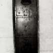
In Spring 2011 Kirkdale Archaeology undertook a detailed Standing Building Recording of the mains doors to Edinburgh Castle, located in the Gate House. The drawings for this can be found in the Kirkdale Archive.
G Ewart 2011
Sponsor: Historic Scotland
Kirkdale Archaeology
Watching Brief (25 May 2012)
NT 2513 7351 A watching brief carried out on 25 May 2012 during a small excavation for a flagpole on the N side of the upper citadel of the castle recorded a surprising depth of deposits below the modern paving. The presence of handmade brick fragments in the upper deposits suggests that these were probably 18th-century or later in date. Prior to the 19th-century restoration of St Margaret’s Chapel the area was used as a gunner’s store and drawings exist which show an apparent yard on its W side. The basal deposit produced a small but fine assemblage of broadly medieval pottery. The presence of a large base sherd indicating the deposit contained relatively undisturbed material.
Archive: RCAHMS (intended)
Funder: Historic Scotland
OASIS ID - kirkdale1-310834
David Murray, Kirkdale Archaeology
2012
Excavation (2 December 2013 - 15 January 2014)
NT 2508 7347 An excavation was carried out, 2 December 2013 – 15 January 2014, in the Governor’s Yard, just to the rear (W) of the mid-18th-century Governor’s House, which is just W of the winding approach road leading up to Foog’s Gate and the upper citadel of the castle.
The bedrock showed only limited evidence of modification. Examination of the space under the tunnel accessing the yard from the E showed substantial areas of bedrock visible. This dropped near vertically to the N, and probably reflects the construction of the Governor’s House, although this is likely to be an enhancement of the existing rock formation, rather
than an entirely new creation. Features were seen which were certainly of an older date than the features associated with the construction of the Governor’s House, but it was not possible to determine their date on the basis of the available evidence.
Archive: RCAHMS (intended)
Funder: Historic Scotland
Information from David Murray (Kirkdale Archaeology) 6 March 2014.
OASIS ID: kirkdale1-279183
Excavation (5 June 2013 - 25 November 2013)
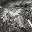
NT 2512 7349 An integrated programme of test trenching, standing building recording and survey over exposed areas of bedrock was completed at intervals between 5 June and 25 November 2013.
The earliest features recorded were traces of eroded rock-cut features comprising slots and crudely-squared cuts thought to predate mid-16th-century masonry. The masonry and other remnants of defensive features were thought to range from the mid-16th century to the late 18th century, over which the first of the works to install water towers were carried out in the mid-19th century, with further work on new water towers in the early 1900s.
Archive: RCAHMS
Funder: Historic Scotland
Information from Alan Radley (Kirkdale Archaeology) 8 March 2014. OASIS ID: kirkdale1-279033
Watching Brief (4 November 2013 - 5 May 2014)
NT 2515 7348 In response to water ingress within the W half of the N side of the Scottish National War Memorial, an irregular area of concrete screed at the base of the outside face of the N wall was removed in stages under archaeological supervision. The work which was undertaken, 3 March – 30 September 2014, showed that the concrete extended W, along the full length of the N wall from its junction with the centrally placed semi-octagonal apse. The present building is the latest in a series of major structures on the same site and was built between 1924 and 1927. The concrete was a single and extremely compacted deposit filling a series of shallow declivities within the bedrock. These were the result of clearance and quarrying activities associated with a small complex of early 19th-century service structures including a cookhouse and washhouse, which lay immediately N of the 18th-century barrack block, which was partly recycled to create the present Scottish National War Memorial.
Alan Radley 2015
Sponsor: Historic Scotland
Kirkdale Archaeology
OASIS ID: kirkdale1-279007
Excavation (4 March 2014 - 25 April 2014)
In Spring 2014 Kirkdale Archaeology were asked to complete an excavation in Edinburgh Castle in preparation for the construction of a memorial garden. The area of excavation followed the footprint of the proposed memorial garden and as such, defines an irregular trench up to c.10m N/S x 10m E/W, located immediately S of the present paved roadway S of St Margaret’s Chapel (Fig. 7). The site is known to have been extensively cleared alongside the construction of the National War Memorial in 1923 - creating an informal garden area with low shrubs and bushes surrounded by lawn.
The recent excavation has revealed archaeological features associated with four principal phases of clearance/construction/occupation:
1. Residual bedrock features;
2. Governor’s Garden;
3. Construction and use of Cook House; and,
4. Demolition of existing service structures associated with the construction of the new National War Memorial.
For more information please see the full report.
G Ewart 2014
Sponsor: Historic Scotland
Kirkdale Archaeology
Standing Building Recording (20 April 2015 - 5 June 2015)
NT 251 734 A programme of standing building recording was carried out, 20 April – 5 June 2015, at Edinburgh Castle. The work focused on a number of key areas of the castle: the Half Moon Battery (including the walling and masonry below), the bedrock, the Guardhouse Building (and adjacent walling,) the Fore Well Tower, the Inner Barrier, the Curtain Wall, the Eastern Approach Wall, the Lang Stair, the Portcullis Gate, the Dog Cemetery, Mills Mount Wall, and the South
Water Tank.
Between 1450–1573 the upper part of the Fore Well Tower was constructed, alterations were made to the Portcullis Tower (including the turnpike stair), and David’s Tower was modified to accommodate artillery defences. The outwork below the Fore Well Tower was enhanced, the Inner Barrier created and repairs to the Curtain Wall effected. Repairs were also made to the Lang Stair.
From 1573–1610, the Half Moon Battery was constructed, along with the eastern facade of the Portcullis Gate. The N wall of the Portcullis Gate was thickened, and there were repairs to the Curtain Wall.
Between 1610–1780 an upper storey was added to the Portcullis Gate, and a wall was constructed on the gate’s eastern approach.
From 1780–1850, the water tanks below the Half Moon Battery were constructed, a boundary wall was built on Mills Mount, and the Dog Cemetery (as a place of burial) came into being.
Between 1850–1950, the upper part of the Portcullis Gate was restored (including the replacement of the royal coat of arms). A gun port was opened on the Half Moon Battery, and the Kirkcaldy of Grange memorial was emplaced.
Gordon Ewart and Dennis Gallagher 2015
Sponsor: Historic Scotland
Kirkdale Archaeology
Ground Penetrating Radar (1 October 2015 - 8 October 2015)
NT 25112 73497 As part of a wider project of research and consolidation programme by HES, a ground penetrating radar (GPR) survey was carried out, 1–8 October 2015, over several areas with the hope of mapping earlier structural remains associated with the castle. Survey was carried out within Crown Square, the Upper Ward, the Half Moon Battery, the Dog Cemetery, Dury’s Battery, and Hawk Hill. In addition, several individual transects were also collected within the Forewell Tower Office, St Margaret’s Chapel and the road leading to Museum Square.
Although the different nature of the ground cover, cobble setts and most especially electromagnetic interference resulted in markedly different levels of attenuation (loss) of the signal in different areas, several anomalies of potential significance have been detected. Some of the clearest responses have been recorded within Crown Square where anomalies suggestive of potential structural remains have been identified, including a possible 14th-century curtain wall.
The signal within the Upper Ward areas was severely attenuated with few anomalies being identified. However, well defined anomalies within the grassed area adjacent to the National War Memorial have been detected. It is thought that these may relate to the former Governor’s Garden and Guardhouse, or potentially earlier structures. Additional anomalies to the W of the National War Memorial have also been noted which are thought to be related to the former barracks.
Responses thought to be associated with former structures have been detected within Dury’s Battery. More ephemeral anomalies have been detected in the S of the area, against the battery wall. These may indicate former structures although interpretation is cautious.
Within the Hawk Hill and Approach there are suggestions of a cut feature which may be associated with an earlier access route. Numerous services and service trenches have also been recorded throughout the survey areas, but in particular within the Hawk Hill and Approach area.
Archive: Rose Geophysical Consultants
Funder: Historic Scotland
Susan Ovenden – Rose Geophysical Consultants
Note (14 November 2017)
A collection of metalwork (mainly cast-iron) components associated with historic fireplaces have long been stored within Edinburgh Castle’s vaults. These had been removed from various parts of the castle during works over the preceding 50 years or so. The project was intended to provide a catalogue and assessment of these items, in part to inform decision-making in relation to their retention or disposal. The work was carried out in December 2017.
The components were found to be the partial remnants of a number of individual fireplaces, with numerous associated elements such as grates, etc. The earliest of these include a later 18th- or early 19th-century hob-grate as well as a 19th-century kitchen range and 19th-century insert fireplaces; however, the bulk of the items were of fireplaces of likely early 20th-century date.
The fireplace elements to be catalogued were stored in a vaulted chamber within Edinburgh Castle, mostly stacked on wooden pallets on the ground with a few loose parts in a pile. Each element was separated, laid out on the floor and individually photographed - front and rear and any significant details. Each photograph included a 0.50m scale and a photo board in frame with the site name, date and element ID number clearly marked. Basic measurements of each element were made as well as a written record of any identifying makers or model markings.
OASIS ID: addymana1-302937
Kenny Macfadyen - Addyman Archaeology
Archive: NRHE (intended)
Funder: Historic Environment Scotland
(Source: DES Vol 20)
Watching Brief (23 October 2017 - 31 October 2017)
Headland Archaeology (UK) Ltd was commissioned by Network Rail to monitor all ground-breaking works to be carried out as a requirement in the SM consent. These works consisted in the erection of a new fence line to replace the existing, adjacent to the railway lines between Waverley and Haymarket stations and within the boundaries of the Scheduled Monument of Edinburgh castle.
Information from Rafael Maya-Torcelly (Headland Archaeology) January 2018. OASIS ID: headland1-300188
Ground Penetrating Radar (21 May 2018 - 22 May 2018)
NT 25112 73497 A ground penetrating radar survey was undertaken, across selected walls and floors at Edinburgh Castle. The NE wall of the passageway beneath the portcullis gate was surveyed together with a limited area within the room which houses the portcullis gate within the Argyle Tower. Survey of the S and E elevations of St Margaret’s Chapel was attempted, together with survey within the chapel.
All data was collected with an 800MHz antenna, which has a depth of investigation of c1m. The GPR survey was undertaken in conjunction with the HES Conservation Section with a 1.2GHz antenna.
Survey of the NE wall of the passageway beneath the portcullis gate did identify several anomalies. However, most of these are thought to be due to variations in the surface of the wall due to damage and repairs, and the natural build-up of material against the wall. One coherent anomaly, c2 x 1m, was recorded within the data and this may be archaeologically significant, but interpretation is extremely cautious.
Survey of the S and E elevations of St Margaret’s Chapel was limited due to bushes and the rough nature of the facing stone. What little data was collected suggests relatively uniform material within the structure. Survey of the chapel floor was dominated by near surface changes but there was some suggestion of outcropping bedrock.
Archive: Rose Geophysical Consultants
Funder: CFA Archaeology on behalf of HES
Susan Ovenden – Rose Geophysical Consultants
(Source: DES Vol 19)
OASIS ID: cfaarcha1-435402
Watching Brief (30 January 2024 - 29 February 2024)
NT 25246 73460 AOC Archaeology was commissioned to undertake an archaeological watching brief in two locations within Edinburgh Castle, City of Edinburgh (SM90130). The archaeological watching brief was conducted over four non-consecutive days in January and February 2024. Three trenches were hand excavated to accommodate the installation of lightning protection systems located in the Gatehouse and at the Half Moon Battery. Trenches within the Exercise Yard at the Gatehouse revealed the footer foundation wall adjoined to the existing standing wall and associated construction fills. A single fine grey stoneware fabric, possibly of Seigburg-type, was recovered from. Excavation revealed a similar series of fills and footer foundation wall. The single trench within the Halfmoon Battery revealed a layer of existing paving setts atop a concrete surface and underlying levelling deposits. No significant archaeological material was recovered in this location.
Information from S. Morris – AOC Archaeology Group
OASIS ID: aocarcha1-523277


