Following the launch of trove.scot in February 2025 we are now planning the retiral of some of our webservices. Canmore will be switched off on 24th June 2025. Information about the closure can be found on the HES website: Retiral of HES web services | Historic Environment Scotland
Edinburgh, Granton Harbour
Harbour (19th Century), Harbour (Second World War), Harbour (First World War)
Site Name Edinburgh, Granton Harbour
Classification Harbour (19th Century), Harbour (Second World War), Harbour (First World War)
Alternative Name(s) Firth Of Forth; Granton Station; Hms Lochinvar; Granton Naval Base; Middle Forth Estuary
Canmore ID 52051
Site Number NT27NW 28
NGR NT 23747 77701
NGR Description Centred NT 23747 77701
Datum OSGB36 - NGR
Permalink http://canmore.org.uk/site/52051
- Council Edinburgh, City Of
- Parish Edinburgh (Edinburgh, City Of)
- Former Region Lothian
- Former District City Of Edinburgh
- Former County Midlothian
The harbour at Granton was a naval base from 14 August 1914 to 15 July 1919. The base initially held 29 trawlers and three yachts, employed in patrol work and minesweeping, and grew through the war to 300 ships, serviced by 400 officers, 8000 men and 300 Wren officers and ratings. From 1915 Granton became a base for the fitting out and operation of "Q" Ships, merchantmen and trawlers fitted with hidden weapons, to lure in and then attack German submarines. From 1916 onwards more German mines were placed on the east coast and the role of the Granton minesweepers became more important. The Granton boats were also responsible for the maintenance and operation of the permanent anti-submarine booms and for temporary, mobile nets that were deployed to protect the Grand Fleet when training in the lower part of the estuary. After the Armistice the base was engaged in mine clearance.
The harbour was used again during the Second World War.
No structures specifically related to the military use seem to survive.
Information from HS/RCAHMS World War One Audit Project (GJB) 4 October 2013.
NT27NW 28.00 centred 23747 77701
NT27NW 28.01 23880 77683 to NT 23752 77135 Middle pier and pilot house
NT27NW 28.02 23810 77863 to NT 23148 77489 Western breakwater and esparto wharf
NT27NW 28.03 23934 77888 to NT 24071 77059 Eastern breakwater
NT27NW 28.04 2393 7790 Eastern breakwater, lighthouse (beacon)
NT27NW 28.05 2381 7788 Western breakwater, lighthouse (beacon)
NT27NW 28.06 23829 77658 Middle Pier, lighthouse (beacon)
NT27NW 28.07 2377 7727 Railway Station
NT27NW 28.08 2377 7735 Middle Pier, building
NT27NW 28.09 23803 77566 Stone-built Warehouse
NT27NW 28.12 23700 77400 Seaplane Station
Not to be confused with Leith Docks (NT 25 77 to NT 27 76) and Newhaven Harbour (centred NT 2545 7714), for which see NT27NW 57.00 and NT27NW 76 respectively.
Not to be confused with HMS Lochinvar (Port Edgar), for which see NT17NW 181.00.
For associated former 'ferry terminal' buildings (railway hotels) placed in opposition across Granton Square, see NT27NW 29 and NT27NW 30.
For associated lighthouse and buoy depot and leading light at 22 West Harbour Road, see NT27NW 206.00.
For corresponding railway harbour (centred NT 2305 8545) at Burntisland, Fife, see NT28NW 30.00.
For industrial estate (Forth Industrial Estate, centred NT 2350 7730) built over the reclaimed SW side of Granton Harbour, see NT27NW 44.
Architect: John Henderson
EXTERNAL REFERENCE:
National Archive of Scotland
RHP 9474/9486
RHP 9490
RHP 9504
RHP 9509/9512
Plans c. 1830-40, 1882, 1895/6
(Undated) information in NMRS.
Edinburgh, Leith and Granton Railway and subsequently North British Railway. Opened 19 February 1847 as S terminus for Burntisland train ferry, until opening of Forth rail bridge.
J Thomas 1971.
(Location cited as NT 23 77). Granton Harbour, built 1835 on, by the Duke of Buccleuch, enginners Walker and Burgess, London. Consists of a wide central pier, completed 1845, protected by east and west (c. 1863) curved breakwaters. Used by railway ferry steamers to Burntisland from 1848-90.
J R Hume 1976.
Starting in 1835, Granton was the scene of heavy investment by its feudal superior, the Duke of Buccleuch. A complex of piers, jetties and breakwaters was built around a pier 1700ft (519m) long and 200ft (61m) broad, which could, by 1844, provide berths for ten steamers of u to 1,000 tons. The breakwaters were over 3000ft (915m) long and the minimum depth of water was 13ft (4m) at Low Water Springs.
In 1909 the harbour was recorded as clearing a total of 456,585 tons of shipping in the same year as the Anglo-Saxon Petroleum Company opened a terminal at Granton. Trade in petroleum and its products soon became substantial and was later to grow steadily (particularly between 1919 and 1921) despite a fall in the coal export trade.
In 1912 the harbour was noted as being well provided with steam cranes, including special coal cranes and tips capable of handling 110 tons (112t) of coal an hour. Coal was the major export (mainly to Denmark, Sweden and Germany), but machinery, castings and whisky were also sent outwards. Imports were more varied, but included timber, iron, grain, cement, china clay and esparto grass. The harbour was then served by both the North British and Caledonian Rlys.
During the First World War, Granton was taken over by the Admiralty as a destroyer and minesweeper base.
Between 1919 and 1937 the Duke of Buccleuch (who was still the owner) carried out an ambitious programme of wharf reconstruction, while the harbour flourished as a trawler harbour, a place of import for esparto grass and petroleum, and (most profitably) as an export harbour for coal and also for coke from nearby Granton gasworks (NT27NW 20). In 1932 the harbour became a private limited company with the Duke of Buccleuch as chairman, and in 1937 there was inaugurated a new carrying-belt coal-loading plant based on a new reinforced concrete jetty 450ft (137m) long which was copied from a similar installation on Tyneside.
B Lenman 1975.
The Forth Ports Authority (FPA) was formed in 1968 to control the ports of Leith (NT27NE 57), Grangemouth (NS98SW 7), Burntisland (NT28NW 30), Methil (NT39NE 11), Kirkcaldy (NT29SE 44) and Granton (NT27NW 28), from headquarters at Leith. Between 1968 and 1983 over £40 million was spent on facilities. In 1982 over 27.5 million tonnes of cargo (of varied types) passed through the Firth of Forth. The FPA also controls the Forth Navigation Service, and is the pilotage authority. The FPA fleet provides towage at Leith, Granton and the Forth ports.
Situated adjacent to Leith, this tidal harbour is mainly used for landing refined petroleum products and loading heavy indivisible loads (notably transformers and pressure vessels) by specialised Ro-Ro vessels. The infilling of redundant areas has led to the establishment of transport and warehousing companies. Principal details are as follows:
Access: tidal entrance 103.6 wide.
Area: total water 30ha, total land 33ha.
Middle Pier: Ro-Ro for very heavy loads (up to 400t). Quayage 347m.
West Breakwater: oil berth. Quayage 184m.
General warehouses, including freight terminal and privately owned: 13,006 sq m.
Granton has steadily developed into a small but effective tidal port handling some 250,000t of traffic (predominantly oil products) a year. Water depth in the Western Harbour exceeds 10m at HW, allowing the handling of tankers carrying refined petroleum products, specialised heavy lift vessels, and North Sea equipment barges. Reconstruction of the specialist oil berth in the Western Harbour is under consideration, and there is scope for further industrial expansion on reclaimed land.
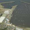
The reinforced Ro-Ro ramp at the Middle Pier allows the handling of heavy loads on a tidal basis, while the Eastern Harbour is used by a large number of pleasure craft, and the harbour is the base for the FPA pilot launches, and for small service craft (tugs and tenders).
Total cargo handled in 1982 was 245,296t (244,526t inwards, and 770t outwards).
(Table of principal tenant companies).
[Forth Ports Authority] 1983.
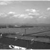
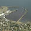
Granton Harbour is still in use and is well maintained. The south side of the western Harbour appears to be reclaimed by dumping waste material. There appears to be some recent dumping and erosion of this area.
Site recorded by GUARD during the Coastal Assessment Survey for Historic Scotland, 'The Firth of Forth from Dunbar to the Coast of Fife' 26th February 1996.
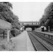
The broad slipway at NT 2378 7726 is apparently the basis of Thomas Bouch's 'patent slipway' used in the loading of train ferries for Burntisland (NT28NW 30.00). The railway station stood adjacent to this.
Information from RCAHMS (RJCM) 26 January 1990.
Since the end of Burntisland (railway) ferry traffic at the opening of the Forth rail bridge (NT17NW 70), this tidal (unlocked) harbour has usually been seen as essentially subsidiary to the lock-gated complex (NT27NE 57.00) at Leith, some 2.5 km to the E. It was for many years a major middle water steam trawling harbour (latterly for the vessels of Messrs. Croan), giving its name to the fundamental innovation of the 'Granton trawl'. By extension, it saw service in the Second World War as a major training and trials establishment for minesweeping techniques, being run from the naval reserve training centre NT27NW 30 as HMS Lochinvar.
The use of the harbour as a base for fishing drew to a close about 1970, by which date the harbour was already the base for pilot boats covering the approaches to Leith, the pilot house being established at the N end of the middle pier. In the 1970's and 1980's the cargo use of the harbour declined, although it remained in use for specialist heavy lift consignments, largely of plutonium and nuclear waste. The naval use of the harbour declined further as the sea tenders (successively HMS Killiecrankie, HMS Kedleston and HMS Spey) of Forth Division RNR were more usually kept in Leith, and the boathandling training facilities of Leith Nautical Training College closed with it. A berth alongside the middle pier was occasionally used for the maintenance of oil platform modules (supported on floating barges) and many of the buildings along the pier were converted to commercial and light industrial use. Much of the western harbour was infilled and this time (covering the extensive timber framework of the western breakwater) and the eastern harbour became the province of recreational sailing from the Forth Corinthian and Royal Forth Yacht Clubs.
At present many of the pier buildings are falling into dilapidation while only pilot boats and recreational craft use the harbour. No specialist loading or discharging facilities are in use.
Information from RCAHMS (RJCM), 23 April 2001.
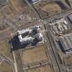
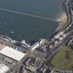
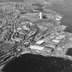
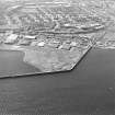
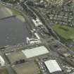
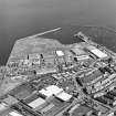
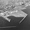
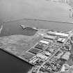
RAF vertical air photography (CPE/SCOT/UK 60 5019-20) flown 13 August 1947 records the varied use of the harbour at that date, the extensive and well-used network of railway tracks being particularly evident. This imagery shows the western breakwater as being occupied by a medium-sized passenger/cargo ship (nearest the entrance), four probable side-trawlers (apparently in refit), and smaller vessels. A shipbreaking yard is in operation at the SW corner of the harbour, the dismembered hull of a probable destroyer being evident. The major feature of the middle pier is the prominent coal-loading plant (at the N end) while further trawlers of different sizes are prominent among other vessels lying along both sides and across the end. A further small ship- or boat-building yard is in operation at the SE corner of the harbour.
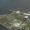
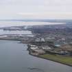
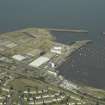
Later vertical imagery (JASAIR 51988118-19 flown 7 June 1988 and Geonex 41/090/200-2, flown 24 July 1990) records the infilling of the western harbour, the decay of the timberwork inside the western breakwater, the abandonment of the harbour by commercial traffic and the corresponding increase in recreational use. The latter imagery (at 1:5000 scale) provides a particularly good record of the buildings on the middle pier.
Information from RCAHMS (RJCM), 30 May 2001.
NT 2380 7756 Robert Stevenson and Son, Engineers - famed for lighthouse construction - designed Granton Harbour in 1835. The harbour has since witnessed many alterations. The redevelopment of the harbour's interior has led to the exposure of several important industrial features that have, until recently, been buried when the harbour was reclaimed during the early 1970s. A desk-based assessment was carried out to determine the spatial extent of later industrial remains associated with Granton Harbour's coal handling facilities. Further survey and a series of watching briefs followed from this.
Excavation work by contractors on the western breakwater (NT27NW 28.02) exposed the remains of a 25-ton steam crane plinth constructed of large blocks of ashlar sandstone. Service trench construction on the Middle Pier (NT27NW 28.01) revealed a large section of the original 1835 pier work. Large blocks of ashlar sandstone were found to have been pegged together using a system of basalt blocks and iron clamps. The former construction technique was favoured in lighthouse construction.
A series of watching briefs carried out elsewhere on the Middle Pier revealed the foundations of a warehouse with a set of steps or sea-gate leading from the cellar of the building. This provides positive evidence for the position of the 19th-century warehouse that was demolished during the early 20th century. Further excavation confirmed the position of a low water landing slipway with a cobbled stone surface.
Archive to be deposited in the NMRS.
Sponsor: Forth Property Developments Ltd.
M Cressey 2004
(Name cited as Granton Naval Base). Granton Harbour was a base for the operation of Q-ships during the First World War.
[Operation described in detail].
R J B Walker 2006.
Field Visit (15 September 2011)
Project (March 2013 - September 2013)
A project to characterise the quantity and quality of the Scottish resource of known surviving remains of the First World War. Carried out in partnership between Historic Scotland and RCAHMS.


