Pricing Change
New pricing for orders of material from this site will come into place shortly. Charges for supply of digital images, digitisation on demand, prints and licensing will be altered.
Edinburgh, Leith, 19 Water Street, Lamb's House
Merchants House (17th Century)
Site Name Edinburgh, Leith, 19 Water Street, Lamb's House
Classification Merchants House (17th Century)
Alternative Name(s) 13 Waters' Close; Burgess Street; Water Lane
Canmore ID 51956
Site Number NT27NE 4
NGR NT 27102 76422
Datum OSGB36 - NGR
Permalink http://canmore.org.uk/site/51956
First 100 images shown. See the Collections panel (below) for a link to all digital images.
- Council Edinburgh, City Of
- Parish Edinburgh (Edinburgh, City Of)
- Former Region Lothian
- Former District City Of Edinburgh
- Former County Midlothian
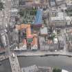
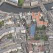
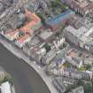
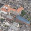
C17th Merchant's house, said to have been built on the site of a house visited by Mary, Queen of Scots after her landing on Scottish soil. Possibly once the grandest house in Leith, the house was restored by Neil & Hurd, 1937-9 for the Marquess of Bute and Robert Hurd & Partners, 1959-61 for use as a day centre for the elderly of Leith.
The house was bought in 2010 by the architect, Nicholas Groves Raines, to become a residence and office for the GRA practice. A small ogee roofed pavilion is planned on a corner site, part of the spot where the 1960's extension stood.
RCAHMS (CAJS) 2012.
NT27NE 4 27091 76423
(NT 27091 76423) Lamb's House (NR)
OS 25"map, (1971)
Lamb's House is a merchant's house of late 16th or early 17th century date (National Trust 1959). Both residence and ware-house were contained within this five-storey building of exceptional architectural quality. It was extensively remodelled internally and the windows enlarged in the 18th century; ruinous by 1937, restored in 1938 by the Marquis of Bute, whose son presented it to the National Trust in 1958, when further restoration took place.
The house is commonly identified as that of Andro Lamb, visited by Mary Queen of Scots after landing at Leith in 1561, but this is discounted by the RCAHMS, who assign it a date of erection in the second decade of the 17th century.
RCAHMS 1951; National Trust of Scotland 1959.
Lamb's House is as described and in good condition. It is now in use as an old peoples Welfare Centre.
Visited by OS (B S) 27 November 1975.
Edinburgh, Water's Close.
NMRS/ Simpson and Brown photographs.
Box 1, album no 3 - general exterior views, including Lamb's House, 1981.
Box 2, album no 23 - landscape.
Publication Account (1951)
225. 13 Waters' Close.
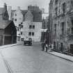
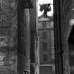
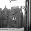
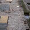
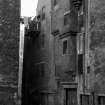
Mary, Queen of Scots, after landing at Leith on 19th August 1561 "remainit in Andro Lamb's hous be the space of ane hour," (1) and her resting-place is commonly identified as the house still extant at the corner of Water Street and Waters' Close. This building, however, has all the appearance of dating from the second decade of the 17th century. Certainly the finest of the historic houses in Leith, it contains four main storeys with a garret in the roof and is oblong on plan, with its major axis running roughly E. and W. The masonry is of harled rubble with exposed dressings, those of the original windows being either rounded or chamfered. Against the W. end of the building abuts an 18th-century mutual gable, while more modern buildings cover the E. end of the N. wall. Thus only the S. side and E. gable of the house stand free and unobscured (Fig. 428). Centred in the front or S. elevation is a stair-tower of slight projection, handsomely corbelled and effectively offset, which rises to a gablet, the re-entrant angle on the E. side of this containing a turret-stair for access to the garret. Attention may be drawn to the manner in which the W. side of the projection is taken in beneath corbelling to accommodate an angle window lighting the lower part of the stair, a device employed at a higher level on the E. gable for a similar purpose. Another feature of the same elevation is the broad crow-stepped chimney-stalk rising from the wall-head on the W. of the stair. A corresponding stalk on the opposite wall and a third on the E. of the stair are also original provisions, although partly rebuilt in the 18th century.
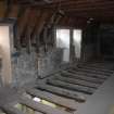
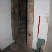
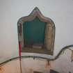
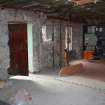
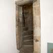
The lowest storey was devoted to store-rooms, entered from four wide doorways on the S. side and from a fifth in the E. gable. But there may also have been a workshop behind one of the storerooms since the flue of an original fireplace has recently been found in the back wall. All had wooden floors, with wide boards resting on joists which seem to have been bedded in sand. There are numerous cupboards in the walls. As far as can be ascertained there were two flats on each of the two floors immediately above, all four dwellings being entered off the common stair in front and each comprising hall, "chalmer" and kitchen. Whatever the arrangement, the rooms were spacious and fairly well lit; they had large fireplaces and some had wall-presses. Sanitation was probably provided by an outside privy, but there are two slop-sinks housed in recesses with ogival heads within the stair well, discharging into a common vent which emerges at the base of the wall of the stair. The W. flat on the second floor shows slight traces of painted decoration. On the third floor, where the main stair ends, there seem to have been two store-houses at the W. end-so much at least is suggested by a doorway in each of the side walls, to which goods might have been hoisted by block and tackle-but the remainder of the storey contained two habitable flats. The garret was no doubt divided into separate rooms, of which one still survives above the main staircase; these were probably intended for servants.
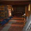
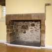
In the 18th century the property was extensively remodelled. Windows were enlarged, fireplaces were contracted, and the accommodation was almost certainly rearranged. The second floor, for instance, became a single flat of not less than five habitable apartments. Its principal room was panelled, and in the panelling was set a shelved niche of plaster with stucco enrichment in the head.
In 1938 the fabric was carefully restored.
RCAHMS 1951, visited c.1941
(1) Diurnal, p. 66.
Photographic Survey (24 February 1958)
Photographic survey by the Scottish National Buildings Record/Ministry of Work in February 1958.
Test Pit Survey (14 August 2007 - 15 August 2007)
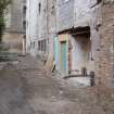
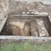
NT 2709 7642 Two test pits were excavated on 14 to 15 August 2007 in the courtyard to the SW of Lamb's House (NT27NE 4) (a mid-17th-century structure) on the site of intended geotechnical investigations prior to development. Two slight linear gullies, dated to the medieval period by pottery, were discovered in one of the test pits. These did not follow the alignment of the medieval burgage plots. The area excavated was too small to interpret these features with any confidence. In the other test pit a wall of early 19th-century date was discovered, which corresponds closely in position with one shown on the 1849-53 OS town plan. The results of these investigations suggest that any medieval remains in the courtyard of Lamb's House are likely to be severely truncated with only cut features surviving.
Archive to be deposited with RCAHMS. Report to be deposited with CECAS and RCAHMS.
Funder: EDI Group Ltd.
OASIS ID: headland1-32884
Photographic Survey (18 June 2008)
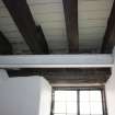
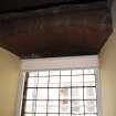
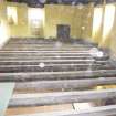
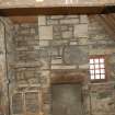
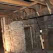
Photographed by the Threatened Buildings Survey prior to partial demolition and alteration.
RCAHMS (CAJS) 2012.
Standing Building Recording (23 September 2010 - 14 May 2012)
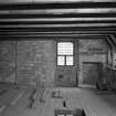
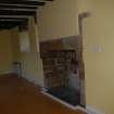
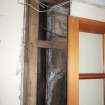
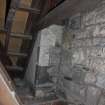
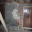
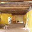
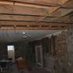
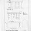
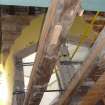
Headland Archaeology was commissioned by Groves-Raines Architects to undertake a programme of recording at Lamb's House, 19 Water Street, Leith. This report forms a basic written, metric and photographic record of the building. It is clear from the documentary work that the main structure of the building has stayed almost the same for the last 200 years. During this time the use of the property has changed and at times has been in a very poor state of repair. From being a rich merchant's house from at least the 17th century by the turn of the 20th century it was occupied by a number of families and was derelict by the early 1930's. Building repairs were then undertaken although still laid empty until it was converted into a day care centre in 1961. The work undertaken as part of the current project identified a number of features that had changed but found that the overall structure had not been altered from its original construction.
Tim Holden and Don Wilson (Headland Archaeology) August 2012. OASIS id: headland1-84347.


