
Aberdour, General


Burgh (Medieval), Village (Period Unassigned)
Site Name Aberdour, General
Classification Burgh (Medieval), Village (Period Unassigned)
Alternative Name(s) Aberdour West
Canmore ID 50833
Site Number NT18NE 37
NGR NT 1920 8540
Datum OSGB36 - NGR
Permalink http://canmore.org.uk/site/50833


- Council Fife
- Parish Aberdour (Dunfermline)
- Former Region Fife
- Former District Dunfermline
- Former County Fife
NT18NE 37 1920 8540.
Aberdour or Aberdour West: erected burgh of barony 1500/1; became burgh of regality in 1638.
G S Pryde 1965.
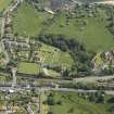
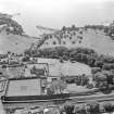
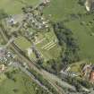
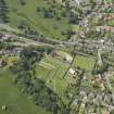
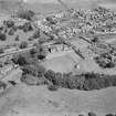
Aerial Photography (1966)
Oblique aerial photographs of Aberdour, FIfe, photographed by John Dewar in 1966.
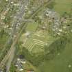
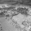
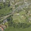
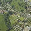
Aerial Photography (1966)
Oblique aerial photographs of Aberdour, Fife, photographed by John Dewar in 1966.

