
Following the launch of trove.scot in February 2025 we are now planning the retiral of some of our webservices. Canmore will be switched off on 24th June 2025. Information about the closure can be found on the HES website: Retiral of HES web services | Historic Environment Scotland
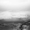
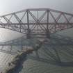
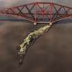
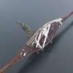
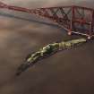
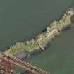
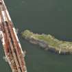
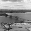
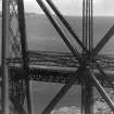
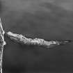
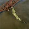
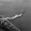
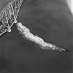
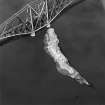
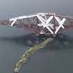
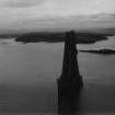
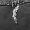
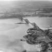
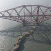
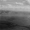
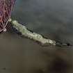
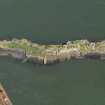
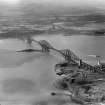
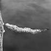
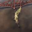
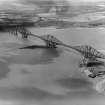
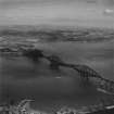
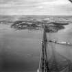
Inch Garvie


Artillery Fortification (17th Century)
Site Name Inch Garvie
Classification Artillery Fortification (17th Century)
Alternative Name(s) Inchgarvie; Firth Of Forth
Canmore ID 50636
Site Number NT17NW 9
NGR NT 1357 7956
Datum OSGB36 - NGR
Permalink http://canmore.org.uk/site/50636


- Council Edinburgh, City Of
- Parish Dalmeny
- Former Region Lothian
- Former District City Of Edinburgh
- Former County West Lothian
NT17NW 9 1357 7956
(NT 1357 7956) Fort (NR) (rems of)
OS 6" map (1968).
See also NT17NW 10 and NT17NW 13.
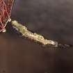
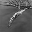
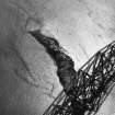
Inchgarvie, an important strategic point, was strongly defended by the Royalists against Cromwell in 1650-1. It had as many guns mounted on it, and men set to work them, as its castle could hold. (See also NT17NW 10 and NT17NW 13 ). In conjunction with the Royalist fort described on NT18SW 36, it was fairly effective in preventing Cromwell's supplies passing up the Forth, but was forced to surrender to Cromwell in person on 24 July 1651, probably because of a lack of fresh water (W S Douglas 1898).
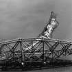
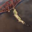
The remains consist of a low, roughly built wall with embrasures and of an oval figure; the wall is about 4 1/2 ft high and about a yard in width, constructed of rough, small stones and mortar.
Name Book 1854.
The remains of this fort are in poor condition, modern brickwork having been introduced into the structure, possibly when the island was fortified during the last two wars. The average height of the walls is 4.5m.
Visited by OS (JD) 9 March 1955.
Inchgarvie was defended by the Royalists against Cromwell in the Civil War. It had many guns mounted on it. The remains of a fort were described as being in poor condition in 1955 with modern brickwork having been incorporated into the structure during the past two World Wars. The average height of the walls was 4.5m. Dickson 1899 Inchgarvie, pp 3- 31
Site recorded by GUARD during the Coastal Assessment Survey for Historic Scotland, 'The Firth of Forth from Dunbar to the Coast of Fife' 1996.
Scheduled (with NT17NW 10 and NT17NW 13) as Inch Garvie, Firth of Forth, defensive installations.
Information from Historic Scotland, scheduling document dated 19 August 1996.
EXTERNAL REFERENCE:
National Library of Scotland
'Master Masons I p....o '

