Pricing Change
New pricing for orders of material from this site will come into place shortly. Charges for supply of digital images, digitisation on demand, prints and licensing will be altered.
Forth Bridge
Railway Bridge (19th Century)
Site Name Forth Bridge
Classification Railway Bridge (19th Century)
Alternative Name(s) Forth Rail Bridge; Forth Railway Bridge; River Forth; Inner Forth Estuary; Queensferry Narrows; South Queensferry; Dalmeny
Canmore ID 50614
Site Number NT17NW 70
NGR NT 13554 79252
NGR Description NT 13885 77955 to NT 13286 80332
Datum OSGB36 - NGR
Permalink http://canmore.org.uk/site/50614
First 100 images shown. See the Collections panel (below) for a link to all digital images.
- Council Edinburgh, City Of
- Parish Dalmeny
- Former Region Lothian
- Former District City Of Edinburgh
- Former County West Lothian
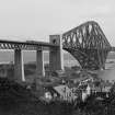
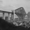
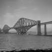
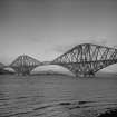
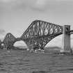
Built between 1882 and 1890, the Forth Railway Bridge is regarded as a masterpiece of Victorian engineering. It was designed by the engineers Sir John Fowler and Sir Benjamin Baker, and the contractor for the construction was Tancred, Arrol & Co.
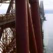
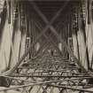
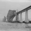
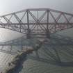
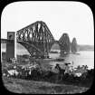
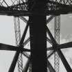
The form of the bridge comprises three double cantilevers, supported by massive granite foundations, and connected by latticed girders. The bridge spans some 2.5km between North and South Queensferry.
Information from RCAHMS (SC) 27 June 2007
Hume, J 1976
Smith, M 1994
Forth Bridge [NAT]
OS 1:10,000 map, 1984.
Not to be confused with Alloa, Forth Rail Bridge (NS 8627 9156 to 8616 9110), for which see NS89SE 79.
For (nearby) Forth Road Bridge (NT 124 782 to 125 807), see NT17NW 171.
For (associated) railway cottages at Dalmeny (NT 1394 7792 and 1402 7784), see NT17NW 146 and NT17NW 167 respectively.
For Forth Bridge Workshops and related crane at Dalmeny Station (NT 1400 7775), see NT17NW 174.00.
For associated and adjacent Battery Quarry (North Queensferry), see NT18SW 346.
For (apparently-associated) lifeboat station at NT 12552 80541, see NT18SW 348.
For (supplying) stone quarries at Kemnay, Aberdeenshire, see NJ71NE 79.
Architect: Sir John Fowler 1881 (with Sir Benjamin Baker)
Built 1883-1890
Sir William Arrol - contractor.
The following is taken from photograph D/81710/PO:
The Forth Bridge. The labour of 5000 men (day and night) for 7 years.
Engineers - Sir John Fowler & Sir Benjamin Baker.
Contractor - Sir William Arrol. Opened March 1890.
Cost over £3,000,000
Length, including approach viaducts, over 1 1/2 miles. Two spans of 1710 Ft each and two of 690 Ft each. Highest part above sea level at high tide, 361 Ft. Height of rails above sea level at high tide, 157 Ft 8 Ins. Depth below water level 91 Ft.
Materials used:
Steel : 54,160 Tons.
Concrete : 64,300 Cubic Yards
Granite : 740,000 Cubic Feet
Cement : over 21,000 Tons.
Ordinary Stone : 47,400 Cubic Yards.
Rivets : 6,500,000 = 4,200 Tons.
Reference: MacKay, S 1990 "The Forth Bridge. A Picture History", Edinburgh.
National Library - "Scots Magazine" April 1807: engraving of section of Forth from Hopetoun to Rosyth.
(Undated) information in NMRS.
(Location cited as NT 13 79). Forth Railway Bridge: built 1882-90 by engineers Sir John Fowler and Benjamin Baker. Probably the best-known bridge in Scotland with its three double cantilevers and dramatically high approach spans. Its total length is 8295 ft 9.5 ins (2,528.6m) and the two main spans are each 1700 ft (518.3m) long.
J R Hume 1976.
The designers were John Fowler (best known for the Metropolitan and District Railways in London) and Benjamin Baker (his partner and former assistant). The contract was let to Tancred, Arrol & Co. in December 1882 and work began in the following year. On 24 January 1890 the Marchioness of Tweeddale drove the first train across the bridge, and on 4 March the Prince of Wales declared the bridge open. The bridge is seen at its simplest, in pure, distant elevation, from Hopetoun House (NT07NE 13) to the W; at its most complex and powerful from the old ferry pier (NT17NW 172) by the Hawes Inn, or best of all from the water.
C McWilliam 1978.
Over the summer and autumn of 1879, William Arrol, whose modest company had successfully tendered for the ironwork of the bridge, prepared to begin construction, acquiring ground near South Queensferry for workshops and building a brickworks at Inverkeithing. However, in July 1880 and after the Report of the Commissioners enquiring into the collapse of the Tay Bridge, contracts for the Forth Bridge were cancelled and the project abandoned. However, a meeting of the four major railway companies involved reconsidered this move on 30 September 1881, and the Abandonment Bill was withdrawn.
The Act for the present bridge received Royal assent on 12 July 1882, and work started in December of that year. So as to take full advantage of the structure, the North British Rly. had been engaged for some time on permanent way schemes to improve access both to the bridge and Edinburgh.
W S Bruce 1980.
The Forth Bridge was built by contractors Tancred, Arrol & Co to the design of engineers John Fowler and Benjamin Baker on behalf of the Forth Bridge Co (a joint composite of the North British, North Eastern, Midland and Great Northern Rlys) at a cost of 3 million pounds.
It comprises 23 spans (including the approaches) and was built of granite and mild steel to a cantilever and lattice girder design. Lack of approach track capacity initially limited the use of the bridge and it lost its status as the world's largest cantilever bridge with the opening of the Quebec Bridge (over the St Lawrence River, Canada) in December 1917.
M Smith 1994.
This bridge carries the Edinburgh-Aberdeen main line of the (former) North British Rly. (which was grouped into the London and North-Eastern Rly.) across the inner estuary of the River Forth at the Queensferry Narrows, between the parishes of Dalmeny (in the former county of West Lothain and City of Edinburgh District of Lothian Region) and Inverkeithing (in the former county of Fife and Dunfermline District of Fife Region).
Information from RCAHMS (RJCM), 13 January 1996.
Twin track steel railway bridge 2.5km long and 47m above MHWM. Built in 1882-90. Spans the Firth of Forth between South and North Queensferry. It was constructed just after the Tay Bridge disaster and so safety was a great consideration.
Site recorded by GUARD during the Coastal Assessment Survey for Historic Scotland, 'The Firth of Forth from Dunbar to the Coast of Fife' 18 February 1996.
The Forth Bridge may be seen as the symbol of the 'Golden Age' of British railways, being the apogee of a prolonged period of development and having an effect far beyond the railway industry, representing the excellence of British products in general. It also redeemed the reputation of the British engineering industry after the collapse of the first Tay bridge (NO32NE 17), and is paralleled in many respects by the Severn Tunnel.
A Vaughan 1997.
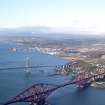
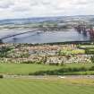
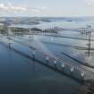
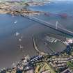
This bridge forms a notable panorama with the corresponding road bridge (NT17NW 171) which stands a short distance to the W. The N ends of the two bridges lie close together, but they diverge towards the S, the village of South Queensferry (NT17NW 175) lying between them. Like the road bridge, this structure over-arches the village of North Queensferry (NT18SW 121).
The location assigned to this record defines the midpoint of the structure. The available map evidence indicates that it extends from NT c. 13885 77955 to NT c. 13286 80332.
Information from RCAHMS (RJCM), 3 March 2006.
(Appendix: list of names of men killed during construction works).
E Wills 2009.
Forth Bridge [NAT]
OS (GIS) MasterMap, December 2010.
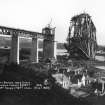
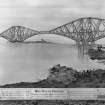
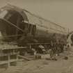
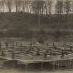
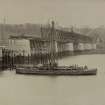
Construction (1883 - 1890)
Built by engineers Sir John Fowler and Sir Benjamin Baker. Contractor Sir William Arrol.
J R Hume 1976; W S Bruce 1980; C McWilliam 1978.
Photographic Record (1900 - 1909)
Photographs of the bridge, including during its construction, taken by Scottish Colorfoto.
Photographic Record (1900)
Aerial Photography (1939 - 1945)
Reconnaissance photographs of the Forth Bridge taken by the Luftwaffe during WWII.
Photographic Survey (June 1957)
Photographs of the Forth Bridge by the Scottish National Buildings Record in 1957.
Photographic Record (1960 - 1969)
Photographic Record (1970 - 1979)
Photographs of The Forth Bridge taken by William McKelvie in the 1970s.
Publication Account (1985)
One of the latter-day wonders of the world and a remarkable tribute to Victorian engineering, this bridge-the first really major structure to be made entirely of steel-was built between 1882 and 1890. Over 2.5 km long, and expanding by almost a metre from mid-winter to mid-summer, it incorporates 3 massive double cantilevers, the Queensferry, Inchgarvie and Fife Erections, which support in turn 2 main spans each 518 m long and 110 m high. The approach spans, supported on slender stone piers, are equally dramatic as they reach out across the Forth; they are quite separate, however, from the main cantilevers, and bear none of the weight Massive 1016 tonne counterpoise weights at either end of the bridge are responsible for this.
After his Tay Bridge collapsed in the winter storm in 1879, Thomas Bouch was stopped from beginning work on the new bridge across the Forth. Finally the crossing was engineered by Sir John Fowler and Benjamin Baker. It owes its massive structure, in part at least, to a deep-seated concern that it, too, should not collapse; and contemporary comment suggests that not every one found it as overtly beautiful as it was strong!
It was the equally remarkable road bridge, however, opened in 1964, that fmally put an end to the ferry crossing and completed the metamorphosis of Queensferry from ferry-toun to commuter suburb. The first public ferry had been established in 1129 by David I, though Margaret, wife of Malcolm Canmore, had regularly crossed there since 1067, travelling between the abbey at Dunfermline and the castle at Edinburgh. The monks of Dunfermline were given a charter to operate it, and it helped encourage pilgrims from the south to visit the shrine at St Andrews.
The last in a sequence of piers, a straight stone-built sloping jetty built c1812 by John Rennie in the subsequent shadow of the railway bridge, has been left to the inshore lifeboat and seasonal excursion boat to the 12th century Augustinian abbey on Inchcolm. A central breakwater bisects it, with a hexagonal lighthouse at its landward end.
Information from 'Exploring Scotland's Heritage, Lothian and Borders' (1985).
Standing Building Recording (28 February 1986)
Photographic Survey (29 August 1988 - 9 September 1988)
Photographic Survey (1991)
Photographic Record (3 September 2000)
Aerial Photography (13 July 2006)
This flight was designed to explore the potential of the cropmarks along the Moray Plain noted the previous week and produced a good clutch of previously unrecorded and known sites in the Nairn - Elgin - Forres area, extensive areas of rig among them.
Project (2007)
This project was undertaken to input site information listed in 'Civil engineering heritage: Scotland - Lowlands and Borders' by R Paxton and J Shipway, 2007.
Publication Account (2007)
The Forth Bridge, often dubbed ‘the eighth wonder of the world’, carrying the east coast main line railway across the Forth at Queensferry was designed between 1880–82 in the aftermath of the Tay Bridge disaster. This event engendered a major loss of confidence in Victorian engineering, but resulted in a gigantic leap forward in bridge design and construction with the achievement of the Forth Bridge built from 1883–90. The bridge was to provide a shorter rail route to the north in place of the time-consuming ferry crossings. In order to cross two deep channels, two main spans of 1710 ft utilising the isle of Inchgarvie were required, a daunting and unprecedented project.
Initially Thomas Bouch proposed a stiffened suspension bridge design with two spans of 1600 ft and construction began in 1878, but, following the fall of the Tay Bridge, confidence in his judgement and design waned, although it had been checked and was being implemented by William Arrol. The base of one of the brick piers of his structure still remains at Inchgarvie, now carrying a beacon.
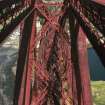
An innovative design involving the balanced cantilever principle and the use of steel was devised by consulting engineers Sir John Fowler & Benjamin Baker of Westminster. The Board of Trade laid down the stringent requirement of 56 lb sq ft to be allowed for in the design for wind pressure. Extensive use was made of tubular members in compression, many of unprecedented size. The design was subjected to intense scrutiny as it developed. Wind pressures were recorded and endless tests made on the quality of the steel. Nothing was left to chance.
The contract for constructing the bridge was awarded to Tancred, Arrol & Co. William Arrol took personal charge of the operations, both at his works in Glasgow and on site, Andrew Biggart playing a key role. He showed great ingenuity in the design of plant, including hydraulic riveting machines, cranes and drilling methods, and provided many safety devices for his workers. The carefully devised design enabled the bridge to be constructed with the minimum of temporary works and staging.Much of the labour employed on the bridge was recruited from shipyards of the Clyde and Forth, and steelworkers from Lanarkshire. The superstructure is basically three towers with cantilever arms on each side. The towers are 330 ft high above the granite pier foundations, and the cantilever arms are each 680 ft long, projecting outwards from the towers.The ends of the cantilevers over the river are linked by suspended spans of 350 ft. Other dimensions are:
Main spans 1710 ft
South approach ten spans of 168 ft
North approach five spans of 168 ft
Overall length 8296 ft
About 54 160 tons of steel were used in the bridge’s construction, secured by 6 500 000 rivets. At the peak of construction 4600 men were employed. For more than a century there were believed to have been 57 fatalities during construction but this number has increased into the 60s following recent research. Electric light was in its infancy, but primitive lighting was employed here for the first time on a major construction site. The final, so called, ‘Golden Rivet’ was ceremoniously driven by the Prince of Wales at the opening of the bridge on 4 March 1890. The bridge is now (2007) undergoing a major long-term refurbishment. Its traditional Craig & Rose paint is being replaced by a paint regime developed in the offshore oil industry consisting, after blast cleaning to bare metal, of an application of a zinc based primer (35 microns), a glass flake epoxy paint barrier (400 microns) and a polyurethane gloss top coat (35 microns).
R Paxton and J Shipway 2007
Reproduced from 'Civil Engineering heritage: Scotland - Lowlands and Borders' with kind permission of Thomas Telford Publishers.


