Following the launch of trove.scot in February 2025 we are now planning the retiral of some of our webservices. Canmore will be switched off on 24th June 2025. Information about the closure can be found on the HES website: Retiral of HES web services | Historic Environment Scotland
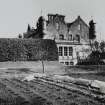
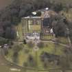
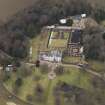
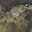
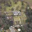
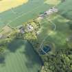
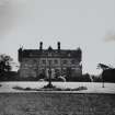
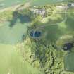
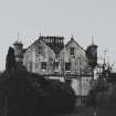
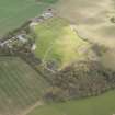
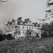
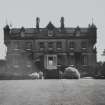
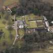
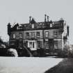
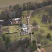
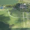
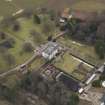
Bonnington House
Country House (17th Century), Well (Post Medieval)
Site Name Bonnington House
Classification Country House (17th Century), Well (Post Medieval)
Alternative Name(s) Jupiter Artland
Canmore ID 50367
Site Number NT16NW 9
NGR NT 11141 69102
Datum OSGB36 - NGR
Permalink http://canmore.org.uk/site/50367
- Council Edinburgh, City Of
- Parish Ratho
- Former Region Lothian
- Former District City Of Edinburgh
- Former County Midlothian
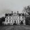
Bonnington House, c.1840, ?Thomas Hamilton
Actually in Edinburgh but with its entrance in West Lothian. Refurbished, 2001, by Lee Boyd Architects, including garden room and elegant structural glass staircase. Voted Britain's best listed home in a national television survey.
Taken from "West Lothian: An Illustrated Architectural Guide", by Stuart Eydmann, Richard Jaques and Charles McKean, 2008. Published by the Rutland Press http://www.rias.org.uk
NT16NW 9.00 11141 69102
NT16NW 9.01 NT 1122 6844 Lodge; Gate Piers
NT16NW 9.02 NT 1106 6917 House
NT16NW 9.03 NT 1104 6911 Stables
NT16NW 9.04 NT 1110 6908 Walled Garden
NT16NW 9.05 NT 11097 69099 Sundial
NT16NW 9.06 NT 11139 68791 Ornamental pond
NT16NW 19 NT 11143 69143 Dovecot
(NT 1114 6908) Bonnington House was built in 1622.
NSA 1845 (J Clason)
Bonnington House is an early 19th century transformation of the 17th century mansion. Jacobean style, two storeys, harled. It belonged to Sir James Foulis, Lord Colinton, in the mid-17th century, and passed eventually to Wilkies of Ormiston.
SDD List 1964.
Ground Penetrating Radar (2009)
A geophysical survey undertaken by the University of Bradford Department of Archaeological Sciences in 2009 ( Bonnington House, Geophysical Survey Report s2137. (Unpublished DSR produced by the University of Bradford Department of Archaeological Sciences on behalf of CFA)indicated that the area to the east of the house where the new wings will be
constructed had been heavily landscaped in the past. The GPR data indicated the presence of paths, roadways and garden features, the majority of which occurred at a depth of 0-0.5m. There was no clear evidence of the wings depicted on Roy’s map, supporting the cartographic evidence that they lay further to the east than those currently proposed.
Information from C. Gaffney and T. Sparrow 2009. OASIS ID: cfaarcha1-121082
Watching Brief (1 August 2011 - 25 February 2012)
An archaeological watching brief was carried out during ground works for new wing extensions to Bonnington House, near Wilkieston. Hand dug trial pits indicated that the foundations for the house sat directly on top of the natural subsoil at a depth of 0.9m or greater below the current ground surface, and that deep deposits of made ground (2.2m deep) were present on the southern side of the house. The watching brief in the area to the north of Bonnington House monitored the demolition of the boiler house, a later addition to the house. The removal of the boiler house exposed the original set of sandstone steps into the structure and a length of sandstone wall beneath the concrete floor. Walling to the east of the door, on the north side of the main house, was also exposed. No features were discovered that may have related to the north wing of the house. To the south of Bonnington House the demolition of the modern kitchen revealed the foundation walls and plinth for the extension building. A stone box drain, stone built water cistern and a brick built septic tank were also recorded within the watching brief area to the south of Bonnington House. An 'L'-shaped foundation wall which protrudes from the main house foundations was exposed running for 1.4m N-S and 3.7m E-W. This wall does not align with the front wall of the main house and may relate to an earlier structure or a now demolished extension.
Information from Magnus Kirby (CFA Archaeology) Ausust 2011.
Archaeological Evaluation (August 2013 - September 2013)
NT 11141 69102 An evaluation was carried out, August–September 2013, during groundworks associated with garden landscaping at Bonnington House. A stone-built well was recorded to the E of the House and cobbled paths, relating to the garden recorded on the 1853 OS map, were recorded to the W.
A lead pipe on the interior W side of the well runs to the bottom of the well and was probably used to pump water to the house. An old pump in the basement of the house has a matching lead pipe, but no remains of a connecting pipe were found. The well is probably of 17th/18th-century date and is contemporary with the house.
Archive: RCAHMS (intended)
Funder: Mr R Wilson
Melanie Johnson and Gary Savory, CFA Archaeology Ltd, 2013
(Source: DES)


