Pricing Change
New pricing for orders of material from this site will come into place shortly. Charges for supply of digital images, digitisation on demand, prints and licensing will be altered.
Harelaw Muir
Long Cairn (Neolithic)
Site Name Harelaw Muir
Classification Long Cairn (Neolithic)
Alternative Name(s) Harlaw Muir; Old Deepsykehead
Canmore ID 50228
Site Number NT15SE 5
NGR NT 1799 5464
Datum OSGB36 - NGR
Permalink http://canmore.org.uk/site/50228
- Council Scottish Borders, The
- Parish Linton (Tweeddale)
- Former Region Borders
- Former District Tweeddale
- Former County Peebles-shire
NT15SE 5 1799 5464
For Talla Observatory (adjacent to NE), see NT15SE 59..
(NT 1799 5464) Long Cairn (NR) (remains of)
OS 25" map (1971)
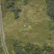
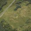
The remains of this long cairn lie in undulating moorland at 930ft OD. The Ordnance Survey Name Book (ONB) describes the place as 'the site of a large cairn which was composed of stones of different sizes situated in a small plantation. The stones have been long since removed and were used for the purpose of building the wall round the plantation. It could not be ascertained whether there were any human remains found in the cairn at the time of its removal'.
The remains now consist of a low, grass-covered stony mound measuring 197ft ENE-WSW by 58ft across the E end, narrowing to about 38ft across the W end; Its maximum height is 3ft. The edges and the E end are vague; the latter appears to have been almost straight or slightly convex on plan. There is no sign of any internal structure. The mound is crossed by the ruinous plantation wall. The plantation has been removed. (Information from A McLaren notebook 1, 23)
RCAHMS 1967, visited 1959; A S Henshall 1972; Name Book 1856
Field Visit (April 1959)
Long Cairn, Harelaw Muir.
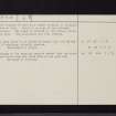
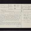
The remains of what has probably been a long cairn are situated on level ground, at a height of 930 ft OD, about half a mile NE of the cross-roads of Old Deepsykehead and 100 yds NW of the road from West Linton to Penicuik. Most of the cairn lies within an old plantation which is enclosed by a stone dyke; the trees have now been felled and the dyke is in very ruinous condition. It is reported (ONB 21, p.41) that the cairn was a large one and that it was demolished to provide stone for the dyke surrounding the plantation. It is not known whether any relics were found. At the present time the remains consist simply of a low, grass-grown-ragged mound from which a few boulders protrude, especially at the ends; it measures 190 ft in length from NE to SW, 45 ft in breadth and 3 ft in maximum height. There is no sign of any internal structure.
RCAHMS 1967, visited April 1959
NT15SE (‘Cairn, site of’)
179546
Field Visit (2 February 1970)
This long cairn is as described except that the NE end is, if anything, slightly concave.
Resurveyed at 1/2500.
Visited by OS (RD) 2 February 1970
Field Visit (1 March 1979)
No change to the previous reports except that the cairn is now 55.0m long and 16.0m wide at the east end.
Surveyed at 1/10,000.
Visited by OS (JRL) 1 March 1979.
Sbc Note
Visibility: This is an upstanding earthwork or monument.
Information from Scottish Borders Council


