Pricing Change
New pricing for orders of material from this site will come into place shortly. Charges for supply of digital images, digitisation on demand, prints and licensing will be altered.
Camilty Hill
Sheepfold (Period Unassigned)
Site Name Camilty Hill
Classification Sheepfold (Period Unassigned)
Canmore ID 49002
Site Number NT05NW 5
NGR NT 0491 5935
Datum OSGB36 - NGR
Permalink http://canmore.org.uk/site/49002
- Council West Lothian
- Parish Mid Calder
- Former Region Lothian
- Former District West Lothian
- Former County Midlothian
NT05NW 5 0491 5935.
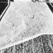
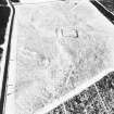
(NT 049 593) A circular enclosure lies about 250 yds NW of Castle Greg fort, and measures 40' internal diameter, surrounded by an earth mound now spread to 12' wide and 2' high. The S arc has an ill defined entrance c.13' wide. Encircling this enclosure, at intervals varying from 66 to 100 yds., is a second low-lying earth ridge with an average spread of 10', broken to some extent on the NE.
RCAHMS 1929, visited 1925
When visited in May 1965, this site seemed hexagonal in shape, and may be a Roman shrine.
Oral information from R W Feachem, 31 May 1965.
The enclosure lies some 91.0m NW of the fort and is no more than the remains of a sheepfold or animal pound.
Visited by OS (BS) 14 April 1975
NT 0491 5935. The remains of this collapsed turf-banked sheepfold are generally as described. The outer enclosure is probably a stock pen.
Visited by OS (MJF) 27 April 1979
Field Visit (20 July 1925)
Circular Enclosure and surrounding Rampart, Camilty Hill.
At an elevation of 900 feet above sea level and about 250 yards north-west of the ‘Roman Camp’ at Camilty Hill [NT05NW 5] is a circular enclosure, 40 feet in internal diameter, surrounded by an earthen mound now spread over a width of 12 feet and rising 2 feet at most above the neighbouring ground-level. The entrance, though not well defined, seems to have been on the southern arc and to have measured approximately 13 feet in width. Encircling this enclosure, at intervals varying from 66 to 100 yards, is a second low-lying earthen ridge with an average spread of 10 feet, broken to some extent on the north-east.
RCAHMS 1929, visited 20 July 1925
OS map: xi S.E. (unnoted).


