Scheduled Maintenance
Please be advised that this website will undergo scheduled maintenance on the following dates: •
Tuesday 12th November from 11:00-15:00 & Thursday 14th November from 11:00-15:00
During these times, some services may be temporarily unavailable. We apologise for any inconvenience this may cause.
West Lindsaylands
Causewayed Enclosure (Neolithic)(Possible), Fort (Period Unassigned)
Site Name West Lindsaylands
Classification Causewayed Enclosure (Neolithic)(Possible), Fort (Period Unassigned)
Canmore ID 48665
Site Number NT03NW 35
NGR NT 01575 36572
Datum OSGB36 - NGR
Permalink http://canmore.org.uk/site/48665
- Council South Lanarkshire
- Parish Biggar
- Former Region Strathclyde
- Former District Clydesdale
- Former County Lanarkshire
NT03NW 35 NT 01575 36572
See also NT03NW 70.
(Location cited as NT 016 366). Crop marks, Biggar, Lanarks., West Lindsaylands.
CUCAP imagery: AVX 40-1, flown 26 July 1968 and BRB 36-7, flown 1 August 1974.
[Undated] information in CUCAP card index.
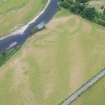
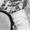
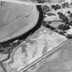
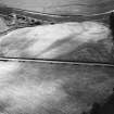
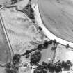
NT 015 365. Earthwork, West Lindsaylands (Site): Cropmarkings on air photographs reveal the presence of two curving ditches forming the arc of a D-shaped earthwork situated in the W corner of a fairly level arable field 600 m WSW of West Lindsaylands farmhouse. The chord is formed by the steep river-bank, and from it the inner ditch swings round in a gentle arc towards the fence bordering the W edge of the field, the area originally enclosed measuring about 100m along the chord by about 50m transversely. There is a well-marked entrance gap facing NE. The outer ditch is not concentric with the inner, the interval between them being twice as great on the E as on the NNE. The crop markings show only an isolated arc, and this suggests either that it was never completed or that its function was limited to covering the entrance through the inner ditch.
RCAHMS 1978, visited 1970.
Nothing is visible on the ground.
Visited by OS (RD) 25 July 1972.
The two ditches that are visible on air photographs (CUCAP 1968 and 1974; RCAHMSAP 1988 and 1992-5) are not concentric and the well-marked entrance through the inner ditch does not correspond with a gap in the outer ditch; this suggests that the ditches may not be of the same date. Furthermore, the W end of the outer ditch appears to be of segmented construction, and while this may indicate that it was never completed, such a technique is characteristic of causewayed enclosures of Neolithic date. The enclosure formed by the outer ditch is plotted as an interrupted-ditch enclosure on a distribution map of Neolithic monuments covering southern Scotland.
Information from RCAHMS (ARG), 24 April 1998.
RCAHMS 1997.
(Listed as possible causewayed enclosure). This plough-levelled enclosure measures 0.65ha in area. It was discovered during aerial reconnaissance by CUCAP in 1940 [sic.].
A Oswald, C Dyer and M Barber 2001.
Field Visit (25 July 1972)
Nothing is visible on the ground.
Visited by OS (RD) 25 July 1972.
Note (28 July 2015 - 18 May 2016)
This promontory work occupies a low-lying position on the steep N bank of the River Clyde, in the angle between the river and a minor unnamed burn that joins it from the NNE. The defences are drawn in broad arc across the NE and E approaches, comprising two widely-spaced ditches on divergent lines. The inner, which ranges from 4m to over 8m in breadth, in effect describes a D-shape on plan, and encloses an area measuring about 100m from WNW to ESE along the river bank by 50m transversely (0.39ha). Allowing for the presence of an internal rampart, the interior, which is featureless apart from a possible palisade trench that detaches itself from the inner lip of the ditch on the W, would have extended to about 0.32ha. The inner ditch itself, however, may represent at least two periods of construction. The main evidence for this is seen where the ditch displays its greatest breadth on the W side of what is probably the entrance in the middle of the arc on the NE. While the ditch appears to gradually expand towards the entrance, a lobe projects its outer edge into the gap on this side, suggesting that this broad mark hides the remains of two ditches, one re-cutting the other. Likewise an irregularity in the line of the ditch adjacent to the river bank on the E may indicate that in one scheme there was an entrance causeway here, while in the other the ditch was carried through to the river. The outer ditch does not seem to form a complete enclosure and is notable for for the causeways that break its W end into three or four short segments; in an Iron Age context this would be regarded as evidence that perhaps this outer work was unfinished, but the possibility that this is the remains of a Neolithic causewayed enclosure (RCAHMS 1997, 115) should not be discounted, though it has yet to be shown conclusively that such monuments were constructed in Scotland. The surrounding landscape here, however, has a notable concentration of Neolithic sites and monuments and in this same field the cropmarks of a possible pit-defined cursus have been identified extending away from the outer ditch on the NE.
Information from An Atlas of Hillforts of Great Britain and Ireland – 18 May 2016. Atlas of Hillforts SC3230


