
White Type


Watch Tower (Roman)
Site Name White Type
Classification Watch Tower (Roman)
Alternative Name(s) Willie's Well
Canmore ID 48494
Site Number NT01SE 2
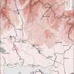
NGR NT 05567 11922
Datum OSGB36 - NGR
Permalink http://canmore.org.uk/site/48494


- Council Dumfries And Galloway
- Parish Moffat
- Former Region Dumfries And Galloway
- Former District Annandale And Eskdale
- Former County Dumfries-shire
NT01SE 2 0557 1192.
(NT 0557 1192) Roman Signal Station (R)
OS 6" map, (1962)
A probable Roman signal station on the shoulder of White Type hill was observed from the air in 1939 by O G S Crawford and located on the ground a year later. A circular ditch, broken on the E by an entrance 6 ft wide, encloses a level area measuring 10 yds in diameter across the ditch.
J K St Joseph 1952
This signal station is a small near-circular earth-work, comprising a central platform 8.7m N-S by 8.5m transversely and 0.4m high. This is bounded by a shallow ditch about 1.7m wide, with a slight outer bank some 1.7m broad and 0.2m high which are best preserved on the S. The overall dimensions re 11.9m by 11.5m. A causeway, 2.1m broad, crosses the ditch on the E side, facing the Roman road (RR 7f), about 30m distant. It is flanked by high ground on the W, but has an extensive view to NW and SE (along the line of the road).
Visited by OS (WDJ) 14 September 1959
This feature is noted by the RCAHM as a watch-tower, bearing a close resemblance in dimensions and plan to that at Beattock Summit (NS91NE 11), associated with the Antonine fortlet of Redshaw Burn (NT01SW 2). Its main function would have been to observe movement along the road leading to that fortlet from the SE.
RCAHMS 1978
Field Visit (16 January 1991)
NT 0557 1192 NT01SE 2
On the date of visit this site was covered by snow to a depth of about 0.2m, but the remains are as previously described. The watch-tower and the nearby Roman road (NT01SE 19) are preserved in clearings with recently created conifer plantations.
Visited by RCAHMS (JRS), 16 January 1991.
Listed as watch tower.
RCAHMS 1997.

