
Witch's Wate


Cairn (Prehistoric)
Site Name Witch's Wate
Classification Cairn (Prehistoric)
Alternative Name(s) Beattock Hill; Beattock Hill
Canmore ID 48393
Site Number NT00SE 31
NGR NT 06215 01993
Datum OSGB36 - NGR
Permalink http://canmore.org.uk/site/48393


- Council Dumfries And Galloway
- Parish Kirkpatrick-juxta
- Former Region Dumfries And Galloway
- Former District Annandale And Eskdale
- Former County Dumfries-shire
NT00SE 31 0621 0199
See also NT00SE 27.
NT 062 019 An oval enclosure, 7.5m x 9.0m within 1.5m thick walls is situated c. 1/4 mile WSW of the summit of Beattock Hill, on a prominence N of road. Traces of internal structures are similar to the enclosure NT00SE 7.
On a line of walling extending SW for 8m from the enclosure is a free boulder with a cup mark 5 cms deep 6.5 cms diameter.
RCAHMS 1920; T C Welsh 1972
NT 0621 0199. The remains of a robbed cairn measuring 12.5m x 14.0m and up to 0.7m high. No kerb is visible the alleged 'walls' being the unrobbed periphery of the cairn. No internal structures are visible.
The alleged cup mark is natural being similar to numerous other solution holes on rocks in the area.
Surveyed at 1/2500.
Visited by OS (DWR), 11 September 1973.
No change to previous field report.
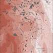
See Plan.
Visited by OS (TRG), 19 September 1978.
(Location cited as NT 062 020). This cairn is situated on a small hill below Beattock Hill to the SW and overlooking moorland to the W. It has been heavily robbed (probably for the construction of the nearby road) and now comprises little more than a rim of stones measuring 13m in diameter and 0.3m in height. There are a few large boulders in the centre but no evidence of a cist or kerb; the stony centre suggests identification as a cairn rather than a circular house.
M J Yates 1984.
Field Visit (24 April 1990)
NT00SE 31 06215 01993
The remains of this cairn which lies on a low, but prominent knoll within rough pasture, measure 13.4m from E to W by 13m transversely over cairn material which has been severely disturbed and now measures no more than 0.3m in height. There are no internal features and the alleged cupmark is natural.
Visited by RCAHMS (JRS), 24 April 1990
Listed as cairn.
RCAHMS 1997.

