Garpol Water
Moated Site (Medieval)
Site Name Garpol Water
Classification Moated Site (Medieval)
Canmore ID 48380
Site Number NT00SE 2
NGR NT 0529 0396
Datum OSGB36 - NGR
Permalink http://canmore.org.uk/site/48380
- Council Dumfries And Galloway
- Parish Kirkpatrick-juxta
- Former Region Dumfries And Galloway
- Former District Annandale And Eskdale
- Former County Dumfries-shire
NT00SE 2 0529 0396
Not to be confused with Garpol Water, motte (NT 0505 0402), for which see NT00SE 1.
(NT 0529 0396) Enclosure (NR)
OS 6" map, 1957.
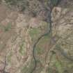
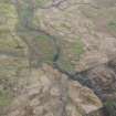
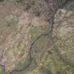
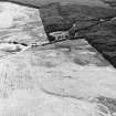
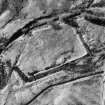
Earthwork (R W Feachem 1956) A stony rampart some 3' high, with traces of an outer ditch, forms a rectangular enclosure, the S angle of which appears to have been washed away by the stream, the Garpol Water. Within the rampart on the E side are the remains of a stony mound or cairn, some 20' across, which appears to have been excavated.
RCAHMS 1920, Visited 1912
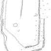
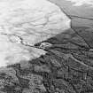
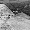
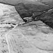
A five-sided homestead moat, measuring internally 89.5m NW-SE by 59.0m within, for the most part, the remains of a double bank and medial flat-bottomed ditch. An internal quarry ditch is visible along the NE side, and the entrance lies in the NW. Within the interior are two small circular enclosures which may be shooting butts and the possible foundations of a later small rectangular structure.
Resurveyed at 1/2500.
Visited by OS (D W R) 13 September 1973
This earthwork lies on the marshy floodplain of Garpol Water and is surrounded by disturbed ground. Its interior is at ground level and there is no evidence of building stances; the purpose of the stony mound cannot be deduced. The ditch is heavily silted and there is no evidence to suggest that the stream was ever diverted to fill it. It would appear to be of Medieval date, and may have been a homestead moat.
Surveyed at 1:10 000.
Visited by OS (M J F) 1 November 1978
This moated site is situated in badly-drained ground on the E side of the Garpol Water. Of five sides, it measures 87.5m by 56.5m internally and is defined on the NW, NE and SE by a flat-bottomed ditch up to 5.3m broad and 0.8m deep with an internal bank up to 6m thick and 1.3m high; there is an external bank up to 6.5m thick and 1.3m high on the SE side and at the SE end of the NE side. On the SW and S, where river erosion may have taken place, it is defined by a stony scarp up to 1m high. A band of stony debris which crosses the NW half of the interior may have formed one side of an enclosure created in the E corner, whilst elsewhere in the interior there are the remains of at least two small stone structures, one of which may be a shooting butt, the other a pen.
Visited by RCAHMS (PC), 14 May 1990.
RCAHMS 1920; R W Feachem 1956.
Measured Survey (14 May 1990)
RCAHMS surveyed Garpol Water moated site on 14 May 1990 with plane-table and self-reducing alidade at a scale of 1:500. The plan was redrawn in ink and published at a scale of 1:1000 (RCAHMS 1997, Fig. 219).
Field Visit (1996 - 2003)
Russell Coleman managed an Historic Scotland funded project to record medieval moated sites in Scotland. Gazetteers were produced for each regional council area between 1996 and 2002 with an uncompleted overall review in 2002-03. The results of the first year of the project were published in Tayside and Fife Archaeological Journal, Volume 3 (1997).
Note (1997)
NT 0529 0396 NT00SE 2
This site is listed in an Atlas of Scottish History (McNeill and MacQueen 1996) as a moated site.
Information from RCAHMS (DE) September 1997
Listed as moated site.
RCAHMS 1997.


