Pricing Change
New pricing for orders of material from this site will come into place shortly. Charges for supply of digital images, digitisation on demand, prints and licensing will be altered.
Bo'ness, Kinneil House
Country House (16th Century), Tower House (15th Century)
Site Name Bo'ness, Kinneil House
Classification Country House (16th Century), Tower House (15th Century)
Alternative Name(s) Kinneil Castle; Palace Of Kinneil
Canmore ID 48195
Site Number NS98SE 7
NGR NS 98197 80557
Datum OSGB36 - NGR
Permalink http://canmore.org.uk/site/48195
First 100 images shown. See the Collections panel (below) for a link to all digital images.
- Council Falkirk
- Parish Bo'ness And Carriden
- Former Region Central
- Former District Falkirk
- Former County West Lothian
NS98SE 7.00 98197 80557
(NS 98197 80557) Kinneil House (NR)
OS 6" map, (1969)
NS98SE 7.01 c. 9817 8058 Subterranean Structure
NS98SE 7.02 98293 80506 Walled Garden
NS98SE 7.03 98345 80658 Ladywell Cottage
NS98SE 7.04 Cancelled duplicate site see 7.02
NS98SE 7.05 98316 80659 2-4 Duchess Anne Cottages
NS98SE 7.06 98302 80637 5 Duchess Anne Cottages
NS98SE 7.07 98327 80567 6 Duchess Anne Cottages
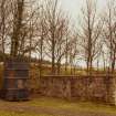
NS98SE 7.08 98321 80601 Gate Piers
NS98SE 7.09 98329 80562 7 Duchess Anne Cottages
NS98SE 7.10 98333 80551 8 Duchess Anne Cottages
For James Watt's Cottage (NS 98195 80518), see NS98SE 5.
For underlying length of Antonine Wall, see NS98SE 82.
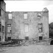
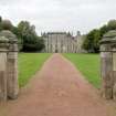
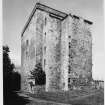
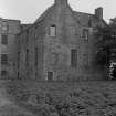
Kinneil House, as it now stands, dates from three periods. First, there was a great tower, the Palace of Kinneil, founded by Arran in 1553, part of which is incorporated, much altered, in the central block of the house. This was demolished with powder in 1570 by the Regent Morton, but the W walling, overhanging the ravine, still partly remains, containing several large gunloops.
An L-shaped house was then built, a little to the N, to replace it. This still forms the N wing of the mansion. In the second half of the 17th century, the present imposing, if ruinous, central block rose up on the remains of the original keep, and wings were extended, that to the N linking up with the L-shaped house already mentioned.
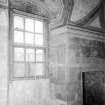
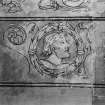
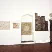
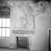
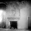
In 1936, when the L-shaped house was being demolished, 16th and 17th century murals were uncovered. They are among the finest in Scotland and were instrumental in the house being taken under guardianship and subsequently restored by the DoE.
RCAHMS 1929, visited 1926; J S Richardson 1941; N Tranter 1962-70.
The whole of Kinneil House, as described, is in a fair state of preservation, although it is gradually deteriorating. The walls have at some time been harled. Only the E part of the N block is roofed, and it is in this block where the rooms with the unique mural paintings are located. This is also the only part of the house which is under guardianship.
Visited by OS (J L D) 14 January 1953.
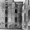
The N wing is well preserved but the remainder of the building is in a ruinous and dangerous state.
Visited by OS (J P) 9 July 1974.
NS 983 806. Kinneil House. Here James Watt carried out some of the development of the steam engine. The workshop he used is now a rofless ruin, but beside it is the cylinder of an engine used to drain the Schoolyard Pit, Bo'ness, preserved in Watt's memory.
J R Hume 1976.
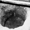
A watching brief was kept during the investigation of the apparent subsidence of materials beneath the floor of one of the basement chambers of Kinneil House. Below the stone-flagged floor was an unlined, circular shaft - probably a well shaft - containing loose materials which were excavated to a depth of 1.60m but which appeared to continue well beyond this level. There were numerous 19th-century artefacts within all of the infilling deposits.
Sponsor: Historic Scotland.
A Barlow 1993.
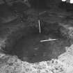
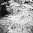
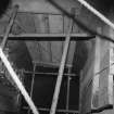
Investigations by Scotia Archaeology Limited within a basement chamber of the N wing of the house revealed a circular well shaft, 1.9m in diameter. The shaft was emptied to a depth of 3.4m; the excavated materials comprising humic soils, sand, shells, rubble, coal and ash and containing artefacts dating from the 18th to the 20th centuries. To a depth of 2.5m, the well was cut through glacio-fluvial deposits of a raised beach; below this point, it was cut through sandstone bedrock.
A framework of horizontal timber beams, perhaps elements of a staging platform, was set into rock-cut niches, 3.10m below the surface of the well. The timbers, which appeared to be adze-hewn from whole logs, were removed and stored. There was no surviving evidence that the well had been lined.
Sponsor: Historic Scotland.
A Barlow 1994.
NS 9820 8057 A watching brief was undertaken in October 2001 during the excavation of two holes for finger posts and a drainage trench in the immediate grounds of Kinneil House (NMRS NS98SE 7.00). Nothing of archaeological significance was disturbed.
Sponsor: Historic Scotland
D Stewart and G Ewart 2001
Guardianship Monument.
ARCHITECT:
Sir Robert Lorimer 1909 - proposed restoration and addition (not executed)
EXTERNAL REFERENCE:
NATIONAL ARCHIVES OF SCOTLAND (SRO)
Visiting House, Park and Garden Walls.
Planning new prison 1744
Claim of (pounds) by John Adam, architect, on behalf of himself and his father, William, against the Duke of Hamilton.
1770 Fea of Clestrain GD 31/554
NMRS REFERENCE:
Wood Sketch Book No.2 - 1 sketch
(Missing at time of upgrade, 1.9.1999)
EXTERNAL REFERENCE
National Library
Country Life 23/1/1948 - article and photographs
(Undated) information in NMRS.
Publication Account (1985)
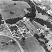
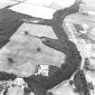
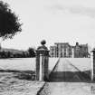
Kinneil House forms the focal point of a large public park which contains a reconstruction of a Roman fortlet (see no. 67), a museum set in a range of restored 18th century farmbuildings, a ruined medieval church and part of an original James Watt steam engine. The principal attraction, however, is Kinneil House itself which boasts a magnificent series of wall-paintings; it consists of two ranges of buildings set at right angles to one another, which were built and modified over a period of some two centuries.
The earliest building was a late medieval tower-house which lay on the site of the present west range, and all that can now be seen of it are a number of gun-loops incorporated in the rear wall of the later house. In 1553 the Earl of Arran added the present north range, known as the Palace, in order to provide more comfortable accommodation. Arran was obliged to spend the years 1564-9 in exile in France and, during this period, it appears that the tower-house was partly destroyed on the orders of the Earl of Morton. The house assumed its present form in 1670 when Anne, Duchess of Hamilton, began the reconstruction of what was by then a derelict group of buildings. Her remodelling consisted of building a rectangular block on the site of the earlier tower-house to which pavilions were added, the one on the north linking the new block to the Palace. On the south a further new wing was contemplated, which would have balanced the Palace, but it was never built, possibly because of difficulties with its foundations which lay across the line of the ditch of the Antonine Wall.
By the early part of this century the house was again abandoned, and during the course of demolition in 1941 an important series of mural and ceiling paintings were uncovered in the Palace (the only part of the buildings now open to the public). Their discovery spared the house, and they are now on display in the first and second floors.
On the west side of the gully that flanks the house, there are ruins of the medieval church of Kinneil, and part of an unusual medieval cross from the church is on display in the house.
To the south of the house is a building used by James Watt while he was trying to perfect a water-pump for one of the local coalmines. Outside the door there is the cylinder of a Watt engine which has been moved there from a local pit.
A small museum lies to the east of the house and it contains well-displayed collections oflocal Roman material and information relating to the industrial development of West Lothian.
Information from ‘Exploring Scotland’s Heritage: The Clyde Estuary and Central Region’, (1985).
Watching Brief (March 1997)
NS 983 806 A watching brief was undertaken by Kirkdale Archaeology during works on a well within the 'palace' wing of Kinneil House. The well was located in a room known as the 'boiler room', a small barrel-vaulted chamber in the extreme SE corner of the building, presumably originally functioning as a service room. The floor of the chamber comprised stone flags, and it was the subsistence of these into the softer well-fill deposits which first led to the discovery of the sub-floor feature around three years ago. Excavations were then undertaken, and approximately 4m of the fill of the well was removed. Nothing is known of the results of this work, but at the time of the current watching brief, a circular hole c 2m in diameter with a stone and mortar lining had been exposed.
The watching brief concerned the monitoring of the drilling of the remaining material. The remaining upper fill was a loose, coarse ashy silt, which was removed by hand, extending to 0.8m deep, after which the fill became more stony, and drilling was commenced. The drilling indicated that the lower fill was 0.4m in depth, beyond which the base of the well was encountered. Thus a total depth of c 5.2m from the floor level could be estimated.
Finds include large quantities of burnt and unburnt bone as well as some diagnostic finds from the upper fill; a near-complete clay pipe, a fragment of white tile, and an iron spanner. It would seem likely, therefore, that the well was deliberately backfilled in Victorian times or later.
Sponsor: Historic Scotland
G Ewart and D Murray 1997.
Watching Brief (22 August 2000)
Under its call–off contract with Historic Scotland, Kirkdale Archaeology was required to monitor limited landscaping operations in the vicinity of the stone footbridge crossing the gorge to the west of the main house. In all, 2 areas were monitored. Nothing of archaeological significance was disturbed.
Watching Brief (6 October 2000)
Under its call-off contract with Historic Scotland, Kirkdale Archaeology was required to monitor the excavation of two small holes for the insertion of finger posts in the grounds of Kinneil House, Bo’ness, Falkirk (NGR NS 981805). The grounds of the Kinneil Estate potentially contain evidence relating to the Antonine Wall as well as the late medieval tower and subsequent House and grounds of the Dukes of Hamilton (Stevenson 1995, 78-9 & 128-9). It is clear that nothing of archaeological significance was disturbed by the holes for the insertion of finger posts. No finds were kept.
Sponsor: Historic Scotland
D Stewart and G Ewart 2000
Kirkdale Archaeology
Watching Brief (26 October 2000)
Under its call-off contract with Historic Scotland, Kirkdale Archaeology was required to monitor the excavation of drainage trench and a small hole for the insertion of finger post in the grounds of the Kinneil Estate, Bo’ness, Falkirk (NGR NS 981 805). It is clear that nothing of archaeological significance was disturbed by the drainage trench to the S of Kinneil House, or by the finger post hole to the N of Kinneil fortlet. No finds were kept.
Watching Brief (16 February 2009)
NS 9820 8057 A watching brief was maintained on 16 February 2009 during the excavation of two trenches along the base of the main E-facing façade of the house, in advance of the installation of drains. No finds or features of archaeological significance were recorded.
Archive: RCAHMS (intended)
Funder: Historic Scotland
Information from Claire Casey (Kirkdale Archaeology) 28 March 2009.
OASIS ID: kirkdale1-249684
Watching Brief (28 July 2011)
NS 9822 8055 A watching brief was undertaken on 28 July 2011 during the excavation of a trench for an information sign. The trench was located SE of the house and the area was considered sensitive as the course of Antonine Wall is thought to run E–W close to the S face of Kinneil House. The sequence of landscaping which had accompanied the development of the estate was noted but no significant archaeological features or finds were recorded.
Archive: RCAHMS (intended)
Funder: Historic Scotland
Kirkdale Archaeology 2011
OASIS ID: kirkdale1-123737
Audits (December 2015 - September 2016)
NS 98197 80557 (NS98SE 7) The collection, which was assessed December 2015 – January 2016 and August – September 2016, falls into two groups, one being architectural stones and the other commemorative/ecclesiastical pieces.
The latter stones, which include the earliest examples in the collection, come not from the house but from the nearby chapel, now disused.
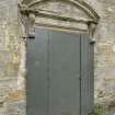
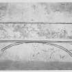
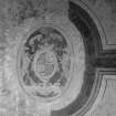
One group of architectural stones once occupied a prominent position on the façade of the house. Originally, two large heraldic panels were set in the front wall of each of the N and S wings. The frame of one of these is still in situ, but that of the other is in pieces in the carved stone collection. It includes jambs, a lintel and a cill. Moreover, the very elaborate heraldic panel once contained in this frame is also in the collection and on display inside the house.
Finials and sections of their moulded plinths from the roof balustrade, and from a staircase in the house are represented in the collection, and Canmore has photographs of the house before these stones became ex situ, showing the extent to which the house exterior and interior has changed in the last hundred years.
This and other inventories of carved stones from Historic Environment Scotland’s properties in care are held by the Collections Unit. For further information please contact collections@hes.scot
Mary Márkus – Archetype
(Source: DES, Volume 17)
Dendrochronology (15 August 2017)
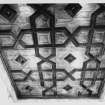
A dendrochronological assessment was undertaken at Kinneil House near Bo'ness at the request of HES through the PIC call-off contract with CFA Archaeology Ltd. The focus of the assessment was the Kinneil House building complex, comprising the main tower, its two flanking pavilion towers, and the north east wing. The following were assessed: (A) three archaeological timbers previously recovered from a well below the north east wing; (B) a group of six decoratively painted boards on display in the north east wing; (C) the coffered wooden ceiling of the Parable Room in the north east wing; (D) joist ends surviving in the fabric of the north east wing; (E) timbers surviving in the fabric of the main tower and its flanking pavilions, including joist ends and lintels.
Information from OASIS Id: cfaarcha1-433176 (C Mills) 2017
Magnetometry (10 May 2021 - 18 May 2021)
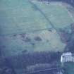
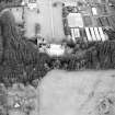
NS 98149 80542 The HES Archaeological Survey Team undertook geophysical (gradiometer and electro-magnetic) survey at Kinneil House, Bo’ness. This forms part of a wider Antonine Wall Geophysical Survey project, which aims to address management and research questions relating to the Antonine Frontier by investigating the extent and significance of sub-surface archaeological remains at various locations within the World Heritage property.
The fieldwork was conducted between 10 and 18 May 2021, covering an area containing a length of the Antonine Wall and the Kinneil fortlet. A total of 8.35ha were surveyed using a Sensys MXPDA gradiometer, of which 0.45ha was also investigated using a CMD Mini Explorer electro-magnetic device. The gradiometer survey has produced good quality results, while the electro- magnetic survey has provided moderate quality results, which have, in part, supported the gradiometer results. There is a high level of confidence that the chosen mixed methodology and survey strategy was appropriate to assess the archaeological potential of the survey area.
The survey has identified an area of later prehistoric activity
to the NE of Kinneil House, comprising a small promontory fort or settlement and roundhouses. Possible droveways, land boundaries, and enclosures have also been identified in this area. Some of these features may be connected to the later prehistoric activity, though a later date is equally possible.
For the Roman period, the survey has successfully confirmed the course of the Antonine Wall ditch, which in most places corresponds well with its previously mapped line. It has also verified, in places, the survival of the stone base of the wall. A possible causeway across the ditch has been identified east of Kinneil House and a previously unrecorded enclosure has been observed abutting the southern side of the wall 85m E of the fortlet. Measuring 10m square, it is similar to the ‘Minor Enclosures’ identified at Wilderness Plantation and therefore it may be only the fourth example of this class of Roman installation so far recognised.
The survey has also identified features of medieval and later
date, including at Kinneil Kirk, where the church appears to sit within an enclosure that is, in part, defined by double-ditches. Other features include possible drove-ways, land boundaries, enclosures, and a road or trackway, defined by a pair of parallel ditches, which crosses the Antonine Wall ditch. In the area known as ‘The Meadows’, survey has revealed a series of anomalies believed to relate to Kinneil village. The nature of these anomalies suggest they may reflect a period of destruction when the village was removed in the late 17th century. Responses relating to the landscaped gardens of Kinneil House have been identified at various locations throughout the survey area.
Archive: HES
Funder: Historic Scotland Foundation
Nick Hannon – Historic Environment Scotland (HES)
(Source: DES Vol 22)
Characterisation
This site falls within the Kinneil Area of Townscape Character (NS98SE 204), which was defined as part of the RCAHMS Urban Survey Programme 2013. Text relating to the historical development and topography, and present character of the Kinneil Area of Townscape Character can be viewed at site NS98SE 204.
Information from RCAHMS (LK), January 2014


