
Strathsheaskich


Burnt Mound (Prehistoric)
Site Name Strathsheaskich
Classification Burnt Mound (Prehistoric)
Alternative Name(s) Strathseasgaich
Canmore ID 4749
Site Number NC31SW 1
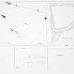
NGR NC 3027 1019
Datum OSGB36 - NGR
Permalink http://canmore.org.uk/site/4749


- Council Highland
- Parish Kincardine (Sutherland)
- Former Region Highland
- Former District Sutherland
- Former County Ross And Cromarty
NC31SW 1 3027 1019.
(NC 30271019) Mound (NR).
OS 6"map, (1963)
A burnt mound was discovered during field investigation in 1961; kidney-shaped with a hollow into the centre from the south, and blocked at its outer end by a smaller turf-covered mound in a fashion similar to some of the burnt mounds of Orkney. Two small scrapes in the side have exposed the content of small cracked stones, some fire-reddened. Surveyed at 1:10 560.
Visited by OS (J L D) 24 April 1961 and (J M) 9 July 1974.
The mound is about 14.5m in overall diameter with a maximum height of 1.5m; otherwise it is as described above.
Visited by OS (J B) 23 September 1976.
The area has been deep-ploughed and planted with conifers; the burnt mound is preserved in a clearing.
Visited by OS (N K B) 17 June 1980.
Field Visit (24 August 1961)
A burnt mound was discovered during field investigation in 1961; kidney-shaped with a hollow into the centre from the south, and blocked at its outer end by a smaller turf-covered mound in a fashion similar to some of the burnt mounds of Orkney. Two small scrapes in the side have exposed the content of small cracked stones, some fire-reddened. Surveyed at 1:10 560.
Visited by OS (J L D) 24 April 1961 and (J M) 9 July 1974.
Field Visit (9 July 1974)
A burnt mound was discovered during field investigation in 1961; kidney-shaped with a hollow into the centre from the south, and blocked at its outer end by a smaller turf-covered mound in a fashion similar to some of the burnt mounds of Orkney. Two small scrapes in the side have exposed the content of small cracked stones, some fire-reddened. Surveyed at 1:10 560.
Visited by OS (J L D) 24 April 1961 and (J M) 9 July 1974.
Field Visit (23 September 1976)
The mound is about 14.5m in overall diameter with a maximum height of 1.5m; otherwise it is as described above.
Visited by OS (J B) 23 September 1976.
Field Visit (17 June 1980)
The area has been deep-ploughed and planted with conifers; the burnt mound is preserved in a clearing.
Visited by OS (N K B) 17 June 1980.

