Scheduled Maintenance
Please be advised that this website will undergo scheduled maintenance on the following dates: •
Every Thursday from 17th October until 7th November from 11:00 to 15:00 •
Tuesday, 22nd October from 11:00 to 15:00
During these times, some services may be temporarily unavailable. We apologise for any inconvenience this may cause.
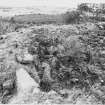
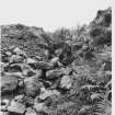
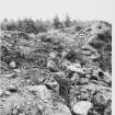
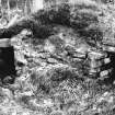
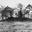
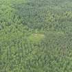
Torwood, Tappoch Broch
Broch (Iron Age), Cup Marked Stone(S) (Prehistoric)
Site Name Torwood, Tappoch Broch
Classification Broch (Iron Age), Cup Marked Stone(S) (Prehistoric)
Alternative Name(s) The Tappoch
Canmore ID 47004
Site Number NS88SW 1
NGR NS 83335 84986
Datum OSGB36 - NGR
Permalink http://canmore.org.uk/site/47004
- Council Falkirk
- Parish Dunipace
- Former Region Central
- Former District Falkirk
- Former County Stirlingshire
NS88SW 1 83335 84986
See also NS88SW 49.
(NS 83335 84986) Tappoch (NAT) Broch (NR)
OS 6" map (1967)
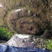
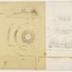
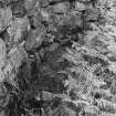
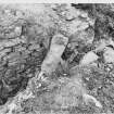
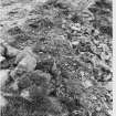
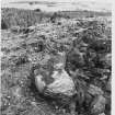
The broch is generally as described and planned by RCAHMS. The outworks are now covered by afforestation and the third bank could not be located. A slab, 13.0cm in diameter, sculptured with three concentric rings, may be seen five stones into the stair lobby from the inner face of the broch.
Revised at 25".
Visited by OS (DWR) 31 January 1974
Traces of what appeared to be an intra-mural chamber were observed on the wallhead on the NE side, and a small scale investigation was carried out in the spring of 1964. The built end of a long chamber about 3' deep was found on the wallhead, appearing to run towards the main entrance at a height which would bring it out above the level of the lintels there. It was surmised that this was a secondary structure, possibly recent, inserted after the broch was in ruins.
E W MacKie 1964
There is a complex carving on a recumbent stone slab at the end of the entrance passage, immediately inside the broch. The carving is of a bar, 19cm long, 9cm wide at one end, and a figure of eight at the other.
N Aitchison 1978
Small lump of vitrified stone from inner concentric bank on N side of broch. A small piece of daub was also found between the inner and outer concentric banks on N side of broch.
N Aitchison 1979.
Field Visit (15 July 1953)
NS88sw 833 849
Broch, The Tappoch, Tor Wood.
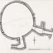
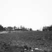
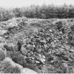
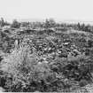
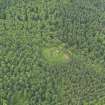
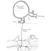
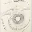
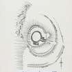
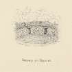
This broch (Fig. 24, DP 170489) is situated at a height of 380 ft. O.D. near the centre of Tor Wood, 700 yds. WSW. of spot-level 214 on the by-road that runs from Larbert to Stirling by West Plean. It can be seen on the skyline from this point. Its position is a typical one for a Lowland broch; it stands on the brink of a broken rocky slope so that in one direction it commands wide views-in this case the slope falls to the W. and the views extend from WSW. through N. to ENE. -while in the opposite direction the approaches are gentle and include some ground slightly higher than that on which the broch stands.
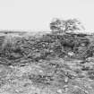
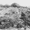
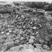
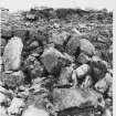
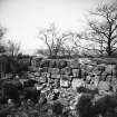
Before the structure was excavated in 1864 (1) it appeared simply as a mound, the only indication that it might not be natural being provided by laid stones appearing in its SE. sector. It is plain that the excavators, even when they had cleared the interior, remained under the impression that the structure was simply a chamber sunk into a natural knoll. In the course of their exploration they removed a mass of boulders and debris, which they estimated to weigh upwards of 200 tons, laid bare the inner wall-faces and an inclined floor formed by the natural rock, and opened the entrance-passage, stair lobby and stair. On the floor they found a central hearth and a number of relics described below. As was natural in view of their belief that they were dealing with a chambered mound, they made no attempt to find the outer face of the wall; and this is now almost wholly concealed by earth and debris, including that resulting from the clearance of 1864. Portions of the outer face which appear on the W., NW. and N. give wall thicknesses of from 17 ft. to 24 ft. ; these are not, however, at ground level but slightly above that of the scarcement, the thickness at present ground level, as measured along the entrance-passage, being 20 ft. 6 in.
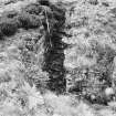
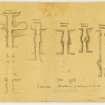
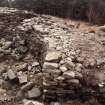
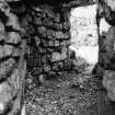
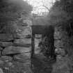
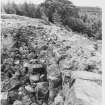
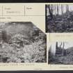
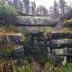
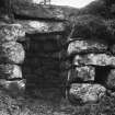
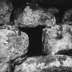
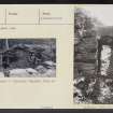
At the entrance it can be seen that the outer wall-face is battered to the extent of 9 in. in five courses. The entrance is in the SE. and is 2 ft. 7 in. wide. It is today approached by a sunken pathway made through the debris that surrounds the outside of the broch, and the stonework and kerbing seen along the sides of this pathway probably represent revetments inserted in 1864 to retain the debris. The outer portion of the entrance passage increases in breadth by one foot as it penetrates the wall, and at 9 ft. 9 in. from the outside it is checked for a door and widens to 4 ft. 6 in. Nine inches within the checks there is the usual bar-hole (Pl. 6 c, SC 1401258) on the N. side, with a recess opposite to receive the end of the bar; these openings are both 9 in. square, the former being at least 5 ft. 9 in. and the latter 1 ft. 3 in. deep. Within the checks the N. wall of the passage maintains its original alinement, but the S. wall diverges slightly and gives the passage a breadth of nearly 5 ft. at 3 ft. 5 in. behind the checks. At its inner end, 10 ft. 8 in. from the checks, the passage narrows to 2 ft. 6 in. Two passage lintels remain in situ (Pl. 6 B, SC 1401268), and the broken ends of others can be seen in the inner portion of the passage; the apparent headroom at the checks is now 5 ft. 3 in., but the true depth to the base of the passage wall was found to be 8 ft., with the result that the bar-hole is seen to have been placed at a normal height above the threshold and not, as previously appeared, within a few inches of the ground.
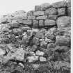
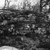
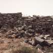
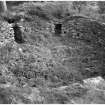
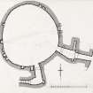
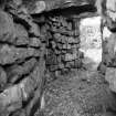
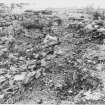
The shape of the interior (Pl. 5, SC 450981) is irregularly circular, showing a bulge where the passage enters, while the W. half is noticeably flattened. The rock floor found by the excavators has now been covered up with debris, earth and vegetation, and the surface of the court consequently stands higher than it did in 1864. It now falls 3 ft. 5 in. from W. to E. and the wall-face stands above it to a height of about 8 ft., while it measures 35 ft. 6 in. from N. to S. by 32 ft. transversely (2). The masonry consists of large, rough blocks, probably quarried from the neighbouring cliffs and outcrops, pinned with smaller material. The wall-face contains numerous small recesses (Pl. 6 A, SC 1401259) about a foot or less in height and breadth and from 1 ft. to 3 ft. in depth. Their purpose is obscure, and the excavators of 1864 reported that nothing was found in them ‘except some white clay peculiar to Torwood’ (3); on the other hand one of the two similar recesses at Coldoch broch, Perthshire, was represented in a sketch made about 1870 as divided in two by a shelf (4). Their number is difficult to calculate, as in some places rather similar cavities have resulted accidentally from the dislodgement of facing-stones, but at least thirteen may be regarded as true constructional features. At heights above the present level of the interior which vary between 4 ft. 5 in. on the W. and about 7 ft. on the E., a scarcement, 1 ft. to 1 ft. 6 in. wide and suffering from dilapidation, runs all round the internal wall-face. It can be seen that the innermost lintels of the entrance-passage and of the stair-lobby, both now vanished, formed parts of the scarcement ledge. The stair-lobby (Pl. 6 A), which retains a double lintel, enters from the court 12 ft. 3 in. to the left, or SW., of the mouth of the entrance-passage, its own entrance being 2 ft. 7 in. wide and, at present, 4 ft. 9 in. high. It extends 11 ft. into the wall, showing a recess at the SE. corner and what may be another just inside the entrance, and at its inner end returns W., widens to 4 ft. 1 in., and gives on to the foot of the stair which rises clockwise in the thickness of the wall. Eight steps now remain of the eleven reported in 1864; they are about 2 ft. 4 in. wide by 9 in. deep, and each rises about 5 in. The uppermost courses of the wall-faces flanking the steps show signs of incipient corbelling.
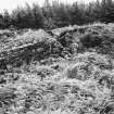
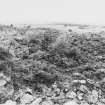
To N., E. and S. the broch is encircled by two wasted concentric banks the ends of which were evidently designed to rest on the brink of the rock-slopes to the W. They were examined in 1948-9 (5) and were found to represent the ruins of rubble-cored, boulder-faced walls. The inner bank now rises to a maximum height of 6 ft. 6 in., and the outer one to 3 ft. Gaps occur in both banks on a line with the entrance of the broch. The ‘third wall’, of which traces were mentioned by the excavators of 1864 as ‘extending along the face of the cliff’, can be identified with some fragmentary footings seen at a point about 40 yds. S. of the SW. end of the outer enclosing-wall. The lip of the slope dips somewhat at this point, and the slope itself is less steep than to N. and S.; a wall may consequently have been built across the dip to render access more difficult.
The small finds made in the course of the excavations include three boulders carved with cup-and-ring markings (No. 44); saddle and rotary querns (6) ; three hollowed pebbles, one of which resembles a crude version of a stone cup of the kind found at West Plean (NS88NW 5); stone balls, one a pecked sphere with an equatorial band in low relief; whorls and other small stone objects; several sherds of hand-made coarse pottery, and two of finer wares which might be mediaeval (7). The coarse pottery includes one sherd with finger-tip ornament under a thin everted rim such as has been found in other brochs (8), and two sherds of an Early Iron Age native ware of a type found in SE. Scotland at such places as Craigs Quarry, East Lothian (9). No Roman relics were recorded. Some of the finds are preserved in the National Museum of Antiquities of Scotland and others in the Falkirk Burgh Museum.
RCAHMS 1963, visited 15 July 1953.
(1) PSAS, vi (1864-6), 259 ff.
(2) The excavators recorded a height of 11 ft. 4 in. on the N. and 8 ft. 6 in. on the S., the difference from today's measurements
being accounted for by the wasting of the upper courses and by the rise in the level of the floor.
(3) PSAS, vi (1864-6), 261.
(4) Ibid., lxxxiii (1948-9), 14, n. 1.
(5) PFANHS, iv (1946-9), 89 ff.
(6) P.S.A.S. , xc (1956-7), 38, fig. 11.
(7) PFANHS, loc. cit., fig. 11, and National Museum of Antiquities No. GM 27.
(8) PFANHS, loc. cit., fig. 19, bottom right.
(9) One illustrated, ibid., bottom left; P.S.A.S., lxxxvi (1951-2) , 195, fig. 6.
Note (1978)
Tappoch Broch, Tor Wood NS 833 849 NS88SW 1
This broch is situated on high ground in a small clearing in the Tor Wood with a broken rocky slope to the W; it is about 10m in diameter within a wall some 5m - 7m thick with a slight external batter; complex entrance with bar-holes and a lintelled roof; excavation in 1864; three stones bear cup-and-ring markings (NMAS nos. GM 36-8 ). Two concentric walls, and possible traces of a third, around the broch - partially excavated in 1948-9.
RCAHMS 1978
(Dundas 1866; DES, 1949, 12-13; Hunter 1949; RCAHMS 1963, pp. 66, 85-7, Nos. 44 and 100; DES 1964, 50)
Publication Account (2007)
NS88 1 TORWOOD (‘The Tappoch’)
NS/8333 8498
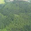
This solid-based broch in Dunipace, Stirlingshire, stands on a hilltop next to a low cliff. It is now in the middle of a forest but many years ago the author photographed it on the skyline when the trees had been cleared. The interior of the broch was cleared out in 1864 [2] and Doreen Hunter undertook a small-scale excavat-ion outside the site in 1948 [3].
Description
The broch
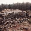
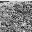
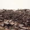
The excavators thought that they were exploring a chamber sunk into a natural knoll and removed a mass of boulders and debris, estimated to weigh over 200 tons. The inner wallface was exposed, and an inclined floor formed by the natural rock on which was a central hearth. The entrance passage was found on the south-east – on the downhill side – and also an internal doorway leading to a flight of steps inside the wall; eight of these now remain. There was no stair-foot guard cell. Except at the entrance the outer face was not exposed and it is now hidden even deeper under the excavated debris.
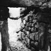
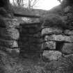
The entrance is 0.79m (2 ft 7 in) wide and 6.25m (20 ft 6 in) long. The sunken pathway, partly revetted, which approaches its outer end is presumably a construction of the excavators to keep a way open through the debris surrounding the site, to which they were constantly adding. The massive door-frame is 2.97m (9 ft 9 in) from the outer end and the checks are formed of upright slabs; the bar-hole is visible behind these on the right side with its socket opposite; both openings are 23cm (9 in) square and both are now quite close to ground level because of the amount of debris still in the passage.
Most of the passage lintels have now been dislodged. The drawing made at the time of the excavation suggests that the roof was then intact; however it is clear from the text that the lintels were dislodged even then, and that they were replaced: “The roof stones of the lower passage are not in position, but a sufficient number of large stones to form the roof were found in clearing out the passages.” [2, 262]. The lintel immediately behind the door-frame is higher than those further forward so that the top of the wooden door would have been protected when it was shut (see Caisteal Grugaig – NG82 1). It is unclear whether this feature is a 19th century reconstruction or original; certainly some such device would be natural in a passage that slopes down towards the exterior.
At 7.30 o’clock is the doorway into the wall leading to the stairway which, as noted, lacks a stair-foot cell. Only eight steps now remain of the eleven reported in 1864. The double lintel over the doorway appears to have been in place when the broch was first explored [2, 260].
The central court is an irregular shape and is an exception to the normal rule that broch inner wallfaces follow exact circles; a geometrical construction can be made to fit the wall quite well but perhaps not quite well enough to be completely convincing. Half of the wall fits a half circle quite well, and the other half a flattened ellipse. In 1953 the inner face stood about 2.4m (8 ft) above the debris in the court but vandalism and accidents have reduced the height considerably in the intervening years [4, pl. 5].
A ledge-type scarcement – now rather dilapidated – runs horizontally around the inner wallface and up to 2.1m (7 ft) above the original floor. The innermost lintels of both doorways in the inner wallface – now dislodged – evidently once formed part of this ledge. However at the point where the stair rises to the level of this ledge (at about 9 o’clock) there were two courses of masonry above the ledge in 1953. Thus if there was once a landing in the stair at the start of Level 2 any doorway from this leading inwards to the ledge (and on to any wooden floor which may once have rested on it) would have emerged at least 45cm (18 in) above the ledge.
The rock floor found by the excavators is now covered with debris, earth, and vegetation; the central hearth, one hopes, is still in position and covered by this rubble and rubbish. Large quantities of charcoal were found on the rock floor all over the court, and especially on the stone slabs forming the central hearth.
The internal wallface contains numerous small recesses about 30cm (1 ft) or less in height and breadth, and from 30 - 90cm (1 - 3 ft) in depth. Their purpose is obscure, and the excavators reported that nothing was found in them "except some white clay peculiar to Torwood". Their number is difficult to calculate, as in some places rather similar cavities have resulted from dislodgement of facing stones, but at least 13 may be regarded as constructional features.
Outer defences
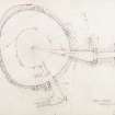
Small scale excavations were under-taken on the outworks in 1948 and 1949 [3] and these were later planned by the Royal Commission [4].
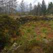
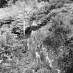
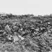
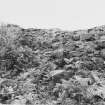
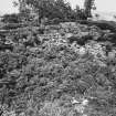
On the north, east and south sides the broch is encircled by two wasted concentric banks, the ends of which were evidently designed to rest on the brink of the rock-slopes to the west. They were examined in 1948-9 [3] and found to represent the ruins of rubble-cored, boulder-faced walls. The inner bank now rises to 1.98m (6 ft 6 in), and the outer one to 93cm (3 ft). Gaps occur in both banks in line with the broch entrance. The "third wall" mentioned in 1864 as "extending along the face of the cliff," can be identified with some fragmentary footings seen about 37m (40 yds) south of the south-west end of the outer enclosing wall. The lip of the slope dips somewhat at this point, and the slope is less steep to north and south; a wall may have been built across the dip to make access more difficult.
Chamber on wallhead
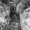
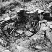
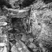
Traces of what appeared to be an intra-mural chamber were observed on the walhead on the north-east side, and a small scale investigation was carried out in the spring of 1964. The built end of a long chamber about 91cm (3 ft) deep was found on the walhead, appearing to run towards the main entrance at a height which would bring it out above the level of the lintels there. However it was difficult to trace the walls for more than a few feet. This chamber seems unlikely to have been a broch feature was doubtless inserted after the broch was in ruins [5]. Many years later the author revisited the site and found that the chamber had been re-exposed and that a flight of steps had been built down into it.
Discussion
The most striking aspect of Torwood broch is its sharp contrast with the two neighbouring sites in the Forth valley – Leckie and Buchlyvie (NS69 2 and NS59 2). In the first place its state of preservation when first explored was relatively good compared with the almost completely demolished wrecks that the other two became in the Iron Age. In the second place the material culture that survived in it was sparse and poor compared with the rich array of finds – both Roman and native – found in the other two, and also in Hurly Hawkin (NO33 1) further away in the north-east. Coldoch (NS69 1) is not much further away than Leckie and Buchlyvie but this site resembles Torwood much more, being better preserved and apparently having few finds inside it.
The obvious conclusion is that Torwood and Coldoch were built at a different time – either earlier or later – than Leckie and Buchlyvie, and probably by a different group of people who had no contact with the Romans. Unfort-unately there is no way of testing this idea as the first two brochs have yielded no useful dating evidence. An argument could be made for a later date – after direct and local Roman influence had disappeared, perhaps in the later second or in the early third century.
As far as the sparse material culture is concerned there is nothing to suggest that the builders and inhabitants of this broch were other than a local Iron Age community. One might assume that a professional broch designer from the far north-east had been recruited to design Torwood and to supervise its construction.
Finds
These include 3 boulders carved with cup and ring marks, saddle and rotary querns, 3 hollowed pebbles, one of which resembles 1 crude version of a stone "lamp" of the type found at the nearby West Plean homestead [4, 88, no. 104], stone balls, whorls, sherds of coarse pottery (with two sherds of finer ware which may be medieval), and 2 sherds of Early Iron Age native ware. No Roman relics were recorded. Some of the finds are in the NMAS, and others in Falkirk Burgh Museum.
Dimensions: at the entrance the wall is 6.25m (20 ft 6 in) thick but measure-ments elsewhere (above the scarcement) vary from 5.19 - 7.32m (17 - 24 ft): the internal diameter varies from 10.83m (35 ft 6 in) from N-S and 9.76m (32 ft) transversely.
Sources: 1. NMRS site no. NS 88 SW 1: 2. Dundas 1868: 3. Hunter 1949a and 1949b: 4. RCAHMS 1963, 85-7, no. 100, and pls. 5 and 6: 5. EW MacKie in Discovery and Excavation in Scotland 1964, 50. 6. MacInnes 1985. Many more passing references are recorded [1].
E W MacKie 2007
Note (18 August 2014 - 23 May 2016)
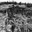
The well-known broch known as The Tappoch stands within a larger enclosure, whose two ramparts are commonly regarded as outworks to the broch. More recently, however, it has been suggested that the broch may have been erected within the interior of an earlier enclosure on the craggy hilltop, and a trial excavation carried out by Murray Cook on what has the appearance of a rib of outcrop about 20m outside the defences on the S suggests that this may also mark the line of an outer rampart, though its precise course and the extent of any enclosure it might form are uncertain. The projected circuit of the inner of the known outworks encloses an area measuring about 45m from N to S by 32m transversely (0.11ha) within a wall about 4.5m thick and 1.4m in external height on the SE, though it peters out to the NE of the broch and cannot be traced to the edge of the escarpment forming the W side of the summit. The outer, displays runs of outer face on the SE, is of lesser stature and also peters out northwards; nonetheless, its projected line takes in the whole of the natural terrace to the N of the broch, enclosing an area measuring about 63m from N to S by 38m transversely (0.18ha). The existence of a third line on the S would enclose an area in excess of 0.2ha. The entrance is on the ESE, on the same axis as that of the broch. Excavations in 1948-49 focused on the outworks, but were unable to elucidate either their date or purpose (Hunter 1949a & b).
Information from An Atlas of Hillforts of Great Britain and Ireland – 23 May 2016. Atlas of Hillforts SC1559
Excavation (27 January 2014 - 1 February 2014)
NS 83335 84986 A programme of vegetation clearance, an excavation supported by volunteers, and laser scanning was undertaken at Tappoch/Torwood Broch. The work which was undertaken, 27 January – 1 February 2014, formed part of the Lowland Brochs Project funded by Forestry Commission Scotland.
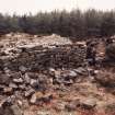
The vegetation, which included heather and bracken and covered most of the broch was removed, by hand, by volunteers, the AaM team (Cara Jones and Phil Richardson), staff from Stirling Council (Fiona Isobel Watson and Murray Cook), and the Archaeology Officer for Falkirk (Geoff Bailey).
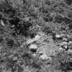
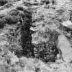
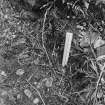
Two trenches were then opened across a previously unrecorded feature, which lay outside the scheduled area. The excavation established that the feature comprised a bank built on top of an augmented bedrock shelf. The bank had been disturbed in places, probably during forestry planting. A peck-marked stone, which may have been used for fire lighting, and a large (50mm long) piece of charcoal, were recovered while sieving the rubble from the bank. The peck-marked stone was c100mm long with a peck mark just off-centre. Funding has been secured from the Catherine
Mackichan Trust to radiocarbon date the charcoal.
A subsequent phase of work at the site consisted of the laser scanning of the broch, by AOC Archaeology Group (Graeme Cavers and Gemma Hudson) and the production of drawings.
Archive: Archaeology Scotland and RCAHMS (intended)
Funder: Forestry Commission Scotland, Adopt-a-Monument (in kind) and Stirling Council Archaeologist
Geoff Bailey, Murray Cook, Cara Jones, Phil Richardson, Fiona Isobel Watson, Graeme Cavers and Gemma Hudson
(Source: DES)
Note
Date fieldwork started: 10/03/2020
Compiled by: ScRAP
Tappoch Broch 3
Location notes: In the collection of National Museums Scotland (accession no. X.GM38), currently held in the Collections Centre.
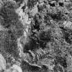
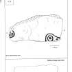
Panel notes: A quadrangular sandstone block measuring 0.65 x 0.3 x 0.2 m, recovered during excavations at Tappoch Broch, Stirling and now in the collection of National Museums Scotland (accession no. X.GM 38). Two other carved stones (Tappoch Broch 1 and 2) were also recovered from the interior of the broch during the excavations. Tappoch Broch 3 appears to have originally formed part of a larger panel as some motifs are truncated. It features two partial motifs, both truncated at the edges of the panel: a cup in a raised boss with a short radial, surrounded by two partial rings, one of which may extend to surround a second raised area with a cup; and a second cup in a raised boss surrounded by two partial rings, leading to a possible cup on a raised area.
Note
Date fieldwork started: 31/01/2020
Compiled by: Callander
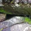
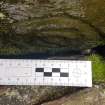
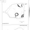
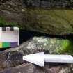
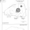
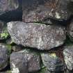
Location notes: Tappoch or Torwood Broch (Scheduled Monument 1738) is situated between Falkirk and Stirling about 1km W of the village of Torwood. It is located on the crest of a low hill surrounded by dense, mature conifer woodland which has now been extensively felled over the lower slopes of the hill. It is reached via the track which branches SW off Glen Road, Torwood at NS 83805 85112 and then a path off to the right. The path is signposted and then way marked to the broch as it winds its way up through the cleared area and then through the trees to the broch at the top of the hill. Entering the interior of the broch through its the passageway on the E side, a lintelled door on the left then leads to the intra-mural stair. The hidden motif can be found on the left hand wall of the passage leading to the bottom of the stair under a stone block forming part of the structure of the wall. The block is incorporated within the fourth stone course from the ground, four blocks in from the doorway (see location diagram). Three cup and ring marked boulders were recovered from the interior of the broch during the 1864 excavations, and some of these are now in the National Museums of Scotland Collection in Edinburgh.
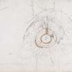
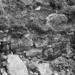
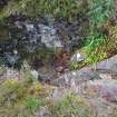
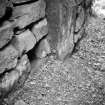
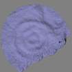
Panel notes: The stone block on which the motif is carved is assumed to be the local sedimentary geology which is a mixed sedimentary rock of sandstone with mud, silt, gravel and peat. The block itself has roughly a trapezoidal shaped. The motif can be found on its slightly upward sloping underside to the left. It consists of 3 concentric rings around a central boss, the dimensions of which are as follows : Diameter of central boss - 2.5cm Overall diameter of motif (across the outside edges of the outer ring) - 14cm Diameter of second ring - 8.5cm Diameter of inner ring - 4.5cm Although the motif is essentially concealed, it appears to have been intentionally made accessible and visible. The motif sits within a natural recess formed by the sloping underside of the block it occupies and the natural shapes of the blocks surrounding it; it is positioned at about waist level, rather than close to the ground or above head height and so can be seen easily from a crouching position; and moreover the block has been raised slightly by chock stones place under its outside face. The chock stones have been graded to ensure that the block maintains its level across the stone coursing with a larger stone on the left hand side and two much smaller stones on the right graded to fit into their respective gaps. It can only be speculated whether or not the ring motif is contemporary with the broch, or is much earlier. If the latter, then it has been deliberately quarried out from its original location and retained on the roughly hewn block intact and then deliberately positioned so as to render it concealed but easily visible and accessible to touch to those knowing its location. The motif is also situated within the entrance way to the interior staircase, which is a seemingly significant and non-random seemingly position in the broch's structure.
Note
Date fieldwork started: 10/03/2020
Compiled by: ScRAP
Tappoch Broch 2
Location notes: In National Museums Scotland collection (accession no. X.GM36), currently held in NMS Collection Centre.
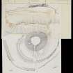
Panel notes: An approximately triangular sandstone panel measuring 0.6 x 0.45 x 0.15 m, recovered during excavations at Tappoch Broch, Stirling and now in the collection of National Museums Scotland (accession no. X.GM 36). The panel features two motifs in high relief: one central circular raised area ('boss') surrounded by two rings with a connecting radial, and a second boss surrounded by a single ring. A partial third ring of the former, and other areas of pecking, may be present but are unclear.
Note
Date fieldwork started: 10/03/2020
Compiled by: ScRAP
Tappoch Broch 2
Location notes: In collection of National Museums Scotland (accession no. X.GM37), currently held in the Collections Centre.
Panel notes: A quadrangular sandstone panel measuring 0.5 x 0.45 x 0.2 m, recovered from excavations at Tappoch Broch, Stirling and now in the collection of National Museums Scotland (accession no. X.GM37). Two other carved stones (Tappoch Broch 1 and 3) were also recovered from the interior of the broch during the excavation. Tappoch Broch 2 appears to have originally formed part of a larger panel as some motifs are truncated. It features motifs in high relief, comprising one central circular raised boss surrounded by a single ring, one boss with a cup surrounded by two partial rings with a possible groove from the outer ring, and various grooves (one of which may surround another possible boss).


