Accessibility

Font Size

100% 150% 200%

Background Colour

Default Contrast
Close Reset

Corra Castle

Castle (16th Century)

Site Name Corra Castle

Classification Castle (16th Century)

Alternative Name(s) Corrax Castle; Corehouse Castle; Corax Castle

Canmore ID 46597

Site Number NS84SE 34

NGR NS 88229 41410

Datum OSGB36 - NGR

Permalink http://canmore.org.uk/site/46597

Ordnance Survey licence number AC0000807262. All rights reserved.
Canmore Disclaimer. © Bluesky International Limited 2025. Public Sector Viewing Terms

Toggle Aerial | View on large map

Digital Images

View from ESE showing entrance archway and tower
View from ESE showing entrance archway and towerView of upper floor of tower from SGeneral view fronm across river to EOblique aerial view of Corra Castle and Corehouse Country House, looking SE.Corra Castle: Ground plan from Falls of Clyde Broadsheet. 400dpi copy of GV006453Oblique aerial view centred on Corehouse with castle adjacent, taken from the NW.General view fronm across river to EDetail of corbel on E side of towerView from SWView of N wallInterior, view of vaulted interiorView of main doorway from NView from E from river bankDetail of slit window on N facadeDetail of inscription at entrance to vaulted chamber at N end of range 'repaired in 1819'Detail of corbel on E side of towerOblique aerial view of Corra Castle and Corehouse Country House, looking ESE.Oblique aerial view of Corra Castle and Corehouse Country House, looking NNE.Falls of Clyde map, from RCAHMS Falls of Clyde Broadsheet 14View of tower from courtyard to SEInterior, view of vaulted interiorDetail of doorwayGeneral view from SSEView from WNWDetail of upper window on E side of towerView of E wallGeneral view of castle from EastInterior, view of vaulted interiorOblique aerial view of Corra Castle and Corehouse Country House, looking NE.View of main doorway from NDetail of upper window on E side of towerCorra Castle.
Modern copy of historic photograph in the Annan Album showing a view of castle.General view from WNWView from WNWView from ESE showing entrance archway and towerView from SWInterior, view of vaulted interiorInterior, view of vaulted interiorInterior, view of vaulted interiorDetail of platform at riverside below castleGeneral view of castle from EastInterior, view of vaulted interiorInterior, view of vaulted interiorInterior, view of vaulted interiorDetail of doorwayView from ESE showing entrance archway and towerView from WOblique aerial view centred on Corehouse with castle adjacent, taken from the NNE.Oblique aerial view centred on Corehouse with castle adjacent, taken from the NNE.Corra Castle, NS84SE 34, Ordnance Survey index card, page number 1, RectoView of tower from courtyard to SEView from WNWView from ESE showing entrance archway and towerInterior, view of vaulted interiorView from NE showing main entranceGeneral view from SSWView from WNWGeneral view from E showing entrance archway and towerView from SWOblique aerial view of Corra Castle, looking NE.Oblique aerial view of Corra Castle and Corehouse Country House, looking NNW.View from SWCorra Castle, NS84SE 34, Ordnance Survey index card, RectoGeneral view from SSEGeneral view from WView from ESE showing entrance archway and towerView from NE showing main entranceGeneral view from SWGeneral view fronm across river to EView from WDetail of doorwayOblique aerial view.General view from WInterior, view of vaulted interiorFirst floor plan, Second floor plan and Third floor planInterior, view of vaulted interiorInterior, view of vaulted interiorView from ESE showing entrance archway and towerDetail of main E entranceOblique aerial view of Corra Castle, looking N.Oblique aerial view of Corra Castle and Corehouse Country House, looking SW.Oblique aerial view centred on Corehouse with castle adjacent, taken from the NNW.Oblique aerial view centred on Corehouse with castle adjacent, taken from the NNE.Corra Castle.
Modern copy of historic photograph in the Annan Album showing a view of castle.Corra Castle, NS84SE 34, Ordnance Survey index card, RectoView from courtyard to SEDetail of upper window on E side of towerView from SWGeneral view from SWDetail of platform at riverside below castleView of N W cornerDetail of stonework including corbels on N sideOblique aerial view centred on Corehouse with castle adjacent, taken from the N.Detail of slit window on N facadeDetail of inscription at entrance to vaulted chamber at N end of range 'repaired in 1819'Detail of inscription at entrance to vaulted chamber at N end of range 'repaired in 1819'Detail of corbel on E side of towerDetail of stonework including corbels on N sideGeneral view from SW

First 100 images shown. See the Collections panel (below) for a link to all digital images.

Administrative Areas

  • Council South Lanarkshire
  • Parish Lesmahagow
  • Former Region Strathclyde
  • Former District Clydesdale
  • Former County Lanarkshire

Archaeology Notes

NS84SE 34 88229 41410.

(NS 8823 4141) Corra Castle (NR) (In Ruins)

OS 6" map (1912)

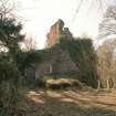
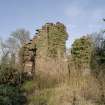
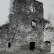
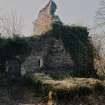
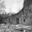
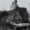
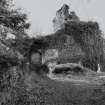
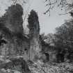
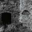
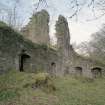
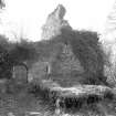
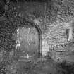
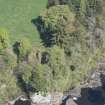
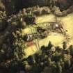
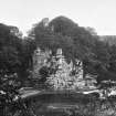
Corra or Corehouse Castle and its courtyard belong to the period from 1572 to 1700.

D MacGibbon and T Ross 1887

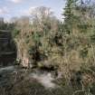
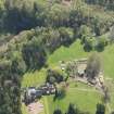
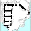
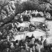
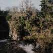
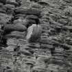
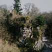
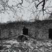
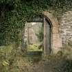
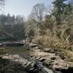
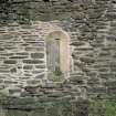
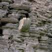
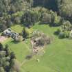
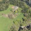
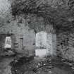
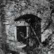
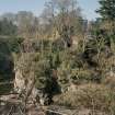
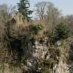
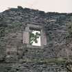
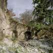
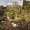
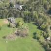
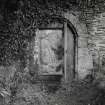
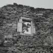
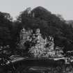
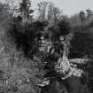
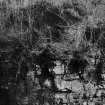
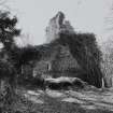
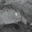
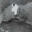
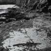
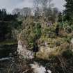
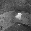
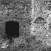
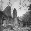
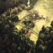
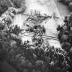
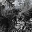
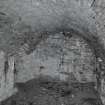
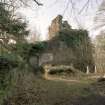
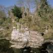
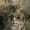
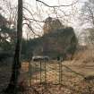
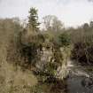
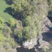
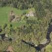
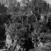
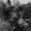
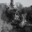
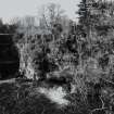
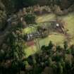
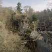
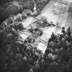
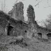
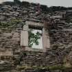
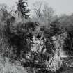
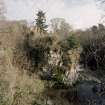
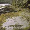
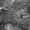
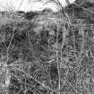
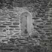
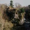
The site is a precipitous rock which, on three sides, overlooks the Clyde. On the fourth, (north) side there are the remains of a ditch at its west end drops down into a chasm. The ruins comprise remains of a tower and a small courtyard to its east, all of rubble masonry about 2.0m thick. They are in poor condition. To the west of the chasm there are remains of a weak wall enclosing a rectangular area, 20.0 metres by 10.0 metres. This is continued along the top of the chasm and joined to the castle at the north entrance.

Visited by OS (JD) 31 March 1955

References

MyCanmore Image Contributions


Contribute an Image

MyCanmore Text Contributions