Pricing Change
New pricing for orders of material from this site will come into place shortly. Charges for supply of digital images, digitisation on demand, prints and licensing will be altered.
Upcoming Maintenance
Please be advised that this website will undergo scheduled maintenance on the following dates:
Thursday, 30 January: 11:00 AM - 3:00 PM
During these times, some functionality such as image purchasing may be temporarily unavailable. We apologise for any inconvenience this may cause.
Leckie 1
Broch (Iron Age), Dun (Iron Age), Natural Feature (Period Unassigned)
Site Name Leckie 1
Classification Broch (Iron Age), Dun (Iron Age), Natural Feature (Period Unassigned)
Alternative Name(s) Knock-o-ronald
Canmore ID 45379
Site Number NS69SE 12
NGR NS 69268 93989
Datum OSGB36 - NGR
Permalink http://canmore.org.uk/site/45379
- Council Stirling
- Parish Gargunnock
- Former Region Central
- Former District Stirling
- Former County Stirlingshire
NS69SE 12 6926 9399.
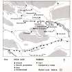
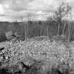
NS 693 940. Situated on a prominent nose of land between the steep-sided gullies of two small streams are the remains of a broch, measuring c.21.0m NW-SE by 20.0m.
Excavation has revealed that there were two constructional phases to the site, both constructions apparently having been built, used, burnt out, and dismantled within a limited period, probably the 1st and 2nd centuries AD.
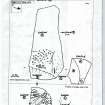
The first phase, on the N half of the site, seems to have been a solid-based broch, the foundations of which, including the mural stair, are quite well preserved. The second, built on the S half of the site after the destruction of the first, was a simple curved wall crossing the promontory. At the base of the outer wall face on the NE, a large piece of outcrop rock has at least eight typical cup marks.
The broch deposit contained one fragment of late 1st century, and several pieces of 2nd century Roman samian ware and some pieces of Roman glass. The promontory fort produced fewer finds, but iron hub-rings and bronze fittings from a vehicle came from its latest occupation stratum. There was a complete absence of native pottery from the site. Radiocarbon dates indicate that the broch was destroyed about AD 45 +/- 120 and the promontory fort, about AD 110 +/- 150.
E W MacKie 1973.
NS 6926 9399. This site is as described by previous authorities and is still in the course of excavation. Most of the circumference is still visible as is the mural stair. In the NW the wall measures 6.0m thick and it is doubtless therefore a broch. The suggestion that this first phase was replaced by a promontory fort is, however, difficult to follow since most of the useable space to the N would be occupied by the broch. Furthermore, there seems to be no real remains of the so-called curving wall which if it were later would surely have been of some strength and should have survived in the same way that the broch has.
Surveyed at 1:10,000.
Visited by OS (J P) 26 November 1975.
Field Visit (July 1978)
Leckie NS 692 939 NS69SE 12
Excavation has shown that a fort succeeded a broch on this steep-sided promontory. Finds from the site, which have been deposited in the Hunterian Museum, and C.14 dating, indicate a limited life span for both fortifications in the 1st and 2nd centuries AD. An outcrop
of rock at the N end of the promontory is cup-marked.
RCAHMS 1979, visited July 1978
DES (1970), 46; MacKie 1973b
Note (11 August 2014 - 1 November 2016)
Excavation of the broch at Leckie, which lies on a steep-sided promontory formed between the E bank of the Leckie Burn and one of its tributaries, revealed that shortly after its destruction, the ruins of the broch were reconstructed as a short-lived structure, with a massive wall across the neck of the promontory. While the excavator, Euan MacKie, has described this as a promontory fort (MacKie 1982), the reconstruction of the broch wall in this form, which he suggested may have been unfinished, it seems to have done little more than mask an area of occupation that can have extended to little more than the interior of the broch. As such it is tiny, even in comparison to the smallest promontory works elsewhere, and is perhaps best regarded as a manifestation of the history of a broch, rather than the construction of a promontory fort. The finds assemblage, however, is remarkable, with a wide range of high status Roman goods as well as iron tools and other domestic debris, all pointing to a relatively brief period of occupation for all phases in the 1st-2nd centuries AD
Information from An Atlas of Hillforts of Great Britain and Ireland – 01 November 2016. Atlas of Hillforts SC1471
Note (22 February 2019)
Date Fieldwork Started: 22/02/2019
Compiled by: Callander
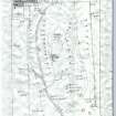
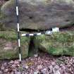
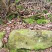
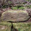
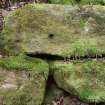
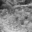
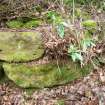
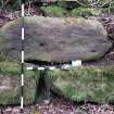
Location Notes: Leckie Broch is about 1 km to the W of the village of Gargunnock on land privately owned by the Leckie Estate. It is in the wooded area along the Leckie Burn known as St. Colm's Glen. There is public access along the tarmac estate roads by foot or bike, though not motor vehicle access/parking is prohibited on the estate without permission. The glen is entered by a gate on the left just before the old sawmill and the bridge over the Leckie Burn (Note : a sign on the gate says that the footpath may be closed on occasion by the estate, presumably during pheasant shoots). The broch itself is on a promontory between the Leckie Burn and the Easter Blackspout Burn just to the S of their confluence. Both burns flow through deep wooded gullies either side of the promontory. The area between the burns is completely overgrown with rhododendrons: so much so that the broch remained undiscovered until the 1960s. It was subject to major excavations in the 70s under E.W. MacKie, but has since become reclaimed by the rhododendrons. Leckie 1 forms part of the dry-stone wall on the S side of the broch, to the left hand side of a small earth ramp leading from the broch, presumably for wheelbarrow access during the 1970s excavations.
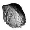
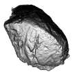
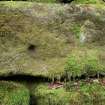
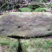
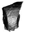
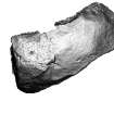
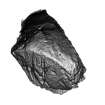
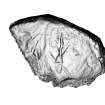
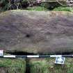
Panel Notes: This is a roughly rectangular block of quarried sandstone occupying the second above-ground course of blocks on the outer wall of the broch. The markings are on the vertical S-facing surface. The 'cup mark' which has been reported is about 6cm in diameter x 2 cm deep. After close examination it was considered that this was probable natural. There are other indentations and depressions on the rock which are more obviously natural but mimic cup marks.
Project (10 June 2019 - 12 June 2019)
Alder Archaeology was commissioned by Scottish Woodlands to undertake a deskbased assessment and walkover survey at Leckie, Gargunnock, Stirling in advance of a proposed afforestation scheme. The survey was undertaken by two archaeologists on 10-12 June 2019.The survey area is divided in two parts by an existing woodland belt. South of the woodland were remains of pre-improvement rig and furrow and grass banks, including a possible former head dyke. North of the woodland belt were the remains of one, possibly two, ha-has as well as some possible rig and furrow. A cropmark on APs may indicate a former building but there were no visible remains on the ground
Information from David Perry, Alder Archaeology, 18 October 2019
OASIS ID: alderarc1-370891


