Baldernock Parish Church
Church (18th Century), Church (Medieval), War Memorial(S) (20th Century)
Site Name Baldernock Parish Church
Classification Church (18th Century), Church (Medieval), War Memorial(S) (20th Century)
Alternative Name(s) War Memorial Plaque, War Memorial Return Offering
Canmore ID 44441
Site Number NS57NE 41
NGR NS 57679 75065
Datum OSGB36 - NGR
Permalink http://canmore.org.uk/site/44441
- Council East Dunbartonshire
- Parish Baldernock (Strathkelvin)
- Former Region Strathclyde
- Former District Strathkelvin
- Former County Stirlingshire
NS57NE 41 57676 75062
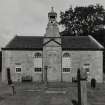
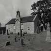
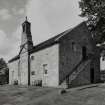
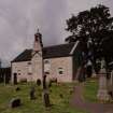
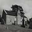
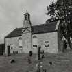
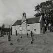
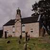
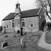
(NS 5767 7506) Baldernock parish church stands by the W side of the road from Strathblane to Bardowie, about a mile and a quarter ENE of Milngavie. It was built in 1795, evidently taking the place of an older structure of several periods, and is a good example of a 'preaching kirk' with its internal arrangements undisturbed.
RCAHMS 1963, visited 1952.
EXTERNAL REFERENCE
Scottish Record Office:
Building a loft at the E end of the Church.
The loft is to be built from wall to wall and raised on a pillar 7 foot and 8-1/2 inches high.
Agreement between Katherine Hamilton of Bardowie and Robert Freeland, Wright.
1766 GD161/Box 24/Bundle 6
Photographic Survey (June 1960)
Photographic survey by the Scottish National Buildings Record in June 1960.
Field Visit (June 1977)
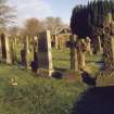
Baldernock, Parish Church and Burial-ground NS 576 750 NS57NE 41
The present church was built in 1795, replacing an earlier structure 'built at different times'.
RCAHMS 1982, visited June 1977
(Stat. Acct., xv, 1795, 277; OPS 1851-5, i, 47; RCAHMS 1963, pp. 163-4, No.159; Cowan 1967, 12)


