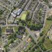
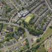
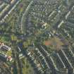
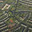
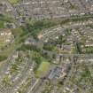
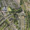
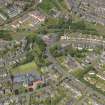
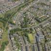
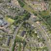
Glasgow, Carmunnock Road, Old Cathcart Parish Church And Churchyard
Burial Aisle (18th Century), Burial Aisle(S) (19th Century), Burial Ground (Period Unassigned), Church (19th Century), Churchyard (Period Unassigned), Commemorative Monument(S) (Period Unassigned), Watch House (19th Century)
Site Name Glasgow, Carmunnock Road, Old Cathcart Parish Church And Churchyard
Classification Burial Aisle (18th Century), Burial Aisle(S) (19th Century), Burial Ground (Period Unassigned), Church (19th Century), Churchyard (Period Unassigned), Commemorative Monument(S) (Period Unassigned), Watch House (19th Century)
Alternative Name(s) 118-120 Carmonnock Road; Cathcart Tower; Kilmailing Road; St Fillan's Primary School; Session House
Canmore ID 44320
Site Number NS56SE 57
NGR NS 58726 60618
Datum OSGB36 - NGR
Permalink http://canmore.org.uk/site/44320
- Council Glasgow, City Of
- Parish Cathcart (City Of Glasgow)
- Former Region Strathclyde
- Former District City Of Glasgow
- Former County Lanarkshire
NS56SE 57 58726 60618
(NS 5872 6061) Cathcart parish church was dedicated to St Oswald, probably of 6th century date (OPS 1851; Scott et al 1915-61). The old parish church, built in 1707, was taken down in 1831, when a new church was built (at NS 5887 6060).
New Statistical Account (NSA) 1845; Orig Paroch Scot 1851; H Scott et al 1915-61.
NS 587 606 An evaluation was undertaken in June 2005, comprising two 2 x 4m trial trenches, within the present school
grounds immediately to the S of the churchyard of St Oswald's Church (NS56SE 57). The evaluation aimed to assess the possibility for the survival of human remains or settlement connected to St Oswald's Church, purported to have been founded in AD 642. Both trenches contained a simple soil profile of topsoil derived from parent subsoil, and make-up deposits comprising modern building debris and rubble. No significant archaeological finds or features were identified.
Report lodged with WoSAS SMR and NMRS.
Sponsor: Glasgow City Council Development and Regeneration Services.
D Atkinson 2005
NS56SE 57 58726 60618
Glasgow, 118-120 CArmunnock Road, Old Cathcart Parish Church, Churchyard.
Demolished except for tower.
Architect: James Dempster, 1830-1831.
Graveyard.
Architect: A. Thomson.
EXTERNAL REFERENCE:
Sources: Strathclyde Regional Archives: Pollok Maxwell Collection.
CATHCART CHURCH, N.D.
Plan of sittings in CAthcart PArish Church. Scale: 4':1".
Addressed to John Gordon of Aikenhead by Peter Macquisten. N.d.


