
Ayr, General


Burgh (Medieval), Town (Medieval) - (Post Medieval)
Site Name Ayr, General
Classification Burgh (Medieval), Town (Medieval) - (Post Medieval)
Canmore ID 41743
Site Number NS32SW 108
NGR NS 3386 2247
NGR Description Centred NS 3386 2247
Datum OSGB36 - NGR
Permalink http://canmore.org.uk/site/41743


- Council South Ayrshire
- Parish Ayr
- Former Region Strathclyde
- Former District Kyle And Carrick
- Former County Ayrshire
NS32SW 108 centred 3386 2247
Formerly also entered as NS32SW 104 at cited location NS 33 21.
For burgh of Newton-upon-Ayr (NS c. 33 22), see NS32SW 105.
EXTERNAL REFERENCE
Architect: St Evox - maps of the Turnpike and Parish Roads.
Plans: at Darley Hay Partnership, Ayr.
(Undated) information in NMRS.
NMRS REFERENCE
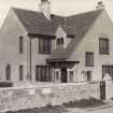
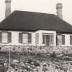
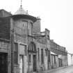
The National Trust Survey mentions seven houses in Ayr as being of interest. These are mainly in Sandgate and the High Street. Loudon House in the Boat Bennel is, however, a pleasing L plan house now, unfortunately, deserted and in bad condition.
CLASSIFICATION - 1B, 6C houses.
NMRS - Catalogue of guide to Glasgow University Library - typescript
NMRS REFERENCE
Alloway, Burns Institute - Sir Robert Lorimer 1929 - 30, for Lord Glentanar.
EXTERNAL REFERENCE
Glasgow university Library Archives - 1700 - Town plan
National Library of Scotland - Earnock MSS 1, 39 - from Brown Carrick Hill
Architect: Villa for Mr McLauchlan, Ayr (gothic gable tablet bears date 1873)
Plans: Darley Hay Partnership, Ayr.
Architect: Unidentified building for Mr McLauchlan, Ayr, c.1885, including sundial 1894.
Plans: Darley Hay Partnership, Ayr.
Architect: John Mercer, I A, Town Chambers, Ayr, 1884. Drawings of bracket.
Plans: Darley Hay Partnership, Ayr.
Architect: Allan Stevenson. 1926. Three-apartment flated houses. Ayr District Committee Housing
Plans: at Darley Hay Partnership, Ay
Architect: ns. 1888. Shelving in shop.
Plans: at Darley Hay Partnership, Ayr.
Architect: New. 1899-1900 - Robertson Memorial Church
Plans: at Darley Hay Partnership, Ayr
Architect: McCulloch & Wilson. 1946. 1 Hunter Street. Adds and alts for Thos McShane.
Plans: at Darley Hay Partnership, Ayr.
Architect: R McClymont, New Thornton Heath, Surrey. (Copy by W Fisher 1885) Lnag Circus 1881. Villa for James Douglas.
Plans: at Darley Hay Partnership, Ayr.
Architect: McCulloch & Wilson. 1947. Adds & alts for Mrs Begg.
Plans: at Darley Hay Partnership, Ayr.
Architect: E A Darley. 1968. Extension for F Bothwell.
Plans: at Darley Hay Partnership, Ayr.
Architect: John Macrae, CE, 107 Princes Street, Edinburgh. 1883. Bridge.
Copy by W Fisher. c.1885.
Plans: at Darley Hay Partnership, Ayr.
Architect: Allan Stevenson & Kair. c. 1885? - Dr Watt's House
Plans: at Darley Hay Partnership, Ayr.
Architect: McCulloch & Wilson. 1946. New House for Mrs J Black.
Plans: at Darley Hay Partnership, Ayr.Architect: McCulloch & Wilson. 1946. New House for Mrs J Black.
Architect: James McDerment. 1842. Plan of the lands belonging to the Whipmen Society, with surrounding porperties (Robsland & Commonhead).
Plans: at Darley Hay Partnership, Ayr.
Architect: James Campbell & John Paterson. 1846. Parish and Trunpike Roads, lithograph.
Plans: at Darley Hay Partnership, Ayr.
Architect: James McDerment. 1852. Parish and Turnpike Roads, lithograph.
Plans: at Darley Hay Partnership, Ayr.
Architect: Duncan McCulloch. 1945. Alts.
Plans: at Darley Hay Partnership, Ayr.
Architect: McCulloch & Wilson. 1948. Adds & alts for F Terret, 26 Arran Drive
Plans: at Darley Hay Partnership, Ayr.
Architect: John Murdoch & Lochart. 1908. Office Building, for R B Armour & Son.
Plans: at Darley Hay Partnership, Ayr.
Architect: John Murdoch. 1901-2 - Commonhead feuing plans.
Plans: at Darley Hay Partnership, Ayr.
Architect: John Murdoch & Wilson. 1947. Adds and alts for D E McNab.
Plans: at Darley Hay Partnership, Ayr.
Note (1985)
Ayr NS 33 21 NS32SW 104, 6, 7, 8, 11, 12, 23, 24 & 49
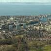
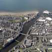
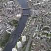
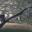
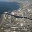
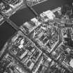
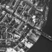
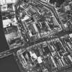
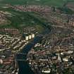
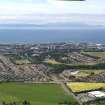
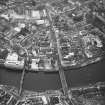
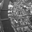
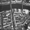
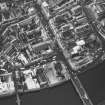
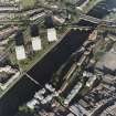
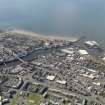
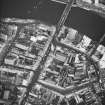
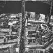
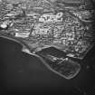
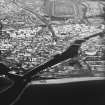
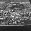
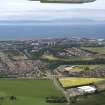
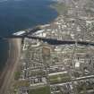
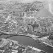
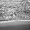
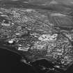
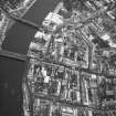
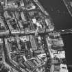
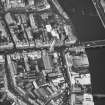
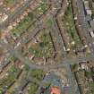
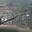
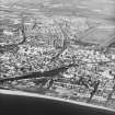
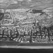
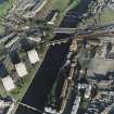
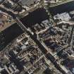
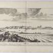
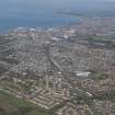
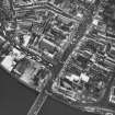
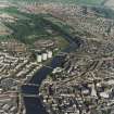
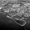
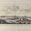
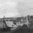
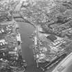
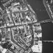
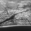
Ayr was erected a royal burgh about 1203-6. It developed around the harbour and along two main thoroughfares (Sandgate and High Street) with market centres at the Fish Cross (NS 3379 2204) and the Malt Cross (NS 3369 2210). The castle, probably incorporating a motte (NS 3345 2218), was built towards the end of the 12th century; the parish church (NS 3337 2201 ), dedicated to St John the Baptist, is on record in 1233. In about 1230 a Dominican friary (NS 3390 2181) was established, and about 1472 that of the Greyfriars (NS 3390 2192). During the mid-17th century, with the construction of the
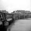
Cromwellian citadel (NS 3339 2213), a new parish church (the Auld Kirk of Ayr) was founded on the site of the Greyfriars. During the 17th century the burgh of Newton-upon-Ayr (SE NS32SW 105, 9 & 25) developed on the N side of the river; a bridge is known to have been in existence during the reign of Alexander II (1214-49) but the Auld Brig (NS 3385 2210) probably dates to the 15th century.
RCAHMS 1985.
(Dillon 1954, 69-70; Pryde 1957, 10-12, 23-4, 26, 40, 48-9; Dunlop 1953; Pryde 1965, 16, no. 1; 72, no. 364; SBS Ayr; Lindsay 1985).

