Following the launch of trove.scot in February 2025 we are now planning the retiral of some of our webservices. Canmore will be switched off on 24th June 2025. Information about the closure can be found on the HES website: Retiral of HES web services | Historic Environment Scotland
Maybole, 2, 4 High Street, The Castle
Estate Office (Period Unassigned), Tower House (17th Century)
Site Name Maybole, 2, 4 High Street, The Castle
Classification Estate Office (Period Unassigned), Tower House (17th Century)
Alternative Name(s) Maybole Castle
Canmore ID 41650
Site Number NS31SW 12
NGR NS 30130 10029
Datum OSGB36 - NGR
Permalink http://canmore.org.uk/site/41650
First 100 images shown. See the Collections panel (below) for a link to all digital images.
- Council South Ayrshire
- Parish Maybole
- Former Region Strathclyde
- Former District Kyle And Carrick
- Former County Ayrshire
Maybole Castle was recorded by the Threatened Buildings Survey in September 2010 prior to its sale by the Cassillis Estate and proposed conversion.
STG 2014
NS31SW 12 30130 10029
(NS 3013 1002) The Castle (NR)
OS 6" map (1958)
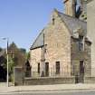
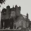
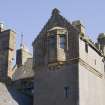
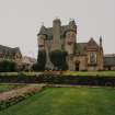
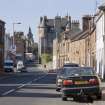
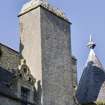
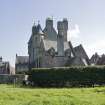
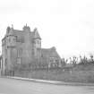
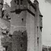
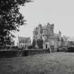
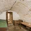
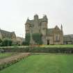
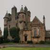
Maybole Castle was the town house of the Earls of Cassillis, and is still the property of the holder of that title. It is a typical defensive fortalice, probably of late 16th or early 17th century date. It consists of an L-shaped tower, four storeys and a garret in height, with large circular turrets corbelled out at the NE and SE angles and a stair-wing projecting to the SW. A later two-storyed addition extends to the N. The main tower is of harled rubble, but the turrets and projecting watch-chamber at the head of the stair-tower are of worked ashlar. The SE turret has been renewed above the level of the corbelling. The basement is vaulted.
D MacGibbon and T Ross 1889; N Tranter 1965
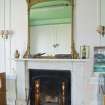
This considerably restored mansion is generally as described above. It is in use as the offices of the Cassillis and Culzean Estates, and is still known as "The Castle".
Visited by OS (JLD) 7 December 1955
No change to the previous report.
Visited by OS (JRL) 8 August 1977
NMRS REFERENCE
Owner: Marquis of Ailsa. Agent (Mr Gray) has office in castle itself (1945)
Architect: 17th century. Situated in Main Street.
Folio - tracing of EAA
L-plan 4 storey tower, the stair in the southern wing. Harled, with ashlar dressings, rubble-built 2- storey crowstepped, gabled extensions to south and west added prior to 1856.
Built as town Mansion of Earls of Cassillis hereditary bailiffs of Carrick. Probably built for John, 6th Earl, who was appointed Extra ordinary Lord of Session at the Restoration. ( Historic Scotland).
Publication Account (2005)
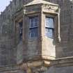
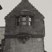
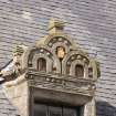
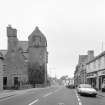
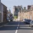
The castle (NS 3013 1002, Category A-listed) was originally a townhouse of the Earls of Cassillis (figs 2 & 29); it may be identified with the 'new house ofMaybole' mentioned in a document of 1545. It is an L-shaped tower of four storeys and garret, with large circular turrets corbelled out at its north and east angles. A stair-wing projects to the south-west, the corbelled top floor of which has an elaborate oriel window which overlooks the High Street. A later two-storey addition extends to the north-west. Maybole Castle was extended in the sixteenth century. The date of origin of the tower is disputed; it may have been constructed by Gilbert, third Earl of Cassillis, in c 1540. Above the doorway is a square recess where a coat of arms was formerly displayed. In 1584, the property was described as the 'tower, manor place and fortalice in Mayboyle'. The castle did not always stand as an isolated tower; it is probable that it was within a walled enclosure or barmkin, along with other ancillary ranges. Barns and other service buildings existed until the first years of the nineteenth century, in the area of the present St Cuthbert's Road and Barns Road. These were removed when the present Cassillis Road (fig 22), formerly known as New Yards, was created.
Information from ‘The Scottish Burgh Survey, Historic Maybole: Archaeology and Development’ (2005).


