|
Photographs and Off-line Digital Images |
AY 3071 S |
RCAHMS Aerial Photography |
Oblique aerial view. |
1978 |
Item Level |
|
 |
On-line Digital Images |
SC 2422843 |
Records of the Ordnance Survey, Southampton, Hampshire, England |
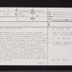
Cambusdoon, NS31NW 5, Ordnance Survey index card, page number 1, Recto |
c. 1958 |
Item Level |
|
 |
On-line Digital Images |
SC 2422844 |
Records of the Ordnance Survey, Southampton, Hampshire, England |
Cambusdoon, NS31NW 5, Ordnance Survey index card, page number 2, Verso |
c. 1958 |
Item Level |
|
 |
On-line Digital Images |
SC 2422845 |
Records of the Ordnance Survey, Southampton, Hampshire, England |
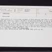
Cambusdoon, NS31NW 5, Ordnance Survey index card, Recto |
c. 1958 |
Item Level |
|
 |
On-line Digital Images |
SC 2422846 |
Records of the Ordnance Survey, Southampton, Hampshire, England |
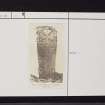
Cambusdoon, NS31NW 5, Ordnance Survey index card, Recto |
c. 1958 |
Item Level |
|
 |
On-line Digital Images |
SC 2422847 |
Records of the Ordnance Survey, Southampton, Hampshire, England |
Cambusdoon, NS31NW 5, Ordnance Survey index card, Recto |
c. 1958 |
Item Level |
|
 |
On-line Digital Images |
SC 2422848 |
Records of the Ordnance Survey, Southampton, Hampshire, England |
Cambusdoon, NS31NW 5, Ordnance Survey index card, Recto |
c. 1958 |
Item Level |
|
|
Photographs and Off-line Digital Images |
SC 2748548 |
RCAHMS Aerial Photography |
Oblique aerial view. |
1978 |
Item Level |
|
|
All Other |
551 166/1/1 |
Records of the Ordnance Survey, Southampton, Hampshire, England |
Archaeological site card index ('495' cards) |
1947 |
Sub-Group Level |
|