Ardrossan, Burnfoot Bridge
Fish Trap(S) (Post Medieval)
Site Name Ardrossan, Burnfoot Bridge
Classification Fish Trap(S) (Post Medieval)
Alternative Name(s) Montfode Burn; Firth Of Clyde; Outer Clyde Estuary
Canmore ID 41119
Site Number NS24SW 26
NGR NS 2249 4336
NGR Description NS 2249 4336 to NS 2234 4316
Datum OSGB36 - NGR
Permalink http://canmore.org.uk/site/41119
- Council North Ayrshire
- Parish Ardrossan
- Former Region Strathclyde
- Former District Cunninghame
- Former County Ayrshire
Note (1981)
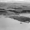
NS 225 434 At mouth of Montfode Burn a complex of five connected alignments occurs near HWH, resting on beach and in association with sedimentary rock outcrops. Constituent boulders mostly of igneous rocks, basalt, dolerite and felsite derived by marine erosion of till. Combined length of alignments is c200m.
NS 223 431 An isolated massive straight wall of very large boulders
occurs near LWM on a stony area of beach named Long Craigs. Length of
wall c150m.
E M Patterson 1981
Field Visit (18 October 1982)
At NS 223 431, on a stony area of beach (near low water mark) named Long Craigs, is an isolated fish trap comprising a massive straight wall of large boulders, some 150m long.
Visited by OS (JRL) 18 October 1982.
Note (1989)
NS 225 434
Complex of 5 connected alignments near HWM, in associatioon with rock outcrops, at mouth of Montfode Burn. Total length c. 200m.
NS 223 431
Massive straight wall nr LWM in stony area of Long Craigs. Length ca. 150m. Function uncertain, possibly a primitive breakwater.
Patterson 1989 Nos. 4 and 5
Field Visit (5 March 2014)
NS 2249 4336
There are three stretches of boulder wall at the mouth of the Montfode Burn, where it debouches into the intertidal zone. The function of these walls is unknown but they are most unlikely to have served as fish traps as previously suggested (Patterson 1989). The longest section measures about 46m in length from NNE to SSW.
Visited by RCAHMS (AGCH) 5 March 2014


