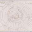
Howmoor
Dun (Prehistoric)
Site Name Howmoor
Classification Dun (Prehistoric)
Alternative Name(s) Dun Ean, Trees Hill
Canmore ID 40952
Site Number NS21SE 3
NGR NS 27707 11809
Datum OSGB36 - NGR
Permalink http://canmore.org.uk/site/40952
- Council South Ayrshire
- Parish Maybole
- Former Region Strathclyde
- Former District Kyle And Carrick
- Former County Ayrshire
NS21SE 3 2770 1180.
(NS 2770 1180) Fort (NR)
OS 6" map (1971)
There is a fort on the Castle Knoll on Trees Hill; its original name was probably Dun Ean. There are the remains of three ramparts and ditches on its SW side; on the N side are the remains of a low wall, accompanied by a ditch. The rock has been quarried on the W side. The summit area is 24 paces in diameter.
J Smith 1895
A rocky knoll, much disturbed on top by quarrying, contains what may be the remains of a dun. The top measures 26.0m E-W by 22.0m transversely. At the S end of the top, there is a wide ditch, possibly a stone-robber trench, extending round the S half of the knoll. This ditch is 4.6m wide and outside this is a bank, followed lower down the slopes by two slight terraces, traceable as ditches on the SW side. To the N the slopes are small and steep, ending in a small hollow before there is a gradual rise in higher ground. The E and S slopes are very steep, but to the W there are only slight slopes, the ditch and rampart ending just N of W. No trace of a wall was found to the N.
Visited by OS (JD) 7 December 1955
Generally as described above. Within the rampart or wall which encloses the summit, and concentric with it, is the turfed-over outline of a circular structure. These features may represent the outer and inner limits of the broad wall of a dun or similar structure.
Resurveyed at 1:2500.
Visited by OS (WDJ) 15 March 1967
As previously described. The RCAHMS assumption (Marginal Lands Survey 1955) that this is a robbed dun is consistent with the remains. A slightly dished internal area, approximately 7.0m in diameter, surrounded by walling in excess of 2.5m thickness is the most likely interpretation of the knoll top.
Visited by OS (JRL) 18 July 1977
Field Visit (9 September 1942)
This site was included within the RCAHMS Emergency Survey (1942-3), an unpublished rescue project. Site descriptions, organised by county, vary from short notes to lengthy and full descriptions and are available to view online with contemporary sketches and photographs. The original typescripts, manuscripts, notebooks and photographs can also be consulted in the RCAHMS Search Room.
Information from RCAHMS (GFG) 10 December 2014.
Field Visit (5 September 1955)
This site was included within the RCAHMS Marginal Land Survey (1950-1962), an unpublished rescue project. Site descriptions, organised by county, are available to view online - see the searchable PDF in 'Digital Items'. These vary from short notes, to lengthy and full descriptions. Contemporary plane-table surveys and inked drawings, where available, can be viewed online in most cases - see 'Digital Images'. The original typecripts, notebooks and drawings can also be viewed in the RCAHMS search room.
Information from RCAHMS (GFG) 19 July 2013.
Field Visit (October 1982)
Howmoor NS 277 118 NS21SE 3
There is a circular dun situated on a rocky knoll at the edge of a steep scarp 220m SW of the deserted cottage of Howmoor. It has been extensively robbed but probably measured about 15.5m over a wall 3.8m thick, with the entrance possibly lying on the S. Around the base of the knoll, except on the S where the ground falls steeply, additional defence was provided by a bank and internal ditch, and on the W what may be part of an earlier ditch and bank are visible. A series of banks to the NW and SE form part of an early, possibly contemporary, field-system.
RCAHMS 1983, visited October 1982
(Name Book, Ayr, No. 46, p. 61; Smith 1895, 177-8).


