Dunduff
Fort (Iron Age)
Site Name Dunduff
Classification Fort (Iron Age)
Canmore ID 40936
Site Number NS21NE 6
NGR NS 2700 1635
Datum OSGB36 - NGR
Permalink http://canmore.org.uk/site/40936
- Council South Ayrshire
- Parish Maybole
- Former Region Strathclyde
- Former District Kyle And Carrick
- Former County Ayrshire
NS21NE 6 2700 1635.
(NS 2700 1635) Fort (NR)
OS 6" map (1970)
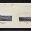
There is a fort (Smith) or enclosure (NSA) near Dunduff Castle. A rocky knoll, locally called the Danes' Hill, has two ramparts and a medial ditch drawn round its SW end. The area of the fort is 37 paces by 52; its surface is very irregular, and its sides are precipitous and rocky, except next to the rampart.
J Smith 1895; NSA 1845 (G Gray)
This fort is as described. The remains comprise a broad, flat-bottomed ditch with a high outer rampart and a lesser one on the SW side of the fort above the scarp of the ditch. The latter stands 1.0m above the interior of the fort in one place, but elsewhere it is only a course of stones for a short distance to the S. The outer rampart is 2.0m high. There are no traces of any fortifications above the craggy slopes on the N and E. The entrance was probably from the W where there is a gradual slope leading to a break in the ramparts. Any possible outer ditch has been obliterated by ploughing.
Visible on APs (540/680/3073-4).
Surveyed at 1:2500.
Visited by OS (JLD) 13 December 1955 and (RD) 14 March 1967
This may have been an early medieval ring-work.
E J Talbot 1974
This fort is basically as described above and measures internaly some 50.0m N-S by 35.0m transversely. The medial ditch on the W side is flat-bottomed and must once have been considerably deeper; it extended northwards to meet the steep rockface along the N side. The interior is undulating with protruding living rock in places but is otherwise featureless. The steep rockfaces provide natural defences on three sides. The entrance is not evident but it was probably on the W side
Revised at 1:2500.
Visited by OS (JRL) 22 July 1977
Field Visit (8 September 1942)
This site was included within the RCAHMS Emergency Survey (1942-3), an unpublished rescue project. Site descriptions, organised by county, vary from short notes to lengthy and full descriptions and are available to view online with contemporary sketches and photographs. The original typescripts, manuscripts, notebooks and photographs can also be consulted in the RCAHMS Search Room.
Information from RCAHMS (GFG) 10 December 2014.
Field Visit (8 September 1955)
This site was included within the RCAHMS Marginal Land Survey (1950-1962), an unpublished rescue project. Site descriptions, organised by county, are available to view online - see the searchable PDF in 'Digital Items'. These vary from short notes, to lengthy and full descriptions. Contemporary plane-table surveys and inked drawings, where available, can be viewed online in most cases - see 'Digital Images'. The original typecripts, notebooks and drawings can also be viewed in the RCAHMS search room.
Information from RCAHMS (GFG) 19 July 2013.
Field Visit (March 1985)
Dunduff NS 2700 1635 NS21NE 6
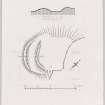
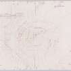
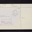
This earthwork is situated on a rocky knoll 170m W of Dunduff Castle. The only visible defences are on the SW, where there are twin ramparts with a medial ditch, but elsewhere the earthwork is protected by steep rocky slopes. On the WSW the inner rampart measures up to 4.7m in thickness by 1m in height; to the S, however, it has been reduced to little more than a scarp, and to the N it stops 12m short of the rocky outcrop that forms the NW side of the knoll, possibly marking the site of the entrance. The ditch is flat-bottomed, measuring up to 9.2m in breadth by 0.9m in depth, and its inner lip, a scarp about 0.6m high, runs past the gap in the inner rampart unbroken. The outer rampart measures up to 7.9m in thickness by 1.3m in height. The interior measures about 43m from NNW to SSE by 28m transversely. There is no evidence to support the suggestion that this is a medieval ring-work (Talbot 1975) and the date and purpose of the earthwork are unknown.
RCAHMS 1985, visited (SH) March 1985
(NSA, v, Ayrshire, 365; Smith 1895, 176-7).
Note (16 July 2014 - 16 November 2016)
This small fortification is situated on a rocky hillock 160m W of Dunduff Castle. The defences comprise twin ramparts and a medial ditch, but these are only visible on the SW flank of the hillock and as a result of quarrying at the NE end it is not known whether they once formed a complete circuit. Nevertheless, the inner and outer ramparts on the SW measure up to 4.7m and 7.9m in thickness respectively by 1m and 1.3m in height, and the ditch is 9.2m in breadth by 0.9m in depth. A gap between the defences and the scarp forming the NW flank of the knoll probably marks the entrance. The interior presently measures 43m from NW to SE by 28m transversely but at least 10m of the summit area has probably been removed from this latter dimension by the quarry, giving an original internal area of about 0.1ha.
Information from An Atlas of Hillforts of Great Britain and Ireland – 16 November 2016. Atlas of Hillforts SC1236


