Following the launch of trove.scot in February 2025 we are now planning the retiral of some of our webservices. Canmore will be switched off on 24th June 2025. Information about the closure can be found on the HES website: Retiral of HES web services | Historic Environment Scotland
Auchenbreck Castle
Castle (Medieval)(Possible)
Site Name Auchenbreck Castle
Classification Castle (Medieval)(Possible)
Alternative Name(s) Auchinbreck Castle; Achnabreac Castle; Auchnabreck Farm
Canmore ID 40525
Site Number NS08SW 1
NGR NS 0195 8142
Datum OSGB36 - NGR
Permalink http://canmore.org.uk/site/40525
- Council Argyll And Bute
- Parish Kilmodan
- Former Region Strathclyde
- Former District Argyll And Bute
- Former County Argyll
NS08SW 1 0195 8142
(Name: NS 0198 8138) Castle (NR) (Remains of)
OS 6" map (1900)
Traditionally these are the remains of Auchinbreck Castle, the residence of Sir D Campbell, whose initials and crest, dated 1610, appear on a stone in the present church wall (see NR98SE 5). The only vestiges remaining visible are a wall in the centre of the garden and the slope on the N side, showing where the castle once stood. The farmhouse and the mill of Auchenbreck were built from material taken from it.
Name Book 1870
Sir Dugald Campbell of Auchinbreck had his chief stronghold at Auchinbreck Castle (fragmentary remains at Auchnabreck Farm) which had passed to his great-great-grandfather c.1500.
SDD List 1963
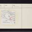
The site is indicated on the ground by a levelled area 50m NE-SW by 19m bounded on the N and W by a scarp 0.8m high and revetted on the S by a lime mortared wall 0.8m thick which stands 2.0m high. There are no traces of a building.
Resurveyed at 1:2500.
Visited by OS (IA) 21 November 1972
NS 0195 8142. No change to field report above.
Surveyed at 1:10,000.
Visited by OS (BS) 13 October 1976.
Field Visit (April 1988)
This former Campbell stronghold occupied a level spur at an elevation of 30m OD, overlooking the head of Loch Riddona nd the mouth of Glendaruel. The ground slopes on the SE of a dry valley and on the NW to the Auchenbreck Burn, on which a ruined watermill is situated l00m to the NE. The former Auchenbreck farmhouse, immediately E of the site, occupies a stone-revetted platform.
The traditional site of the castle is a rectangular platform measuring about 35m from NE to SW by 18m transversely, bounded on the SE by a 25m length of revetment-wall of lime-mortared masonry, 0.7m thick and up to 2.2m high. No dressed stone is identifiable, but the masonry is earlier in character than that supporting the adjacent farmhouse. There are traces of a return at the S angle, and of rubble wall core along the SW scarp of the platform. There is no definite evidence of artificial earthworks on the surrounding slopes, but a terrace to the NW may have been formed by steepening the upper slope.
The Campbells of Auchenbreck were descended from Duncan, a younger son of Duncan Campbell of Lochawe, Lord Campbell, who received a grant of land at Cluniter, near Dunoon, in 1435, and of extensive lands in Glassary at later dates. At first the family used the designation 'of Kilmichael (Glassary)’, and the title 'of Auchenbreck' became usual only in the 16th century (en.1). The principal residence was at Lochgair (No. 136), and Pont's map of the late 16th century does not indicate Auchenbreck as a settlement of unusual importance (en.2). It was purchased about 1703 by John Fullarton, bishop of Edinburgh and formerly minister of Kilmodan (No. 72, 15) who is said to have been 'the last to live in the old castle'. He renamed the estate Greenhall, and it was advertised for sale in 1728 with 'the mansion house of Greenhall’ (en.3*). The only visible remains in 1870 were 'a wall in the centre of the garden', evidently the revetment described above, and it was believed that the building had been dismantled to provide material for the farmhouse and mill (en.4).
RCAHMS 1992, visited April 1988


