Bute, St Colmac Cross
Cross Slab (Early Medieval), Standing Stone (Bronze Age)
Site Name Bute, St Colmac Cross
Classification Cross Slab (Early Medieval), Standing Stone (Bronze Age)
Alternative Name(s) Kilmachalmaig Cross
Canmore ID 40317
Site Number NS06NW 1
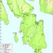
NGR NS 04521 67263
Datum OSGB36 - NGR
Permalink http://canmore.org.uk/site/40317
- Council Argyll And Bute
- Parish North Bute
- Former Region Strathclyde
- Former District Argyll And Bute
- Former County Buteshire
Reference (1662)
Reference (1861)
Reference (1863)
Field Visit (1864)
Reference (1867)
Reference (1885)
Field Visit (1893)
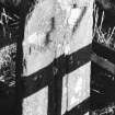
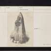
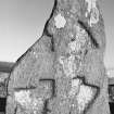
St Colmac Cross, standing beside the site of Kilmachalmaig (see NS06NW 4) is deeply incised in a massive standing stone, 3ft 7ins high by 19 ins broad and of varying thickness.
J K Hewison 1893
Reference (1903)
Field Visit (22 May 1943)
This site was recorded as part of the RCAHMS Emergency Survey, undertaken by Angus Graham and Vere Gordon Childe during World War 2. The project archive has been catalogued during 2013-2014 and the material, which includes notebooks, manuscripts, typescripts, plans and photographs, is now available online.
Information from RCAHMS (GF Geddes) 2 December 2014.
Reference (1955)
This cross, which is engraved on a standing stone, stands in a field at East St Colmac Farm. Dr Hewison in his ‘Bute in Olden Times’ (Vol.1 p116) calls it the cross of Kilmachalmaig. The chapel which once stood beside the cross was dedicated to St Colman or Colmac who was Bishop of Dromore and, like many of the early preachers, was educated in Ireland. He lived in the 6th century. Divine worship was continued on the site till long after the Reformation. In 1591 we hear of Patrick McQueine, pastor of Kingarth, having Killumcogarmick added to his charge. No traces of the chapel are to be seen: about 160 years ago the farmer took the remaining stones to build his steading. Nothing of the cemetery remains either, though something of it could be seen up to the end of the 18th century. The decoration on the cross is unusual and it is not easy to ascribe it to any particular century.
D N Marshall 1955
Photographic Record (1961)
Field Visit (17 July 1975)
Probably a prehistoric standing stone which has been exorcised by having a shafted cross carved on one face. The cross-head needs rubbing, since there are some indications that the centre as well as the arms as far as the expanded ends have been decorated.
Information from K A Steer 17 July 1975.
Field Visit (24 November 1976)
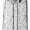
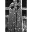
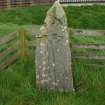
A cross situated at the bottom of a S-facing hillslope in cultivated land. The 1.5m high wedge-shaped stone is 0.5m broad and 0.4m thick at its base, and part of the top is broken off. An ornate Latin cross is recessed in the west face.
Surveyed at 1/2500.
Visited by OS (TRG) 24 November 1976
Reference (1984)
Photographic Record (1987)
Measured Survey (1993)
Reference (2001)
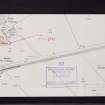
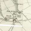
The supposed site of the chapel of Kilmachalmaig (1) is situated in a field a few metres W of East St Colmac farm, on the N side of the low-lying valley that links the E and W coasts of Bute between Kames Bay and Ettrick Bay. The name incorporates an affectionate form of the common Irish name Colman, and a cross-slab of Early Christian type stands a few metres to the SW.
The stone has a vertical W face but is D-shaped in section, tapering in thickness from 0.4m at the foot to a mere point. The W face, which is round-headed but broken at the top left, measures 1.44m in visible height and tapers from a width of 0.48m at the foot. At the top there is a circle 0.4m in diameter enclosing an equal-armed cross potent with wedge-shaped terminals. The outline of the cross is defined by a bead-moulding, and at the centre there is a roundel formed by a double moulding with three spirals emerging from the inner member. The constriction of the lower arm bears traces of ornament, identified by Allen as a square key-pattern (2), and the vertical sides of the expansion have spirals flanking a central sunk panel. This arm is continued as a simple shaft, 0.77m high and 75mm wide, which is formed by two deeply-cut grooves and is open at the foot.
Footnotes:
(1) Blaeu's Atlas (Bute) gives the form 'Kilmachalmak'. The chapel was demolished for building-material about the end of the 18th century (Hewison 1893, 1, 116-17). For the discovery of stone 'coffins' and other burials in the 19th century see Wilson, op.cit., 70-1; Name Book, Bute, No.5, p.18.
(2) Allen and Anderson 1903, 3, 412.
Muir 1861, 124; Stuart 1867, 30 and pl.56; Muir 1885, 7; Hewison 1893, 1, 116-17; Allen and Anderson 1903, 3, 411-12; Marshall 1955, 58 and pl. on p.2; Cross 1984, B43.
I Fisher 2001, 81-2.
Field Visit (22 April 2009)
This early-Christian sculptured stone, which stands within a small fenced enclosure between East St Colmac and South St Colmac farmsteadings, is as previously described. Nothing is now visible of the chapel (NS06NW 4) that once stood immediately to the NE.
Visited by RCAHMS (GFG, PJD) 22 April 2009.
Magnetometry (24 July 2011)
NS 03660 62646, NS 04539 67269 and NS 10004 56658 On the 24 July 2011 a gradiometry survey were undertaken at the four sites of Kilchousland, Kilchatten, East St Colmac Chapel and St Colmac. This work represents the start of the Christian Sites of the Atlantic Rim research project (CSAR).
Archive: Rose Geophysical Consultants
Funder: Rose Geophysical Consultants, British Academy and Discover Bute Landscape Partnership
Rose Geophysical Consultants 2011
Earth Resistance Survey (24 July 2011)
NS 03660 62646, NS 04539 67269 and NS 10004 56658 On the 24 July 2011 a resistivity survey were undertaken at the four sites of Kilchousland, Kilchatten, East St Colmac Chapel and St Colmac. This work represents the start of the Christian Sites of the Atlantic Rim research project (CSAR).
Archive: Rose Geophysical Consultants
Funder: Rose Geophysical Consultants, British Academy and Discover Bute Landscape Partnership
Rose Geophysical Consultants 2011
Project (24 July 2011)
NS 03660 62646, NS 04539 67269 and NS 10004 56658 On the 24 July 2011 gradiometry and resistance surveys were undertaken at the four sites of Kilchousland, Kilchatten, East St Colmac Chapel and St Colmac. This work represents the start of the Christian Sites of the Atlantic Rim research project (CSAR) which, aided by a small grant from the British Academy, aims to answer the question ‘can geophysics alone identify and date chapel sites?’ The project has initially chosen to concentrate on the ‘Celtic’ church and has begun by focusing on the Isle of Bute, as it represents a discrete geographic area and appears to have an abundance of ‘lost’ chapel sites.
The gradiometry survey was employed to identify and discount sites with a ‘domestic’ signature, on the assumption that these sites were either farmsteads or more complex monastery sites. The resistance survey aimed to determine the form and layout of sites, which it is hoped would be indicative of their age. Of the four sites surveyed the results suggest one ‘no show’, one ‘surprising turn up’, one ‘interesting results; possible need for further work’ and one ‘raises more questions than it answers’. However, it is hoped that the surveys have added to Bute's archaeological record. Certainly one completely new site has been located (St Colmac); East St Colmac would bear further investigation with the potential for cists and/or burials and a tentative chapel, and Kilchatten has been confirmed as a large prehistoric monument. In terms of the CSAR Project it could be argued that two sites provide data that confirm the efficacy of the techniques and provide dates, though of a broad spread.
Archive: Rose Geophysical Consultants
Funder: Rose Geophysical Consultants, British Academy and Discover Bute Landscape Partnership
Rose Geophysical Consultants 2011


