
Pricing Change
New pricing for orders of material from this site will come into place shortly. Charges for supply of digital images, digitisation on demand, prints and licensing will be altered.
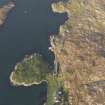
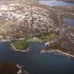
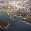
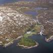
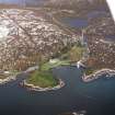
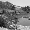
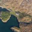
Harris, Amhuinnsuidhe Pier And Harbour


House(S) (Period Unassigned), Pier (Period Unassigned), Storehouse(S) (Period Unassigned)
Site Name Harris, Amhuinnsuidhe Pier And Harbour
Classification House(S) (Period Unassigned), Pier (Period Unassigned), Storehouse(S) (Period Unassigned)
Canmore ID 3989
Site Number NB00NW 1
NGR NB 0472 0790
Datum OSGB36 - NGR
Permalink http://canmore.org.uk/site/3989


- Council Western Isles
- Parish Harris
- Former Region Western Isles Islands Area
- Former District Western Isles
- Former County Inverness-shire
NB00NW 1 0472 0790
(Location cited as NB 047 078). Pier, Amhuinnsuidhe, mid 19th century. A small rubble pier with a single-storey, snecked-rubble range of houses and stores at the landward end.
J R Hume 1977.

