
Arran, Tormore


Chambered Cairn (Neolithic), Arrowhead(S) (Flint)(Period Unassigned), Flake(S) (Flint)(Period Unassigned)
Site Name Arran, Tormore
Classification Chambered Cairn (Neolithic), Arrowhead(S) (Flint)(Period Unassigned), Flake(S) (Flint)(Period Unassigned)
Alternative Name(s) Tormore 2; Tormore Ii; Machrie Moor
Canmore ID 39710
Site Number NR93SW 15
NGR NR 90640 32245
Datum OSGB36 - NGR
Permalink http://canmore.org.uk/site/39710


- Council North Ayrshire
- Parish Kilmory
- Former Region Strathclyde
- Former District Cunninghame
- Former County Buteshire
Desk Based Assessment (14 February 1973)
NR93SW 15 9063 3224.
(NR 9064 3224) Cist (NR)
OS 6" map, Buteshire, (1924)
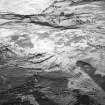
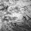
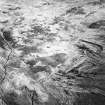
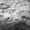
Tormore II: Clyde group, oval cairn. This cairn now appears as a slight heather-covered rise, the edges merging into the surrounding moor. The diameter is about 30ft, and the height 3ft. The chamber is placed centrally; its entrance is to the NE between a pair of transversely set portal stones. It measures 9ft 10 ins long,including the portals,by 3ft wide. Bryce (J Bryce 1909) emptied the chamber and cleared a small area outside the portal stones. He found nothing, but in 1861 it was said that beneath the chamber, 'a large heap of flint flakes and arrowheads was lately dug up' (J McArthur 1861).
Information from OS (IF) 14 February 1973.
Sources: A S Henshall 1972, visited 1962; J Bryce 1909; J McArthur 1861.
Field Visit (1976)
A rectangular cist, set within a cairn. Possible kerb stones were located by probing.
Information from DoE Arran field survey (1976), no. 36 (8).
NMRS, MS/861/13.
Field Visit (18 September 1977)
NR 9063 3224. The chamber is as described by Henshall, except that there appears to be two pairs of transversely set portal stones, one stone of which has fallen across the entrance. Lying on gently undulating moorland at about 100ft OD, the chamber is set 0.7m deep in an amorphous heather-covered raised tump, probably artificial, without definable limit or shape. There is much stone protruding and the overall height is probably exaggerated by excavation debris. No trace of a kerb was found. Surveyed at 1:10 000.
Visited by OS (J R L) 18 September 1977.

