Accessibility

Font Size

100% 150% 200%

Background Colour

Default Contrast
Close Reset

St Kilda, Soay, Taigh Dugan

Rock Shelter (Post Medieval)

Site Name St Kilda, Soay, Taigh Dugan

Classification Rock Shelter (Post Medieval)

Alternative Name(s) Cleit 23, Tigh Dugan

Canmore ID 3965

Site Number NA00SE 7
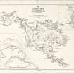
NGR NA 06799 01392

Datum OSGB36 - NGR

Permalink http://canmore.org.uk/site/3965

Ordnance Survey licence number AC0000807262. All rights reserved.
Canmore Disclaimer. © Bluesky International Limited 2025. Public Sector Viewing Terms

Toggle Aerial | View on large map

Digital Images

Mary Harman's plan of structures on Soay, St Kilda.
Mary Harman's plan of structures on Soay, St Kilda.Map of St Kilda or Hirta and adjacent islands and stacs (1963). Annotated with position of antiquities noted on original.St Kilda, Soay, Taigh Dugan, NA00SE 7, Ordnance Survey index card, RectoSt Kilda, Soay, Taigh Dugan, NA00SE 7, Ordnance Survey index card, RectoMary Harman's plans of selected structures on Soay, St Kilda.'Dugan's Cave', copied from Kearton's 'With Nature and a Camera', 1897, 55. Taken on a visit in 1896.Cleit 23Photomerge showing structures on Soay and site numbers

Administrative Areas

  • Council Western Isles
  • Parish Harris
  • Former Region Western Isles Islands Area
  • Former District Western Isles
  • Former County Inverness-shire

Activities

Desk Based Assessment (1966)

NA00SE 7 0670 0135.

NA 0670 0135. Tigh Dugan (Duncan's House). A cave where the bones and dirk of a murderer were found many years after he was exiled from St Kilda.

Sources: J Mathieson, 19278; M Buchanan 1983.

References

MyCanmore Image Contributions


Contribute an Image

MyCanmore Text Contributions