
Arran, Torbeg


Hut Circle (Prehistoric)
Site Name Arran, Torbeg
Classification Hut Circle (Prehistoric)
Canmore ID 39205
Site Number NR82NE 5
NGR NR 89352 29804
Datum OSGB36 - NGR
Permalink http://canmore.org.uk/site/39205


- Council North Ayrshire
- Parish Kilmory
- Former Region Strathclyde
- Former District Cunninghame
- Former County Buteshire
NR82NE 5 8935 2980.
(NR 8934 2979) Hut Circle (NR)
OS 6" map, Buteshire, 2nd ed., (1924)
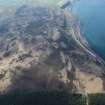
NR 8935 2980 A heather-covered hut circle situated on gently sloping moorland at 250ft OD. The earth and stone bank, spread to 4.0m and up to 1.0m high, encloses a level interior 7.5m in diameter. The entrance is not clear; however a slight lowering of the bank in the south-east would seem to indicate its position.
Clearance mounds lie to the south (NR82NE 9).
Surveyed at 1:2500.
Visited by OS (TRG) 20 October 1977.
Airborne Laser Scanning Interpretation (9 July 2018)
The location, classification and period of this site have been reviewed.
HES Survey and Recording 9 July 2018

