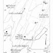
Barnluasgan
Dun (Prehistoric), Enclosure(S) (Prehistoric)
Site Name Barnluasgan
Classification Dun (Prehistoric), Enclosure(S) (Prehistoric)
Canmore ID 39182
Site Number NR79SE 3
NGR NR 79407 92271
NGR Description Centre
Datum OSGB36 - NGR
Permalink http://canmore.org.uk/site/39182
- Council Argyll And Bute
- Parish North Knapdale
- Former Region Strathclyde
- Former District Argyll And Bute
- Former County Argyll
NR79SE 3 7940 9226.
(NR 7939 9226) Circle (NR)
OS 6" map, Argyllshire, 2nd ed., (1924)
Enclosure 48' internal diameter, enclosed by a mound of earth and stone 20' across. An entrance at the E side, 3'4" wide, is marked by two large stones, one erect, the other fallen. Several large stones, laid on edge mark the outer edge of the mound.
J H Craw 1930.
The enclosure is levelled into sloping ground just below the crest of a ridge and appears to be the remains of a small homestead. It has diameter of 11.0m between double faced walling 2.1m in width which survives to a height of 1.0m in the W. There is a well-defined entrance in the SE, 0.8m wide (see also NR79SE 4).
Surveyed at 1:10,000.
Visited by OS (DWR) 23 May 1973.
NR 7941 9226. As described in the report of 23 May 1973.
Surveyed at 1/10,000.
Visited by OS (TRG) 26 January 1977.
A circular enclosure, measuring about 11m by 10m, within a wall, now reduced to a band of rubble, is situated on the summit of a ridge 1.24km NNE of barnluasgan and about 60m ESE of NR79SE 2. Stones forming a rough outer face are visible on the S half of the perimeter. The entrance, situated on the SE, measures 1m in width and has been defined by two large upright slabs, only one of which is now standing.
A second enclosure, about 4m to the N, is some 6m in diameter overall, with a rough exterior face formed of a single course of large stones, and only slight traces of an inner face. The position of the entrance is unclear.
Visited May 1984
RCAHMS 1988
NR 79412 92262 Site included in a field survey carried out by GUARD in 2003. This circular structure is 10m in diameter with substantial banks up to 0.4m high.
Heather F James, 2003 (RCAHMS MS 2371, no.97)
Field Visit (May 1984)
A circular enclosure, measuring about 11m by 10m, within a wall, now reduced to a band of rubble, is situated on the summit of a ridge 1.24km NNE of barnluasgan and about 60m ESE of NR79SE 2. Stones forming a rough outer face are visible on the S half of the perimeter. The entrance, situated on the SE, measures 1m in width and has been defined by two large upright slabs, only one of which is now standing.
A second enclosure [NR79SE 21], about 4m to the N, is some 6m in diameter overall, with a rough exterior face formed of a single course of large stones, and only slight traces of an inner face. The position of the entrance is unclear.
Visited May 1984
RCAHMS 1988
Field Visit (May 1984)
NR 794 922
A circular enclosure, measuring about 11m by 10m, within a wall, now reduced to a band of rubble, is situated on the summit of a ridge 1.24km NNE of Barnluasgan and about 60m ESE of NR79SE 2. Stones forming a rough outer face are visible on the S half of the perimeter. The entrance, situated on the SE, measures 1m in width and has been defined by two large upright slabs, only one of which is now standing.
A second enclosure [NR79SE 21], about 4m to the N, is some 6m in diameter overall, with a rough exterior face formed of a single course of large stones, and only slight traces of an inner face. The position of the entrance is unclear.
Visited May 1984
RCAHMS 1988 No. 331 (2)
Field Visit (1 March 2019)
The location, classification and period of this site have been reviewed.


