 |
On-line Digital Images |
DP 056813 |
RCAHMS Aerial Photography Digital |
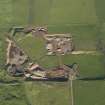
Oblique aerial view centred on the sand and gravel quarry at Langa Links, taken from the S. |
31/10/2008 |
Item Level |
|
 |
On-line Digital Images |
DP 056814 |
RCAHMS Aerial Photography Digital |
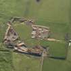
Oblique aerial view centred on the sand and gravel quarry at Langa Links, taken from the SSE. |
31/10/2008 |
Item Level |
|
 |
On-line Digital Images |
DP 143881 |
RCAHMS Aerial Photography Digital |
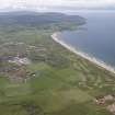
General oblique aerial view of Machrihanish Golf Course, Langa Quarry and Campbeltown Airport, looking SSW. |
11/7/2012 |
Item Level |
|
 |
On-line Digital Images |
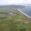
DP 143882 |
RCAHMS Aerial Photography Digital |
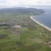
General oblique aerial view of Machrihanish Golf Course, Langa Quarry and Campbeltown Airport, looking SSW. |
11/7/2012 |
Item Level |
|
 |
On-line Digital Images |
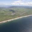
DP 143883 |
RCAHMS Aerial Photography Digital |
General oblique aerial view of Machrihanish Golf Course, Langa Quarry and Campbeltown Airport, looking SSW. |
11/7/2012 |
Item Level |
|
 |
On-line Digital Images |
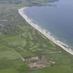
DP 143884 |
RCAHMS Aerial Photography Digital |
General oblique aerial view of Machrihanish Golf Course, Langa Quarry and Campbeltown Airport, looking SE. |
11/7/2012 |
Item Level |
|
 |
On-line Digital Images |
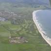
DP 143907 |
RCAHMS Aerial Photography Digital |
General oblique aerial view of Machrihanish Golf Course and Langa Quarry, looking SW. |
11/7/2012 |
Item Level |
|
 |
On-line Digital Images |
DP 143908 |
RCAHMS Aerial Photography Digital |
General oblique aerial view of Machrihanish Golf Course and Langa Quarry, looking SSW. |
11/7/2012 |
Item Level |
|
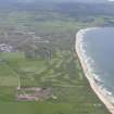 |
On-line Digital Images |
DP 143909 |
RCAHMS Aerial Photography Digital |
General oblique aerial view of Machrihanish Golf Course and Langa Quarry, looking SSW. |
11/7/2012 |
Item Level |
|
 |
On-line Digital Images |
SC 2415678 |
Records of the Ordnance Survey, Southampton, Hampshire, England |
Langa, NR62SE 11, Ordnance Survey index card, page number 1, Recto |
c. 1958 |
Item Level |
|
|
All Other |
551 166/1/1 |
Records of the Ordnance Survey, Southampton, Hampshire, England |
Archaeological site card index ('495' cards) |
1947 |
Sub-Group Level |
|


