
Pricing Change
New pricing for orders of material from this site will come into place shortly. Charges for supply of digital images, digitisation on demand, prints and licensing will be altered.
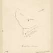
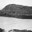
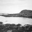
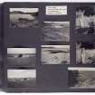
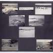
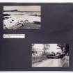
Colonsay, Dun Gallain


Fort (Later Prehistoric)
Site Name Colonsay, Dun Gallain
Classification Fort (Later Prehistoric)
Canmore ID 37978
Site Number NR39SW 1
NGR NR 3486 9314
Datum OSGB36 - NGR
Permalink http://canmore.org.uk/site/37978


- Council Argyll And Bute
- Parish Colonsay And Oronsay
- Former Region Strathclyde
- Former District Argyll And Bute
- Former County Argyll

