
Colonsay, Lower Kilchattan, 'fingal's Limpet Hammers'


Standing Stone(S) (Prehistoric)
Site Name Colonsay, Lower Kilchattan, 'fingal's Limpet Hammers'
Classification Standing Stone(S) (Prehistoric)
Canmore ID 37882
Site Number NR39SE 1
NGR NR 36700 94999
NGR Description NR 36697 95004 and NR 36702 94991
Datum OSGB36 - NGR
Permalink http://canmore.org.uk/site/37882


- Council Argyll And Bute
- Parish Colonsay And Oronsay
- Former Region Strathclyde
- Former District Argyll And Bute
- Former County Argyll
NR39SE 1 3671 9498 and 3670 9500
(NR 3669 9499) Standing Stones (NR)
OS 6" map (1900)
Two standing stones, the remains of a stone circle known as "Fingal's Limpet Hammers" or "Carrach An" (? Carraghan - the pillars or erect stones) The two stones stand 48'5" apart N-S and the circle can still be traced although the ground is cultivated. It is about 48 1/2' in diameter. The more southerly stone is 10'8" high, tapering to a blunt point and 1'4" to 1'8" across, its faces. The north stone is 8'8" high and 1'3" to 1' 6 1/2" across its faces. A corn kiln formerly stood at its west side and when this was removed about 1901 4' of the stone was exposed below ground without reaching the base.
An underground passage was discovered by accident within the circle by the farmer, who covered up the opening to facilitate cultivation. The passage, 2 1/2' to 3' wide, was well built, with a slab roof whose top lay c.18" from the ground surface.
S Grieve 1923; J de V Loder 1935
As described; there is nothing visible to support the claim that an "underground passage" was found, and it is probable that it was a cist that was exposed.
Surveyed at 1:2500.
Visited by OS (BS), 5 April 1974.
Field Visit (June 1976)
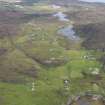
NR 367 949. There is a pair of standing stones situated at the edge of an arable Field about 70m NE of Lower Kilchattan farmhouse. The more southerly of the two stones, which leans slightly to the W, measures 1.5m in girth at the base and 3.1m in height. The other stone, 13.8m to the NNW, leans to the N. and measures 1.5m in girth at the base and 2.6m in height. The name 'Limpet Hammers' refers to the similarity in the shape of the stones to the stone tools commonly thought to have been used to detach limpets from rocks.
RCAHMS 1984, visited June 1976
Measured Survey (1976)
RCAHMS surveyed the standing stones at Drumclach at a scale of 1:100. The plan was redrawn in ink and later published at a reduced scale (RCAHMS 1984 fig. 68).

